Property Record
Warren Rd, Canton, MI 48187

Save to a Folder
{{folder.Name}}
{{folder.ListingIds.length}} Properties
{{folder.ListingIds.length}} Property
Create a New Folder
Property Detail
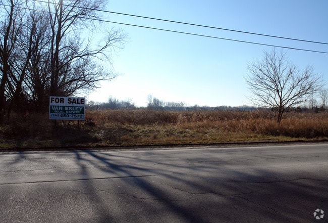
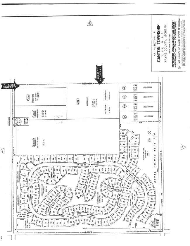
Warren Rd
Detroit-Warren-Dearborn, MI
08E1B PART OF N W 1/4 SEC 8 T2S R8E BEG AT N 1/4 COR OF SEC 8 TH S0DEG 15M 03S E 1896.65FT TH S89DEG 47M 20S W 642.83FT TH
71-030-99-0001-002
WAYNE
Residentialacreage
Michigan
RA
0001
B and X Area of moderate flood hazard, usually the area between the limits of the 100-year and 500-year floods.
15.24 AC
2025
Southern I-275 Corridor
2025
Detroit
563600
NEARBY LISTINGS FOR SALE OR LEASE
DEMOGRAPHICS near Warren Rd
1 mile
3 mile
5 mile
2025 Total Population
6,418
58,645
130,448
2030 Population
6,315
57,712
128,507
Pop Growth 2025-2030
(1.60%)
(1.59%)
(1.49%)
Average Age
41
41
41
2025 Total Households
2,017
20,304
50,075
HH Growth 2025-2030
(1.64%)
(1.60%)
(1.47%)
Median Household Inc
$172,804
$144,677
$117,397
Avg Household Size
3.10
2.80
2.60
2025 Avg HH Vehicles
3.00
2.00
2.00
Median Home Value
$523,734
$434,424
$377,612
Median Year Built
1994
1990
1987
Nearby Places
Map Layers
Map Styles
 Street
 Aerial
Layers
 Traffic
 Biking
Places
Listings with unknown addresses are not visible on the map
- Restaurants
- Banks
- Shops
- Fitness
- Groceries
PUBLIC TRANSPORTATION
AIRPORT
Detroit Metro Wayne County
Drive
Walk
Distance
Detroit Metro Wayne County
31 min
19.2 mi
Windsor International
Drive
Walk
Distance
Windsor International
61 min
40.3 mi
SALE & LEASE HISTORY
LISTING DATE
SALE/LEASE

Sep 24, 2016
For Sale
Nearby Properties
Address
Land Use
TOTAL SIZE
Lot Size
Zoning
Address
Land Use
TOTAL SIZE
Lot Size
Zoning
17.50 AC
R-2
Address
Land Use
TOTAL SIZE
Lot Size
Zoning
176,796 SF
17.08 AC
C-2
Address
Land Use
TOTAL SIZE
Lot Size
Zoning
21.71 AC
MR
Address
Land Use
TOTAL SIZE
Lot Size
Zoning
24.63 AC
MR
Address
Land Use
TOTAL SIZE
Lot Size
Zoning
123,225 SF
9 AC
CJ/ARC
Address
Land Use
TOTAL SIZE
Lot Size
Zoning
186,967 SF
9.75 AC
Address
Land Use
TOTAL SIZE
Lot Size
Zoning
11.40 AC
MR
Address
Land Use
TOTAL SIZE
Lot Size
Zoning
100,098 SF
10.52 AC
C-2
Address
Land Use
TOTAL SIZE
Lot Size
Zoning
187,281 SF
26.35 AC
C-2
Address
Land Use
TOTAL SIZE
Lot Size
Zoning
51,550 SF
6.49 AC
O-1
Address
Land Use
TOTAL SIZE
Lot Size
Zoning
5.43 AC
R-2
Address
Land Use
TOTAL SIZE
Lot Size
Zoning
14.32 AC
R-6
Address
Land Use
TOTAL SIZE
Lot Size
Zoning
6.44 AC
R-2
Address
Land Use
TOTAL SIZE
Lot Size
Zoning
41.45 AC
C-3
Address
Land Use
TOTAL SIZE
Lot Size
Zoning
10.35 AC
MR
Address
Land Use
TOTAL SIZE
Lot Size
Zoning
97,605 SF
5.46 AC
C-2
Address
Land Use
TOTAL SIZE
Lot Size
Zoning
114,139 SF
10.28 AC
C-2
Address
Land Use
TOTAL SIZE
Lot Size
Zoning
86,595 SF
6.04 AC
MRD
Address
Land Use
TOTAL SIZE
Lot Size
Zoning
58,135 SF
17.75 AC
RR
Address
Land Use
TOTAL SIZE
Lot Size
Zoning
104,469 SF
14.43 AC
C-2
Address
Land Use
TOTAL SIZE
Lot Size
Zoning
134,080 SF
15.01 AC
C-2
Address
Land Use
TOTAL SIZE
Lot Size
Zoning
99,742 SF
12.52 AC
C-2
Address
Land Use
TOTAL SIZE
Lot Size
Zoning
59,444 SF
7.20 AC
C-2
Address
Land Use
TOTAL SIZE
Lot Size
Zoning
60,960 SF
4.14 AC
R-5
Address
Land Use
TOTAL SIZE
Lot Size
Zoning
46,000 SF
6.11 AC
C-2
Address
Land Use
TOTAL SIZE
Lot Size
Zoning
75,695 SF
3.69 AC
MRD
Address
Land Use
TOTAL SIZE
Lot Size
Zoning
82,984 SF
8 AC
C-2
Address
Land Use
TOTAL SIZE
Lot Size
Zoning
47,302 SF
3.16 AC
Address
Land Use
TOTAL SIZE
Lot Size
Zoning
115,183 SF
8.28 AC
C-2
Address
Land Use
TOTAL SIZE
Lot Size
Zoning
59,352 SF
7.50 AC
R-1
The World's #1 Commercial Real Estate Marketplace
Connect with us
© 2026 CoStar Group
The information above has been obtained from sources believed reliable. While we do not doubt its accuracy we have not verified it and make no guarantee, warranty or representation about it. It is your responsibility to independently confirm its accuracy and completeness. Any projections, opinions, assumptions, or estimates used are for example only and do not represent the current or future performance of the property. The value of this transaction to you depends on tax and other factors which should be evaluated by your tax, financial, and legal advisors. You and your advisors should conduct a careful, independent investigation of the property to determine to your satisfaction the suitability of the property for your needs.