Property Record
Washburn Switch Rd, Kings Mountain, NC 28086

NEARBY LISTINGS FOR SALE OR LEASE
-
-
View all Kings Mountain listings for sale on LoopNet.com
Property Detail
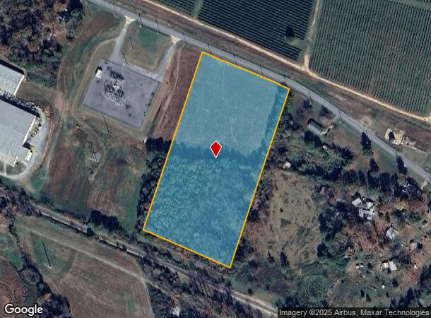
Washburn Switch Rd
Shelby, NC
Industrial Wash Switch
48488
#2 PB 40-51 RD 1313
Industrialacreage
Cleveland
X
North Carolina
3710251800J
149
2025
11.23 AC
2025
Cleveland County
950800
Charlotte
DEMOGRAPHICS near Washburn Switch Rd
1 Mile
3 Mile
5 Mile
2024 Total Population
465
4,746
18,695
2029 Population
481
4,921
19,485
Pop Growth 2024-2029
+ 3.44%
+ 3.69%
+ 4.23%
Average Age
41
42
42
2024 Total Households
183
1,885
7,435
HH Growth 2024-2029
+ 3.28%
+ 3.71%
+ 4.25%
Median Household Inc
$62,250
$58,994
$48,385
Avg Household Size
2.50
2.50
2.40
2024 Avg HH Vehicles
2.00
2.00
2.00
Median Home Value
$124,107
$160,592
$157,248
Median Year Built
1973
1978
1976
Nearby Places
Map Layers
Map Styles
 Street
 Aerial
- Restaurants
- Banks
- Shops
- Fitness
- Groceries
SALE & LEASE HISTORY
LISTING DATE
SALE/LEASE

Sep 24, 2016
For Sale
Nearby Properties
Address
Land Use
TOTAL SIZE
Lot Size
Zoning
Address
Land Use
TOTAL SIZE
Lot Size
Zoning
420 SF
235.30 AC
HI
Address
Land Use
TOTAL SIZE
Lot Size
Zoning
99,594 SF
247.03 AC
LI
Address
Land Use
TOTAL SIZE
Lot Size
Zoning
673,500 SF
59.18 AC
HI
Address
Land Use
TOTAL SIZE
Lot Size
Zoning
1,301 SF
43.26 AC
HI
Address
Land Use
TOTAL SIZE
Lot Size
Zoning
308,638 SF
156.66 AC
GI
Address
Land Use
TOTAL SIZE
Lot Size
Zoning
213,462 SF
22.27 AC
LI
Address
Land Use
TOTAL SIZE
Lot Size
Zoning
106,794 SF
40.60 AC
HI
Address
Land Use
TOTAL SIZE
Lot Size
Zoning
157,500 SF
19.78 AC
LI
Address
Land Use
TOTAL SIZE
Lot Size
Zoning
148,455 SF
15 AC
LI
Address
Land Use
TOTAL SIZE
Lot Size
Zoning
127,744 SF
19.41 AC
Address
Land Use
TOTAL SIZE
Lot Size
Zoning
100,336 SF
15.11 AC
LI
Address
Land Use
TOTAL SIZE
Lot Size
Zoning
18,744 SF
110.59 AC
LI
Address
Land Use
TOTAL SIZE
Lot Size
Zoning
108,989 SF
31.02 AC
Address
Land Use
TOTAL SIZE
Lot Size
Zoning
57,143 SF
21.50 AC
LI
Address
Land Use
TOTAL SIZE
Lot Size
Zoning
6,662 SF
22.34 AC
HI
Address
Land Use
TOTAL SIZE
Lot Size
Zoning
45,310 SF
18.25 AC
GICU
Address
Land Use
TOTAL SIZE
Lot Size
Zoning
32,363 SF
11.95 AC
Address
Land Use
TOTAL SIZE
Lot Size
Zoning
13,461 SF
36.68 AC
HI
Address
Land Use
TOTAL SIZE
Lot Size
Zoning
29,080 SF
27.92 AC
R15
Address
Land Use
TOTAL SIZE
Lot Size
Zoning
53,760 SF
11.48 AC
Address
Land Use
TOTAL SIZE
Lot Size
Zoning
4,633 SF
21.50 AC
R20
Address
Land Use
TOTAL SIZE
Lot Size
Zoning
69,344 SF
10.98 AC
LI
Address
Land Use
TOTAL SIZE
Lot Size
Zoning
4,498 SF
12.04 AC
R15
Address
Land Use
TOTAL SIZE
Lot Size
Zoning
20,000 SF
5.09 AC
LI
Address
Land Use
TOTAL SIZE
Lot Size
Zoning
19,753 SF
3.86 AC
AA3
Address
Land Use
TOTAL SIZE
Lot Size
Zoning
13,441 SF
17.58 AC
R20
Address
Land Use
TOTAL SIZE
Lot Size
Zoning
3,750 SF
4.28 AC
AA0
Address
Land Use
TOTAL SIZE
Lot Size
Zoning
20,285 SF
25 AC
AA1
Address
Land Use
TOTAL SIZE
Lot Size
Zoning
106,900 SF
5.02 AC
LI
Address
Land Use
TOTAL SIZE
Lot Size
Zoning
13,898 SF
15 AC
R20
The World's #1 Commercial Real Estate Marketplace
Connect with us
© 2025 CoStar Group
The information above has been obtained from sources believed reliable. While we do not doubt its accuracy we have not verified it and make no guarantee, warranty or representation about it. It is your responsibility to independently confirm its accuracy and completeness. Any projections, opinions, assumptions, or estimates used are for example only and do not represent the current or future performance of the property. The value of this transaction to you depends on tax and other factors which should be evaluated by your tax, financial, and legal advisors. You and your advisors should conduct a careful, independent investigation of the property to determine to your satisfaction the suitability of the property for your needs.