Property Record
Washington Rd, Washington, IL 61571

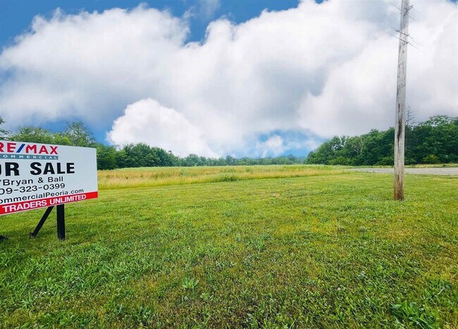
Property Detail
Washington Rd
Peoria, IL
SEC 20 T26N R3W PT LOT 1 (EXC SUB & ROW) NE 1/4 3.18 AC
02-02-20-200-028
TAZEWELL
Residentialacreage
Illinois
B and X Area of moderate flood hazard, usually the area between the limits of the 100-year and 500-year floods.
1
2023
3.18 AC
2024
Outlying Tazewell County
022200
Peoria
NEARBY LISTINGS FOR SALE OR LEASE
DEMOGRAPHICS near Washington Rd
1 mile
3 mile
5 mile
2025 Total Population
3,120
22,356
44,390
2030 Population
3,101
22,216
44,195
Pop Growth 2025-2030
(0.61%)
(0.63%)
(0.44%)
Average Age
41
41
42
2025 Total Households
1,264
8,853
17,646
HH Growth 2025-2030
(0.63%)
(0.63%)
(0.45%)
Median Household Inc
$74,309
$81,982
$83,844
Avg Household Size
2.40
2.50
2.50
2025 Avg HH Vehicles
2.00
2.00
2.00
Median Home Value
$168,497
$192,730
$192,329
Median Year Built
1973
1976
1974
Nearby Places
Map Layers
Map Styles
 Street
 Aerial
Transit
 Traffic
 Biking
Places
Listings with unknown addresses are not visible on the map
- Restaurants
- Banks
- Shops
- Fitness
- Groceries
PUBLIC TRANSPORTATION
AIRPORT
General Downing - Peoria International
Drive
Walk
Distance
General Downing - Peoria International
25 min
14.2 mi
Freight Ports
Port Milwaukee
Drive
Walk
Distance
Port Milwaukee
260 min
223.2 mi
SALE & LEASE HISTORY
LISTING DATE
SALE/LEASE

Sep 24, 2016
For Sale
Jan 07, 2026
For Sale
Nearby Properties
Address
Land Use
TOTAL SIZE
Lot Size
Zoning
Address
Land Use
TOTAL SIZE
Lot Size
Zoning
185,656 SF
33.63 AC
Address
Land Use
TOTAL SIZE
Lot Size
Zoning
24,780 SF
1.62 AC
Address
Land Use
TOTAL SIZE
Lot Size
Zoning
69,113 SF
9.83 AC
Address
Land Use
TOTAL SIZE
Lot Size
Zoning
165,485 SF
15.75 AC
Address
Land Use
TOTAL SIZE
Lot Size
Zoning
133,070 SF
11.11 AC
Address
Land Use
TOTAL SIZE
Lot Size
Zoning
74,620 SF
6.54 AC
Address
Land Use
TOTAL SIZE
Lot Size
Zoning
35,716 SF
4 AC
Address
Land Use
TOTAL SIZE
Lot Size
Zoning
7,615 SF
3.19 AC
Address
Land Use
TOTAL SIZE
Lot Size
Zoning
24,800 SF
3.20 AC
Address
Land Use
TOTAL SIZE
Lot Size
Zoning
21,948 SF
4.65 AC
Address
Land Use
TOTAL SIZE
Lot Size
Zoning
40,040 SF
83.34 AC
Address
Land Use
TOTAL SIZE
Lot Size
Zoning
42,640 SF
4.48 AC
Address
Land Use
TOTAL SIZE
Lot Size
Zoning
81,674 SF
9.88 AC
Address
Land Use
TOTAL SIZE
Lot Size
Zoning
122,215 SF
3.36 AC
Address
Land Use
TOTAL SIZE
Lot Size
Zoning
24,800 SF
2.92 AC
Address
Land Use
TOTAL SIZE
Lot Size
Zoning
41,606 SF
6.96 AC
Address
Land Use
TOTAL SIZE
Lot Size
Zoning
16,371 SF
2.53 AC
Address
Land Use
TOTAL SIZE
Lot Size
Zoning
36,214 SF
3.68 AC
Address
Land Use
TOTAL SIZE
Lot Size
Zoning
101,625 SF
10.62 AC
Address
Land Use
TOTAL SIZE
Lot Size
Zoning
50,781 SF
5.10 AC
Address
Land Use
TOTAL SIZE
Lot Size
Zoning
28,646 SF
2.89 AC
Address
Land Use
TOTAL SIZE
Lot Size
Zoning
14,000 SF
1.37 AC
Address
Land Use
TOTAL SIZE
Lot Size
Zoning
20,000 SF
3 AC
Address
Land Use
TOTAL SIZE
Lot Size
Zoning
52,500 SF
1.21 AC
Address
Land Use
TOTAL SIZE
Lot Size
Zoning
50,840 SF
9.67 AC
Address
Land Use
TOTAL SIZE
Lot Size
Zoning
107,010 SF
1.72 AC
Address
Land Use
TOTAL SIZE
Lot Size
Zoning
58,368 SF
5.63 AC
Address
Land Use
TOTAL SIZE
Lot Size
Zoning
2,906 SF
55.85 AC
Address
Land Use
TOTAL SIZE
Lot Size
Zoning
85,761 SF
5.84 AC
Address
Land Use
TOTAL SIZE
Lot Size
Zoning
13,608 SF
2.93 AC
The World's #1 Commercial Real Estate Marketplace
Connect with us
© 2026 CoStar Group
The information above has been obtained from sources believed reliable. While we do not doubt its accuracy we have not verified it and make no guarantee, warranty or representation about it. It is your responsibility to independently confirm its accuracy and completeness. Any projections, opinions, assumptions, or estimates used are for example only and do not represent the current or future performance of the property. The value of this transaction to you depends on tax and other factors which should be evaluated by your tax, financial, and legal advisors. You and your advisors should conduct a careful, independent investigation of the property to determine to your satisfaction the suitability of the property for your needs.