Property Record
Wassou Rd, Crystal Bay, NV 89402
Property Detail
Wassou Rd
Reno, NV
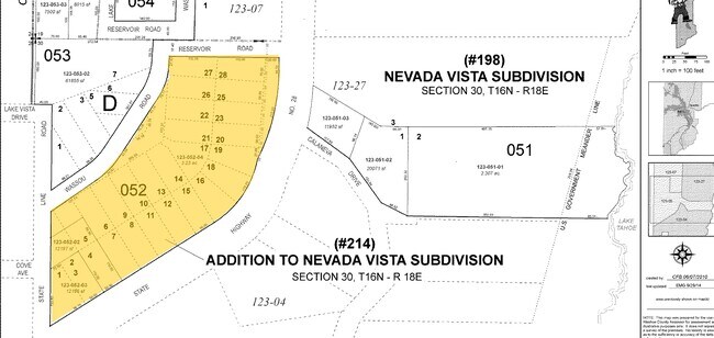
NEVADA VISTA LOT 2 BLOCK F
123-071-04
WASHOE
Vacantlanddestroyeduninhabitableimprovement
Nevada
TA_CB
2
B and X Area of moderate flood hazard, usually the area between the limits of the 100-year and 500-year floods.
0.64 AC
2025
Reno
2026
Reno/Sparks
003308
NEARBY LISTINGS FOR SALE OR LEASE
DEMOGRAPHICS near Wassou Rd
1 mile
3 mile
5 mile
2025 Total Population
653
9,118
23,165
2030 Population
661
9,666
25,476
Pop Growth 2025-2030
+ 1.23%
+ 6.01%
+ 9.98%
Average Age
43
45
46
2025 Total Households
269
3,891
10,189
HH Growth 2025-2030
+ 1.12%
+ 6.27%
+ 10.26%
Median Household Inc
$59,188
$94,446
$136,583
Avg Household Size
2.30
2.30
2.20
2025 Avg HH Vehicles
2.00
2.00
2.00
Median Home Value
$907,407
$999,999
$1,014,567
Median Year Built
1974
1977
1978
Nearby Places
Map Layers
Map Styles
 Street
 Aerial
Layers
 Traffic
 Biking
Places
Listings with unknown addresses are not visible on the map
- Restaurants
- Banks
- Shops
- Fitness
- Groceries
PUBLIC TRANSPORTATION
AIRPORT
Reno/Tahoe International
Drive
Walk
Distance
Reno/Tahoe International
74 min
38.9 mi
Freight Ports
Port of Stockton
Drive
Walk
Distance
Port of Stockton
194 min
162.2 mi
Nearby Properties
Address
Land Use
TOTAL SIZE
Lot Size
Zoning
Address
Land Use
TOTAL SIZE
Lot Size
Zoning
38,050 SF
5.46 AC
Address
Land Use
TOTAL SIZE
Lot Size
Zoning
4,682 SF
3.50 AC
022
Address
Land Use
TOTAL SIZE
Lot Size
Zoning
2,997 SF
0.24 AC
Address
Land Use
TOTAL SIZE
Lot Size
Zoning
15,621 SF
1.74 AC
022
Address
Land Use
TOTAL SIZE
Lot Size
Zoning
2,282 SF
12.01 AC
TA_L
Address
Land Use
TOTAL SIZE
Lot Size
Zoning
70,916 SF
3.31 AC
032
Address
Land Use
TOTAL SIZE
Lot Size
Zoning
612 SF
4.21 AC
TA_L
Address
Land Use
TOTAL SIZE
Lot Size
Zoning
9,308 SF
0.70 AC
022
Address
Land Use
TOTAL SIZE
Lot Size
Zoning
6.25 AC
022
Address
Land Use
TOTAL SIZE
Lot Size
Zoning
54,085 SF
1.50 AC
029
Address
Land Use
TOTAL SIZE
Lot Size
Zoning
8,335 SF
0.81 AC
022
Address
Land Use
TOTAL SIZE
Lot Size
Zoning
12,993 SF
3.89 AC
TA_CB
Address
Land Use
TOTAL SIZE
Lot Size
Zoning
52,257 SF
1.75 AC
032
Address
Land Use
TOTAL SIZE
Lot Size
Zoning
5,710 SF
2.25 AC
029
Address
Land Use
TOTAL SIZE
Lot Size
Zoning
10,463 SF
1.50 AC
022
Address
Land Use
TOTAL SIZE
Lot Size
Zoning
139,654 SF
8.46 AC
TA_CBT
Address
Land Use
TOTAL SIZE
Lot Size
Zoning
1,653 SF
0.24 AC
029
Address
Land Use
TOTAL SIZE
Lot Size
Zoning
12,933 SF
5.10 AC
022
Address
Land Use
TOTAL SIZE
Lot Size
Zoning
33,478 SF
0.86 AC
TA_IVC
Address
Land Use
TOTAL SIZE
Lot Size
Zoning
4,536 SF
0.85 AC
TA_L
Address
Land Use
TOTAL SIZE
Lot Size
Zoning
22,350 SF
1.94 AC
022
Address
Land Use
TOTAL SIZE
Lot Size
Zoning
1,175.62 AC
TA_MR 90%
Address
Land Use
TOTAL SIZE
Lot Size
Zoning
3,368 SF
0.57 AC
029
Address
Land Use
TOTAL SIZE
Lot Size
Zoning
0.91 AC
032
Address
Land Use
TOTAL SIZE
Lot Size
Zoning
2,972 SF
0.17 AC
029
Address
Land Use
TOTAL SIZE
Lot Size
Zoning
236,983 SF
2.92 AC
TA_CBT
Address
Land Use
TOTAL SIZE
Lot Size
Zoning
Address
Land Use
TOTAL SIZE
Lot Size
Zoning
4,529 SF
0.57 AC
028
Address
Land Use
TOTAL SIZE
Lot Size
Zoning
7,711 SF
1.69 AC
023
Address
Land Use
TOTAL SIZE
Lot Size
Zoning
8,212 SF
0.26 AC
029
The World's #1 Commercial Real Estate Marketplace
Connect with us
© 2026 CoStar Group
The information above has been obtained from sources believed reliable. While we do not doubt its accuracy we have not verified it and make no guarantee, warranty or representation about it. It is your responsibility to independently confirm its accuracy and completeness. Any projections, opinions, assumptions, or estimates used are for example only and do not represent the current or future performance of the property. The value of this transaction to you depends on tax and other factors which should be evaluated by your tax, financial, and legal advisors. You and your advisors should conduct a careful, independent investigation of the property to determine to your satisfaction the suitability of the property for your needs.