Property Record
Wato Rd, Apple Valley, CA 92307
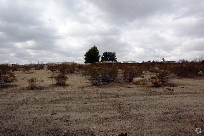


Property Detail
Wato Rd
Riverside-San Bernardino-Ontario, CA
TRACT 7802 LOT 143 DESERT KNOLLS MANOR UNIT NO 1
0473-274-06
SAN BERNARDINO
Vacantlandnec
California
B and X Area of moderate flood hazard, usually the area between the limits of the 100-year and 500-year floods.
143
2025
0.52 AC
2025
Mojave River Valley
009714
Inland Empire (California)
NEARBY LISTINGS FOR SALE OR LEASE
DEMOGRAPHICS near Wato Rd
1 mile
3 mile
5 mile
2025 Total Population
3,898
30,422
110,134
2030 Population
3,958
30,929
112,346
Pop Growth 2025-2030
+ 1.54%
+ 1.67%
+ 2.01%
Average Age
39
37
36
2025 Total Households
1,456
9,548
34,628
HH Growth 2025-2030
+ 1.58%
+ 1.68%
+ 2.09%
Median Household Inc
$84,109
$64,812
$71,220
Avg Household Size
2.70
3.10
3.10
2025 Avg HH Vehicles
2.00
2.00
2.00
Median Home Value
$497,149
$429,840
$420,385
Median Year Built
1993
1983
1988
Nearby Places
Map Layers
Map Styles
 Street
 Aerial
Layers
 Traffic
 Biking
Places
Listings with unknown addresses are not visible on the map
- Restaurants
- Banks
- Shops
- Fitness
- Groceries
PUBLIC TRANSPORTATION
COMMUTER RAIL
Drive
Walk
Distance
5 min
2.2 mi
AIRPORT
Ontario International
Drive
Walk
Distance
Ontario International
60 min
49.0 mi
SALE & LEASE HISTORY
LISTING DATE
SALE/LEASE

Sep 24, 2016
For Sale
Nearby Properties
Address
Land Use
TOTAL SIZE
Lot Size
Zoning
Address
Land Use
TOTAL SIZE
Lot Size
Zoning
Address
Land Use
TOTAL SIZE
Lot Size
Zoning
102,894 SF
12.27 AC
Address
Land Use
TOTAL SIZE
Lot Size
Zoning
88,528 SF
89.31 AC
OS
Address
Land Use
TOTAL SIZE
Lot Size
Zoning
26,980 SF
2.50 AC
Address
Land Use
TOTAL SIZE
Lot Size
Zoning
177.89 AC
Address
Land Use
TOTAL SIZE
Lot Size
Zoning
27,455 SF
3.17 AC
Address
Land Use
TOTAL SIZE
Lot Size
Zoning
37,288 SF
5.92 AC
Address
Land Use
TOTAL SIZE
Lot Size
Zoning
88,419 SF
6.67 AC
Address
Land Use
TOTAL SIZE
Lot Size
Zoning
12,504 SF
2.97 AC
Address
Land Use
TOTAL SIZE
Lot Size
Zoning
42,078 SF
4.85 AC
AP
Address
Land Use
TOTAL SIZE
Lot Size
Zoning
49,851 SF
17.67 AC
Address
Land Use
TOTAL SIZE
Lot Size
Zoning
15,408 SF
1.05 AC
Address
Land Use
TOTAL SIZE
Lot Size
Zoning
1.65 AC
Address
Land Use
TOTAL SIZE
Lot Size
Zoning
41,476 SF
3.66 AC
Address
Land Use
TOTAL SIZE
Lot Size
Zoning
610 AC
Address
Land Use
TOTAL SIZE
Lot Size
Zoning
5,597 SF
1.36 AC
Address
Land Use
TOTAL SIZE
Lot Size
Zoning
167.17 AC
Address
Land Use
TOTAL SIZE
Lot Size
Zoning
19,328 SF
1.24 AC
Address
Land Use
TOTAL SIZE
Lot Size
Zoning
23,760 SF
1.36 AC
Address
Land Use
TOTAL SIZE
Lot Size
Zoning
5,798 SF
1.74 AC
Address
Land Use
TOTAL SIZE
Lot Size
Zoning
4,128 SF
0.99 AC
Address
Land Use
TOTAL SIZE
Lot Size
Zoning
34,742 SF
3.59 AC
Address
Land Use
TOTAL SIZE
Lot Size
Zoning
28,929 SF
1.57 AC
Address
Land Use
TOTAL SIZE
Lot Size
Zoning
22,275 SF
2.27 AC
936
Address
Land Use
TOTAL SIZE
Lot Size
Zoning
31.74 AC
Address
Land Use
TOTAL SIZE
Lot Size
Zoning
12,083 SF
1.27 AC
Address
Land Use
TOTAL SIZE
Lot Size
Zoning
1.32 AC
936
Address
Land Use
TOTAL SIZE
Lot Size
Zoning
68,684 SF
1.55 AC
936
Address
Land Use
TOTAL SIZE
Lot Size
Zoning
10,640 SF
1.18 AC
The World's #1 Commercial Real Estate Marketplace
Connect with us
© 2026 CoStar Group
The information above has been obtained from sources believed reliable. While we do not doubt its accuracy we have not verified it and make no guarantee, warranty or representation about it. It is your responsibility to independently confirm its accuracy and completeness. Any projections, opinions, assumptions, or estimates used are for example only and do not represent the current or future performance of the property. The value of this transaction to you depends on tax and other factors which should be evaluated by your tax, financial, and legal advisors. You and your advisors should conduct a careful, independent investigation of the property to determine to your satisfaction the suitability of the property for your needs.