Property Record
Webb Bartley Rd, West Point, GA 31833
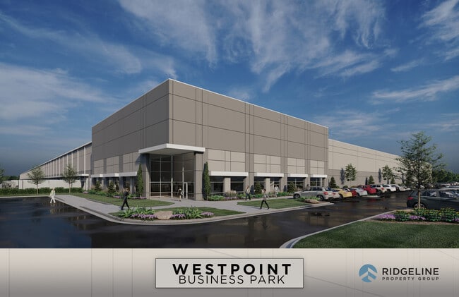

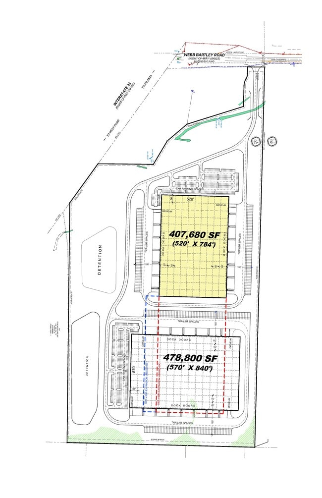
Current Lease Availabilities
Property Detail
Webb Bartley Rd
077-0-000-021A
WEBB BARTLEY RD/LL122/164 LD5TH
Agriculturalland
TROUP
17-MXD-1
Georgia
B and X Area of moderate flood hazard, usually the area between the limits of the 100-year and 500-year floods.
79.93 AC
2025
Troup County
2025
Columbus GA
120198
LaGrange, GA-AL
NEARBY LISTINGS FOR SALE OR LEASE
DEMOGRAPHICS near Webb Bartley Rd
1 mile
3 mile
5 mile
2025 Total Population
215
2,589
9,591
2030 Population
222
2,687
9,884
Pop Growth 2025-2030
+ 3.26%
+ 3.79%
+ 3.05%
Average Age
38
40
41
2025 Total Households
83
975
3,682
HH Growth 2025-2030
+ 3.61%
+ 4.10%
+ 3.29%
Median Household Inc
$37,777
$62,817
$60,046
Avg Household Size
2.50
2.60
2.50
2025 Avg HH Vehicles
2.00
2.00
2.00
Median Home Value
$164,999
$183,104
$175,256
Median Year Built
1998
1985
1979
Nearby Places
Map Layers
Map Styles
 Street
 Aerial
Layers
 Traffic
 Biking
Places
Listings with unknown addresses are not visible on the map
- Restaurants
- Banks
- Shops
- Fitness
- Groceries
PUBLIC TRANSPORTATION
AIRPORT
Columbus
Drive
Walk
Distance
Columbus
51 min
38.9 mi
Freight Ports
Port of Panama City
Drive
Walk
Distance
Port of Panama City
286 min
226.8 mi
Nearby Properties
Address
Land Use
TOTAL SIZE
Lot Size
Zoning
Address
Land Use
TOTAL SIZE
Lot Size
Zoning
415,440 SF
1,989.06 AC
17-I-1
Address
Land Use
TOTAL SIZE
Lot Size
Zoning
Address
Land Use
TOTAL SIZE
Lot Size
Zoning
517,521 SF
27.03 AC
17-I-1
Address
Land Use
TOTAL SIZE
Lot Size
Zoning
255,952 SF
1 AC
17-I-1
Address
Land Use
TOTAL SIZE
Lot Size
Zoning
311,435 SF
1 AC
17-I-1
Address
Land Use
TOTAL SIZE
Lot Size
Zoning
307,800 SF
49.87 AC
17-MXD-1
Address
Land Use
TOTAL SIZE
Lot Size
Zoning
Address
Land Use
TOTAL SIZE
Lot Size
Zoning
426,400 SF
1 AC
17-I-1
Address
Land Use
TOTAL SIZE
Lot Size
Zoning
Address
Land Use
TOTAL SIZE
Lot Size
Zoning
142,270 SF
2 AC
Address
Land Use
TOTAL SIZE
Lot Size
Zoning
88.55 AC
Address
Land Use
TOTAL SIZE
Lot Size
Zoning
88.55 AC
Address
Land Use
TOTAL SIZE
Lot Size
Zoning
Address
Land Use
TOTAL SIZE
Lot Size
Zoning
17,098 SF
17.64 AC
17-SPLIT
Address
Land Use
TOTAL SIZE
Lot Size
Zoning
132,600 SF
1 AC
Address
Land Use
TOTAL SIZE
Lot Size
Zoning
28,850 SF
6.63 AC
17-MXD-1
Address
Land Use
TOTAL SIZE
Lot Size
Zoning
Address
Land Use
TOTAL SIZE
Lot Size
Zoning
70,000 SF
1 AC
17-I-1
Address
Land Use
TOTAL SIZE
Lot Size
Zoning
6,800 SF
10 AC
17-I-1
Address
Land Use
TOTAL SIZE
Lot Size
Zoning
160.49 AC
17-R-1
Address
Land Use
TOTAL SIZE
Lot Size
Zoning
75,684 SF
5.28 AC
17-MXD-1
Address
Land Use
TOTAL SIZE
Lot Size
Zoning
523.41 AC
17-MXD-1
Address
Land Use
TOTAL SIZE
Lot Size
Zoning
63,804 SF
8.60 AC
17-MXD-1
Address
Land Use
TOTAL SIZE
Lot Size
Zoning
57.63 AC
01-SU-R
Address
Land Use
TOTAL SIZE
Lot Size
Zoning
106,133 SF
8.37 AC
17-I-1
Address
Land Use
TOTAL SIZE
Lot Size
Zoning
Address
Land Use
TOTAL SIZE
Lot Size
Zoning
Address
Land Use
TOTAL SIZE
Lot Size
Zoning
7,310 SF
6 AC
17-CGN
Address
Land Use
TOTAL SIZE
Lot Size
Zoning
7,326 SF
4.50 AC
17-I-1
Address
Land Use
TOTAL SIZE
Lot Size
Zoning
36,225 SF
5.74 AC
17-I-1
The World's #1 Commercial Real Estate Marketplace
Connect with us
© 2026 CoStar Group
The information above has been obtained from sources believed reliable. While we do not doubt its accuracy we have not verified it and make no guarantee, warranty or representation about it. It is your responsibility to independently confirm its accuracy and completeness. Any projections, opinions, assumptions, or estimates used are for example only and do not represent the current or future performance of the property. The value of this transaction to you depends on tax and other factors which should be evaluated by your tax, financial, and legal advisors. You and your advisors should conduct a careful, independent investigation of the property to determine to your satisfaction the suitability of the property for your needs.