Property Record
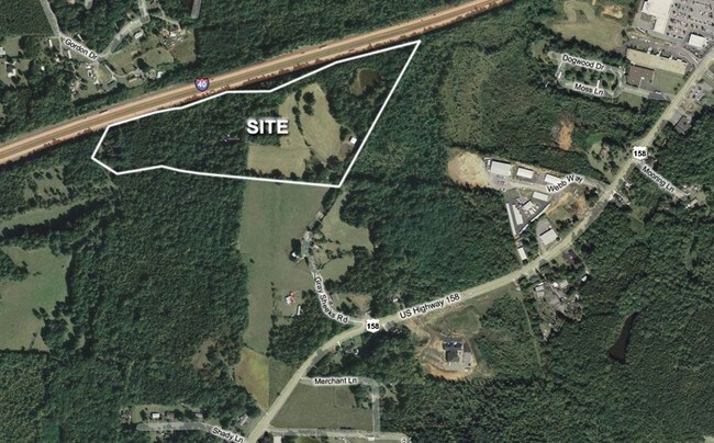
Webb Way, Advance, NC 27006

Property Detail
Webb Way
Winston-Salem, NC
15.435AC WEBB INDUS COURT
D7-000-00-241
DAVIE
Vacantlandnec
North Carolina
AE The base floodplain where base flood elevations are provided. AE Zones are now used on new format FIRMs instead of A1-A30 Zones.
15.49 AC
2025
Davie County
2025
Greensboro/Winston-Salem
080302
NEARBY LISTINGS FOR SALE OR LEASE
DEMOGRAPHICS near Webb Way
1 mile
3 mile
5 mile
2025 Total Population
1,900
13,579
34,112
2030 Population
1,973
14,166
35,446
Pop Growth 2025-2030
+ 3.84%
+ 4.32%
+ 3.91%
Average Age
47
47
45
2025 Total Households
783
5,731
13,816
HH Growth 2025-2030
+ 3.70%
+ 4.31%
+ 3.99%
Median Household Inc
$102,140
$88,871
$88,879
Avg Household Size
2.40
2.30
2.40
2025 Avg HH Vehicles
2.00
2.00
2.00
Median Home Value
$367,829
$374,756
$365,066
Median Year Built
1993
1990
1990
Nearby Places
Map Layers
Map Styles
 Street
 Aerial
Transit
 Traffic
 Biking
Places
Listings with unknown addresses are not visible on the map
- Restaurants
- Banks
- Shops
- Fitness
- Groceries
PUBLIC TRANSPORTATION
AIRPORT
Piedmont Triad International
Drive
Walk
Distance
Piedmont Triad International
45 min
33.7 mi
Freight Ports
Port of Wilmington
Drive
Walk
Distance
Port of Wilmington
283 min
242.4 mi
SALE & LEASE HISTORY
LISTING DATE
SALE/LEASE

Oct 05, 2018
For Sale
Nearby Properties
Address
Land Use
TOTAL SIZE
Lot Size
Zoning
Address
Land Use
TOTAL SIZE
Lot Size
Zoning
161,744 SF
309.97 AC
RA
Address
Land Use
TOTAL SIZE
Lot Size
Zoning
132,856 SF
53.61 AC
R20
Address
Land Use
TOTAL SIZE
Lot Size
Zoning
81,594 SF
1,147.49 AC
IP
Address
Land Use
TOTAL SIZE
Lot Size
Zoning
23,926 SF
11.36 AC
Address
Land Use
TOTAL SIZE
Lot Size
Zoning
49,319 SF
24.81 AC
Address
Land Use
TOTAL SIZE
Lot Size
Zoning
1,971 SF
6.24 AC
HB
Address
Land Use
TOTAL SIZE
Lot Size
Zoning
79,498 SF
10.64 AC
HB
Address
Land Use
TOTAL SIZE
Lot Size
Zoning
71,306 SF
10.36 AC
IP-S
Address
Land Use
TOTAL SIZE
Lot Size
Zoning
46,073 SF
11.74 AC
R12
Address
Land Use
TOTAL SIZE
Lot Size
Zoning
119,240 SF
22.72 AC
Address
Land Use
TOTAL SIZE
Lot Size
Zoning
32,656 SF
3.14 AC
IP-S
Address
Land Use
TOTAL SIZE
Lot Size
Zoning
59,143 SF
8.49 AC
CS
Address
Land Use
TOTAL SIZE
Lot Size
Zoning
53,105 SF
5.42 AC
IP-S
Address
Land Use
TOTAL SIZE
Lot Size
Zoning
59,517 SF
5.90 AC
CSS
Address
Land Use
TOTAL SIZE
Lot Size
Zoning
301.66 AC
RM5-S,RS15
Address
Land Use
TOTAL SIZE
Lot Size
Zoning
50,332 SF
2.45 AC
Address
Land Use
TOTAL SIZE
Lot Size
Zoning
6,192 SF
12.52 AC
R8
Address
Land Use
TOTAL SIZE
Lot Size
Zoning
72,612 SF
5.50 AC
Address
Land Use
TOTAL SIZE
Lot Size
Zoning
51,774 SF
7.02 AC
I2S
Address
Land Use
TOTAL SIZE
Lot Size
Zoning
58,022 SF
7.79 AC
CS
Address
Land Use
TOTAL SIZE
Lot Size
Zoning
36,472 SF
4.88 AC
R8
Address
Land Use
TOTAL SIZE
Lot Size
Zoning
14,820 SF
0.46 AC
HB
Address
Land Use
TOTAL SIZE
Lot Size
Zoning
6,000 SF
1.99 AC
CS
Address
Land Use
TOTAL SIZE
Lot Size
Zoning
21,350 SF
4.52 AC
HB
Address
Land Use
TOTAL SIZE
Lot Size
Zoning
19,338 SF
20.52 AC
Address
Land Use
TOTAL SIZE
Lot Size
Zoning
20,408 SF
222.18 AC
R12
Address
Land Use
TOTAL SIZE
Lot Size
Zoning
19,499 SF
18.97 AC
R20
Address
Land Use
TOTAL SIZE
Lot Size
Zoning
15,597 SF
1.07 AC
CSS
Address
Land Use
TOTAL SIZE
Lot Size
Zoning
11,466 SF
1.31 AC
The World's #1 Commercial Real Estate Marketplace
Connect with us
© 2026 CoStar Group
The information above has been obtained from sources believed reliable. While we do not doubt its accuracy we have not verified it and make no guarantee, warranty or representation about it. It is your responsibility to independently confirm its accuracy and completeness. Any projections, opinions, assumptions, or estimates used are for example only and do not represent the current or future performance of the property. The value of this transaction to you depends on tax and other factors which should be evaluated by your tax, financial, and legal advisors. You and your advisors should conduct a careful, independent investigation of the property to determine to your satisfaction the suitability of the property for your needs.