Property Record
Wein Rd, Odessa, TX 79766
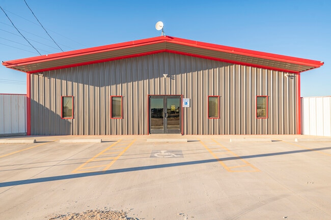

Property Detail
Wein Rd
299860148700000
STERLING PARK 3RD FILING BLOCK 5 LOT 26
Commercialnec
ECTOR
ES2
Texas
B and X Area of moderate flood hazard, usually the area between the limits of the 100-year and 500-year floods.
26
2025
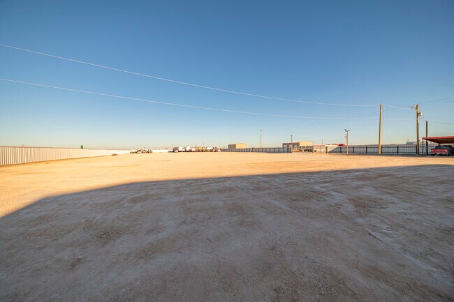
1.24 AC
2025
Midland & Odessa
002200
Other Market Areas
4,250 SF
Odessa, TX
NEARBY LISTINGS FOR SALE OR LEASE
DEMOGRAPHICS near Wein Rd
1 mile
3 mile
5 mile
2025 Total Population
553
13,973
54,803
2030 Population
589
14,891
58,309
Pop Growth 2025-2030
+ 6.51%
+ 6.57%
+ 6.40%
Average Age
36
36
36
2025 Total Households
118
4,561
18,790
HH Growth 2025-2030
+ 7.63%
+ 7.59%
+ 7.52%
Median Household Inc
$82,386
$54,023
$59,202
Avg Household Size
3.40
2.90
2.80
2025 Avg HH Vehicles
2.00
2.00
2.00
Median Home Value
$431,818
$83,154
$142,571
Median Year Built
2006
1985
1970
Nearby Places
Map Layers
Map Styles
 Street
 Aerial
Layers
 Traffic
 Biking
Places
Listings with unknown addresses are not visible on the map
- Restaurants
- Banks
- Shops
- Fitness
- Groceries
PUBLIC TRANSPORTATION
AIRPORT
Midland International Air And Space Port
Drive
Walk
Distance
Midland International Air And Space Port
25 min
15.8 mi
Freight Ports
Port of Corpus Christi
Drive
Walk
Distance
Port of Corpus Christi
504 min
483.5 mi
SALE & LEASE HISTORY
LISTING DATE
SALE/LEASE

Nov 19, 2021
For Sale
Nearby Properties
Address
Land Use
TOTAL SIZE
Lot Size
Zoning
Address
Land Use
TOTAL SIZE
Lot Size
Zoning
23,000 SF
170.58 AC
ES2
Address
Land Use
TOTAL SIZE
Lot Size
Zoning
117,725 SF
19.23 AC
EE5
Address
Land Use
TOTAL SIZE
Lot Size
Zoning
232,969 SF
19.81 AC
EB7
Address
Land Use
TOTAL SIZE
Lot Size
Zoning
10,644 SF
57.53 AC
Address
Land Use
TOTAL SIZE
Lot Size
Zoning
36,648 SF
86.41 AC
ES1
Address
Land Use
TOTAL SIZE
Lot Size
Zoning
11,600 SF
28.47 AC
ES1
Address
Land Use
TOTAL SIZE
Lot Size
Zoning
46,734 SF
10.42 AC
ES2
Address
Land Use
TOTAL SIZE
Lot Size
Zoning
112,000 SF
19.10 AC
ES2
Address
Land Use
TOTAL SIZE
Lot Size
Zoning
72,624 SF
2.28 AC
ES1
Address
Land Use
TOTAL SIZE
Lot Size
Zoning
153,754 SF
9.57 AC
EE5
Address
Land Use
TOTAL SIZE
Lot Size
Zoning
5,826 SF
32.11 AC
ES1
Address
Land Use
TOTAL SIZE
Lot Size
Zoning
61,570 SF
6.44 AC
ES1
Address
Land Use
TOTAL SIZE
Lot Size
Zoning
138,064 SF
8.50 AC
EE5
Address
Land Use
TOTAL SIZE
Lot Size
Zoning
3,141 SF
2.92 AC
EB7
Address
Land Use
TOTAL SIZE
Lot Size
Zoning
15,200 SF
29.64 AC
ES1
Address
Land Use
TOTAL SIZE
Lot Size
Zoning
9,754 SF
14.89 AC
ES1
Address
Land Use
TOTAL SIZE
Lot Size
Zoning
47,000 SF
17.51 AC
EB7
Address
Land Use
TOTAL SIZE
Lot Size
Zoning
50,816 SF
10.73 AC
EB7
Address
Land Use
TOTAL SIZE
Lot Size
Zoning
75,000 SF
3.16 AC
ES2
Address
Land Use
TOTAL SIZE
Lot Size
Zoning
2,592 SF
61.28 AC
ES1
Address
Land Use
TOTAL SIZE
Lot Size
Zoning
10,728 SF
Address
Land Use
TOTAL SIZE
Lot Size
Zoning
1,770 SF
8.59 AC
ES2
Address
Land Use
TOTAL SIZE
Lot Size
Zoning
32,622 SF
2.55 AC
EB7
Address
Land Use
TOTAL SIZE
Lot Size
Zoning
75,000 SF
61.98 AC
ES1
Address
Land Use
TOTAL SIZE
Lot Size
Zoning
77,326 SF
1.96 AC
EB7
Address
Land Use
TOTAL SIZE
Lot Size
Zoning
2,000 SF
4.56 AC
EB7
Address
Land Use
TOTAL SIZE
Lot Size
Zoning
24,220 SF
29.95 AC
ES2
Address
Land Use
TOTAL SIZE
Lot Size
Zoning
48,784 SF
12.86 AC
EE5
Address
Land Use
TOTAL SIZE
Lot Size
Zoning
3,586 SF
2.27 AC
ES2
Address
Land Use
TOTAL SIZE
Lot Size
Zoning
10,300 SF
10.92 AC
ES2
The World's #1 Commercial Real Estate Marketplace
Connect with us
© 2026 CoStar Group
The information above has been obtained from sources believed reliable. While we do not doubt its accuracy we have not verified it and make no guarantee, warranty or representation about it. It is your responsibility to independently confirm its accuracy and completeness. Any projections, opinions, assumptions, or estimates used are for example only and do not represent the current or future performance of the property. The value of this transaction to you depends on tax and other factors which should be evaluated by your tax, financial, and legal advisors. You and your advisors should conduct a careful, independent investigation of the property to determine to your satisfaction the suitability of the property for your needs.