Property Record
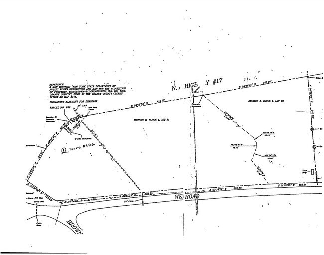
Weld Rd/Brown Rd/17 Exp Expy, T O Wallkill, NY
This Property Is For Sale
NEARBY LISTINGS FOR SALE OR LEASE
Property Detail
Weld Rd/Brown Rd/17 Exp Expy
335200-003-000-0001-031.000-0000
Orange
Commercialacreage
New York
X
30.00
36071C0436E
4.50 AC
2024
Middletown
2024
Northern New Jersey
011102
New York-Jersey City-White Plains, NY-NJ
DEMOGRAPHICS near Weld Rd/Brown Rd/17 Exp Expy
1 Mile
3 Mile
5 Mile
2024 Total Population
887
6,617
43,632
2029 Population
914
6,814
44,073
Pop Growth 2024-2029
+ 3.04%
+ 2.98%
+ 1.01%
Average Age
43
39
40
2024 Total Households
291
2,176
15,508
HH Growth 2024-2029
+ 3.09%
+ 3.17%
+ 1.05%
Median Household Inc
$110,061
$100,882
$92,205
Avg Household Size
2.70
2.90
2.70
2024 Avg HH Vehicles
2.00
2.00
2.00
Median Home Value
$416,216
$423,907
$353,999
Median Year Built
1992
1986
1976
Nearby Places
- Restaurants
- Banks
- Shops
- Fitness
- Groceries
PUBLIC TRANSPORTATION
COMMUTER RAIL
Middletown New York (Bergen County/Port Jervis Line - NJ Transit Commuter Rail (NJ Transit), Main/Port Jervis Line - NJ Transit Commuter Rail (NJ Transit))
DRIVE
WALK
Distance
Middletown New York (Bergen County/Port Jervis Line - NJ Transit Commuter Rail (NJ Transit), Main/Port Jervis Line - NJ Transit Commuter Rail (NJ Transit))
10 min
5.7 mi
AIRPORT
New York Stewart International
DRIVE
WALK
Distance
New York Stewart International
31 min
23.4 mi
Freight Ports
Port Newark Container Terminal
DRIVE
WALK
Distance
Port Newark Container Terminal
96 min
74.7 mi
Nearby Properties
Address
Land Use
TOTAL SIZE
Lot Size
Zoning
Address
Land Use
TOTAL SIZE
Lot Size
Zoning
35.70 AC
R2
Address
Land Use
TOTAL SIZE
Lot Size
Zoning
20.90 AC
Address
Land Use
TOTAL SIZE
Lot Size
Zoning
2.35 AC
Address
Land Use
TOTAL SIZE
Lot Size
Zoning
17,135 SF
3.26 AC
Address
Land Use
TOTAL SIZE
Lot Size
Zoning
30,657 SF
135.40 AC
RA07
Address
Land Use
TOTAL SIZE
Lot Size
Zoning
57,942 SF
14.60 AC
R2
Address
Land Use
TOTAL SIZE
Lot Size
Zoning
12,920 SF
31 AC
RA
Address
Land Use
TOTAL SIZE
Lot Size
Zoning
Address
Land Use
TOTAL SIZE
Lot Size
Zoning
119,071 SF
29.10 AC
ENT-L
Address
Land Use
TOTAL SIZE
Lot Size
Zoning
26,508 SF
20.20 AC
O/R
Address
Land Use
TOTAL SIZE
Lot Size
Zoning
247.69 AC
RAG1
Address
Land Use
TOTAL SIZE
Lot Size
Zoning
1.41 AC
Address
Land Use
TOTAL SIZE
Lot Size
Zoning
4,978 SF
9.90 AC
ENT-L
Address
Land Use
TOTAL SIZE
Lot Size
Zoning
73.60 AC
07
Address
Land Use
TOTAL SIZE
Lot Size
Zoning
3,440 SF
1.16 AC
Address
Land Use
TOTAL SIZE
Lot Size
Zoning
1,624 SF
17.75 AC
Address
Land Use
TOTAL SIZE
Lot Size
Zoning
2,400 SF
25.30 AC
ENT-L
Address
Land Use
TOTAL SIZE
Lot Size
Zoning
29,588 SF
17.90 AC
ENT-L
Address
Land Use
TOTAL SIZE
Lot Size
Zoning
10.90 AC
Address
Land Use
TOTAL SIZE
Lot Size
Zoning
10,086 SF
0.29 AC
Address
Land Use
TOTAL SIZE
Lot Size
Zoning
80.80 AC
Address
Land Use
TOTAL SIZE
Lot Size
Zoning
20,000 SF
12.40 AC
O/R
Address
Land Use
TOTAL SIZE
Lot Size
Zoning
Address
Land Use
TOTAL SIZE
Lot Size
Zoning
8,382 SF
1.10 AC
Address
Land Use
TOTAL SIZE
Lot Size
Zoning
9,538 SF
1.90 AC
R2
Address
Land Use
TOTAL SIZE
Lot Size
Zoning
16,000 SF
14.70 AC
RA07
Address
Land Use
TOTAL SIZE
Lot Size
Zoning
7,250 SF
1.85 AC
Address
Land Use
TOTAL SIZE
Lot Size
Zoning
Address
Land Use
TOTAL SIZE
Lot Size
Zoning
9,100 SF
1.90 AC
ENT-L
Address
Land Use
TOTAL SIZE
Lot Size
Zoning
2,580 SF
0.56 AC
The World's #1 Commercial Real Estate Marketplace
Connect with us
© 2025 CoStar Group
The information above has been obtained from sources believed reliable. While we do not doubt its accuracy we have not verified it and make no guarantee, warranty or representation about it. It is your responsibility to independently confirm its accuracy and completeness. Any projections, opinions, assumptions, or estimates used are for example only and do not represent the current or future performance of the property. The value of this transaction to you depends on tax and other factors which should be evaluated by your tax, financial, and legal advisors. You and your advisors should conduct a careful, independent investigation of the property to determine to your satisfaction the suitability of the property for your needs.