Property Record
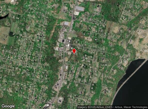
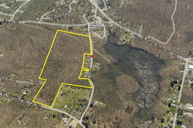
Wells Rd, Newburgh, NY 12550

NEARBY LISTINGS FOR SALE OR LEASE
Property Detail
Wells Rd
New York-Jersey City-White Plains, NY-NJ
Warmers&Vongerichten
334600-039-000-0001-012.440-0000
LT 4 WARMERS&VONGERICHTENSUB MAP 7287
Recreationalacreage
Orange
X
New York
36111C0900F
12.44
2024
45.10 AC
2024
Newburgh
010300
Northern New Jersey
DEMOGRAPHICS near Wells Rd
1 Mile
3 Mile
5 Mile
2024 Total Population
2,674
42,449
90,093
2029 Population
2,755
43,185
91,368
Pop Growth 2024-2029
+ 3.03%
+ 1.73%
+ 1.42%
Average Age
42
39
39
2024 Total Households
920
15,190
33,458
HH Growth 2024-2029
+ 3.15%
+ 1.80%
+ 1.44%
Median Household Inc
$114,549
$81,845
$82,810
Avg Household Size
2.70
2.70
2.50
2024 Avg HH Vehicles
2.00
2.00
2.00
Median Home Value
$323,144
$279,265
$301,230
Median Year Built
1969
1960
1965
Nearby Places
- Restaurants
- Banks
- Shops
- Fitness
- Groceries
PUBLIC TRANSPORTATION
COMMUTER RAIL
Beacon Station (Hudson Line - Metro-North Commuter Railroad Company (Metro-North))
DRIVE
WALK
Distance
Beacon Station (Hudson Line - Metro-North Commuter Railroad Company (Metro-North))
10 min
6.4 mi
AIRPORT
New York Stewart International
DRIVE
WALK
Distance
New York Stewart International
17 min
10.0 mi
Freight Ports
Port of New Haven
DRIVE
WALK
Distance
Port of New Haven
103 min
76.8 mi
SALE & LEASE HISTORY
LISTING DATE
SALE/LEASE

May 16, 2017
For Sale
Nearby Properties
Address
Land Use
TOTAL SIZE
Lot Size
Zoning
Address
Land Use
TOTAL SIZE
Lot Size
Zoning
251,689 SF
43.70 AC
RMF5
Address
Land Use
TOTAL SIZE
Lot Size
Zoning
48,135 SF
40.98 AC
RMF5
Address
Land Use
TOTAL SIZE
Lot Size
Zoning
101,170 SF
28.71 AC
RMF5
Address
Land Use
TOTAL SIZE
Lot Size
Zoning
Address
Land Use
TOTAL SIZE
Lot Size
Zoning
114 AC
Address
Land Use
TOTAL SIZE
Lot Size
Zoning
94,340 SF
31.64 AC
RMF5
Address
Land Use
TOTAL SIZE
Lot Size
Zoning
47,187 SF
33 AC
R40
Address
Land Use
TOTAL SIZE
Lot Size
Zoning
272,943 SF
17 AC
RL
Address
Land Use
TOTAL SIZE
Lot Size
Zoning
21,996 SF
17.36 AC
RMF5
Address
Land Use
TOTAL SIZE
Lot Size
Zoning
112,136 SF
2.70 AC
RM
Address
Land Use
TOTAL SIZE
Lot Size
Zoning
7.65 AC
RMF-5
Address
Land Use
TOTAL SIZE
Lot Size
Zoning
38,962 SF
16.80 AC
RMF5
Address
Land Use
TOTAL SIZE
Lot Size
Zoning
91,705 SF
1.90 AC
RM
Address
Land Use
TOTAL SIZE
Lot Size
Zoning
466.77 AC
R40
Address
Land Use
TOTAL SIZE
Lot Size
Zoning
82,344 SF
1.80 AC
RH
Address
Land Use
TOTAL SIZE
Lot Size
Zoning
50.90 AC
Address
Land Use
TOTAL SIZE
Lot Size
Zoning
35 AC
R40
Address
Land Use
TOTAL SIZE
Lot Size
Zoning
213,521 SF
8 AC
RH
Address
Land Use
TOTAL SIZE
Lot Size
Zoning
104,832 SF
4.85 AC
R15
Address
Land Use
TOTAL SIZE
Lot Size
Zoning
265,660 SF
24.20 AC
Address
Land Use
TOTAL SIZE
Lot Size
Zoning
Address
Land Use
TOTAL SIZE
Lot Size
Zoning
97,011 SF
19.70 AC
Address
Land Use
TOTAL SIZE
Lot Size
Zoning
41,094 SF
6.40 AC
RM
Address
Land Use
TOTAL SIZE
Lot Size
Zoning
138.90 AC
Address
Land Use
TOTAL SIZE
Lot Size
Zoning
54,908 SF
7.60 AC
HD
Address
Land Use
TOTAL SIZE
Lot Size
Zoning
30,801 SF
2.40 AC
IND
Address
Land Use
TOTAL SIZE
Lot Size
Zoning
33,966 SF
2.30 AC
RH
Address
Land Use
TOTAL SIZE
Lot Size
Zoning
14.30 AC
RAG1
Address
Land Use
TOTAL SIZE
Lot Size
Zoning
Address
Land Use
TOTAL SIZE
Lot Size
Zoning
32.30 AC
RMF5
The World's #1 Commercial Real Estate Marketplace
Connect with us
© 2025 CoStar Group
The information above has been obtained from sources believed reliable. While we do not doubt its accuracy we have not verified it and make no guarantee, warranty or representation about it. It is your responsibility to independently confirm its accuracy and completeness. Any projections, opinions, assumptions, or estimates used are for example only and do not represent the current or future performance of the property. The value of this transaction to you depends on tax and other factors which should be evaluated by your tax, financial, and legal advisors. You and your advisors should conduct a careful, independent investigation of the property to determine to your satisfaction the suitability of the property for your needs.