Property Record
Welwood Ave, , PA
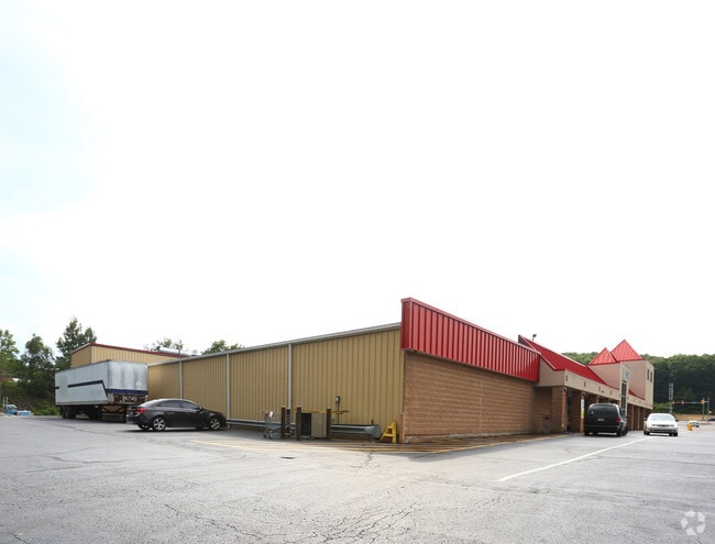

Property Detail
Welwood Ave
108853
SHOOK HAROLD & ANITA
Restaurantbuilding
WAYNE
B and X Area of moderate flood hazard, usually the area between the limits of the 100-year and 500-year floods.
Pennsylvania
2025
0.79 AC
2025
Poconos & Stroudsburg
9606003083
Other Market Areas
NEARBY LISTINGS FOR SALE OR LEASE
DEMOGRAPHICS near Welwood Ave
1 mile
3 mile
5 mile
2025 Total Population
1,332
4,346
8,945
2030 Population
1,325
4,457
9,298
Pop Growth 2025-2030
(0.53%)
+ 2.55%
+ 3.95%
Average Age
45
47
48
2025 Total Households
609
1,930
3,967
HH Growth 2025-2030
(0.82%)
+ 2.54%
+ 4.01%
Median Household Inc
$48,932
$60,529
$66,223
Avg Household Size
2.20
2.20
2.20
2025 Avg HH Vehicles
2.00
2.00
2.00
Median Home Value
$255,063
$296,438
$306,169
Median Year Built
1957
1977
1981
Nearby Places
Map Layers
Map Styles
 Street
 Aerial
Transit
 Traffic
 Biking
Places
Listings with unknown addresses are not visible on the map
- Restaurants
- Banks
- Shops
- Fitness
- Groceries
PUBLIC TRANSPORTATION
AIRPORT
Wilkes-Barre/Scranton International
Drive
Walk
Distance
Wilkes-Barre/Scranton International
62 min
38.7 mi
Nearby Properties
Address
Land Use
TOTAL SIZE
Lot Size
Zoning
Address
Land Use
TOTAL SIZE
Lot Size
Zoning
Address
Land Use
TOTAL SIZE
Lot Size
Zoning
5.93 AC
B2
Address
Land Use
TOTAL SIZE
Lot Size
Zoning
6.70 AC
Address
Land Use
TOTAL SIZE
Lot Size
Zoning
3.67 AC
Address
Land Use
TOTAL SIZE
Lot Size
Zoning
3,575 SF
0.56 AC
R-1
Address
Land Use
TOTAL SIZE
Lot Size
Zoning
11.53 AC
C1
Address
Land Use
TOTAL SIZE
Lot Size
Zoning
235,718 SF
30.55 AC
Address
Land Use
TOTAL SIZE
Lot Size
Zoning
6,927 SF
0.17 AC
B2
Address
Land Use
TOTAL SIZE
Lot Size
Zoning
755 SF
0.81 AC
B2
Address
Land Use
TOTAL SIZE
Lot Size
Zoning
0.17 AC
B-2
Address
Land Use
TOTAL SIZE
Lot Size
Zoning
1.20 AC
I1
Address
Land Use
TOTAL SIZE
Lot Size
Zoning
2.79 AC
B2
Address
Land Use
TOTAL SIZE
Lot Size
Zoning
1.20 AC
Address
Land Use
TOTAL SIZE
Lot Size
Zoning
7,840 SF
3,084.93 AC
Address
Land Use
TOTAL SIZE
Lot Size
Zoning
788 SF
6.63 AC
B2
Address
Land Use
TOTAL SIZE
Lot Size
Zoning
1.51 AC
B2
Address
Land Use
TOTAL SIZE
Lot Size
Zoning
3.40 AC
B2
Address
Land Use
TOTAL SIZE
Lot Size
Zoning
3,290 SF
4.17 AC
Address
Land Use
TOTAL SIZE
Lot Size
Zoning
3.29 AC
C1
Address
Land Use
TOTAL SIZE
Lot Size
Zoning
1.03 AC
B-2
Address
Land Use
TOTAL SIZE
Lot Size
Zoning
2.86 AC
Address
Land Use
TOTAL SIZE
Lot Size
Zoning
0.27 AC
Address
Land Use
TOTAL SIZE
Lot Size
Zoning
3,360 SF
1.39 AC
Address
Land Use
TOTAL SIZE
Lot Size
Zoning
0.83 AC
R1
Address
Land Use
TOTAL SIZE
Lot Size
Zoning
2.77 AC
Address
Land Use
TOTAL SIZE
Lot Size
Zoning
2.87 AC
C1
The World's #1 Commercial Real Estate Marketplace
Connect with us
© 2026 CoStar Group
The information above has been obtained from sources believed reliable. While we do not doubt its accuracy we have not verified it and make no guarantee, warranty or representation about it. It is your responsibility to independently confirm its accuracy and completeness. Any projections, opinions, assumptions, or estimates used are for example only and do not represent the current or future performance of the property. The value of this transaction to you depends on tax and other factors which should be evaluated by your tax, financial, and legal advisors. You and your advisors should conduct a careful, independent investigation of the property to determine to your satisfaction the suitability of the property for your needs.