Property Record
West St, Spindale, NC 28160
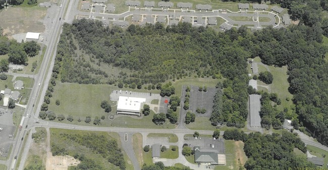


This Property Is For Sale
Property Detail
West St
1649031
GPIN:1620183265320000; WEST ST & RAILROAD AVE
Vacantlandnec
RUTHERFORD
R6
North Carolina
B and X Area of moderate flood hazard, usually the area between the limits of the 100-year and 500-year floods.
10.68 AC
2025
North Carolina West/Cherokee Area
2025
Other Market Areas
960600
Forest City, NC
NEARBY LISTINGS FOR SALE OR LEASE
-
-
View all Spindale listings for sale on LoopNet.com
DEMOGRAPHICS near West St
1 mile
3 mile
5 mile
2024 Total Population
2,793
12,553
22,129
2029 Population
2,865
12,742
22,388
Pop Growth 2024-2029
+ 2.58%
+ 1.51%
+ 1.17%
Average Age
42
43
43
2024 Total Households
1,177
5,127
9,115
HH Growth 2024-2029
+ 2.46%
+ 1.50%
+ 1.12%
Median Household Inc
$37,002
$39,575
$39,673
Avg Household Size
2.20
2.30
2.30
2024 Avg HH Vehicles
2.00
2.00
2.00
Median Home Value
$93,894
$206,417
$200,505
Median Year Built
1971
1972
1974
Nearby Places
Map Layers
Map Styles
 Street
 Aerial
Transit
 Traffic
 Biking
Places
Listings with unknown addresses are not visible on the map
- Restaurants
- Banks
- Shops
- Fitness
- Groceries
Nearby Properties
Address
Land Use
TOTAL SIZE
Lot Size
Zoning
Address
Land Use
TOTAL SIZE
Lot Size
Zoning
334,081 SF
94.10 AC
Address
Land Use
TOTAL SIZE
Lot Size
Zoning
168,615 SF
27.34 AC
CIV
Address
Land Use
TOTAL SIZE
Lot Size
Zoning
29,884 SF
54.60 AC
Address
Land Use
TOTAL SIZE
Lot Size
Zoning
87,123 SF
1.98 AC
Address
Land Use
TOTAL SIZE
Lot Size
Zoning
87,108 SF
26.73 AC
GC
Address
Land Use
TOTAL SIZE
Lot Size
Zoning
421,200 SF
41.90 AC
Address
Land Use
TOTAL SIZE
Lot Size
Zoning
61,023 SF
7.64 AC
R6
Address
Land Use
TOTAL SIZE
Lot Size
Zoning
1,408 SF
6.95 AC
R20
Address
Land Use
TOTAL SIZE
Lot Size
Zoning
63,006 SF
14.29 AC
Address
Land Use
TOTAL SIZE
Lot Size
Zoning
328,907 SF
52.37 AC
Address
Land Use
TOTAL SIZE
Lot Size
Zoning
4,982 SF
27.13 AC
Address
Land Use
TOTAL SIZE
Lot Size
Zoning
2,026 SF
8.71 AC
R6
Address
Land Use
TOTAL SIZE
Lot Size
Zoning
12,480 SF
43 AC
Address
Land Use
TOTAL SIZE
Lot Size
Zoning
210,000 SF
54.75 AC
Address
Land Use
TOTAL SIZE
Lot Size
Zoning
95,267 SF
8.40 AC
GC
Address
Land Use
TOTAL SIZE
Lot Size
Zoning
7,424 SF
6.39 AC
IND
Address
Land Use
TOTAL SIZE
Lot Size
Zoning
53,790 SF
6.37 AC
R6
Address
Land Use
TOTAL SIZE
Lot Size
Zoning
23,990 SF
3 AC
Address
Land Use
TOTAL SIZE
Lot Size
Zoning
6,448 SF
3.30 AC
GC
Address
Land Use
TOTAL SIZE
Lot Size
Zoning
6,000 SF
15.30 AC
Address
Land Use
TOTAL SIZE
Lot Size
Zoning
6,988 SF
1.51 AC
R6
Address
Land Use
TOTAL SIZE
Lot Size
Zoning
10,366 SF
1.22 AC
CIV
Address
Land Use
TOTAL SIZE
Lot Size
Zoning
19,530 SF
1.50 AC
CIV
Address
Land Use
TOTAL SIZE
Lot Size
Zoning
34,861 SF
4.38 AC
CIV
Address
Land Use
TOTAL SIZE
Lot Size
Zoning
93,600 SF
45.11 AC
HCI
Address
Land Use
TOTAL SIZE
Lot Size
Zoning
17,622 SF
5.14 AC
MS
Address
Land Use
TOTAL SIZE
Lot Size
Zoning
53,860 SF
15.88 AC
CIV
Address
Land Use
TOTAL SIZE
Lot Size
Zoning
7,367 SF
0.64 AC
CIV
Address
Land Use
TOTAL SIZE
Lot Size
Zoning
42,360 SF
CIV
Address
Land Use
TOTAL SIZE
Lot Size
Zoning
1,200 SF
6.13 AC
SFR-3
The World's #1 Commercial Real Estate Marketplace
Connect with us
© 2026 CoStar Group
The information above has been obtained from sources believed reliable. While we do not doubt its accuracy we have not verified it and make no guarantee, warranty or representation about it. It is your responsibility to independently confirm its accuracy and completeness. Any projections, opinions, assumptions, or estimates used are for example only and do not represent the current or future performance of the property. The value of this transaction to you depends on tax and other factors which should be evaluated by your tax, financial, and legal advisors. You and your advisors should conduct a careful, independent investigation of the property to determine to your satisfaction the suitability of the property for your needs.