Property Record
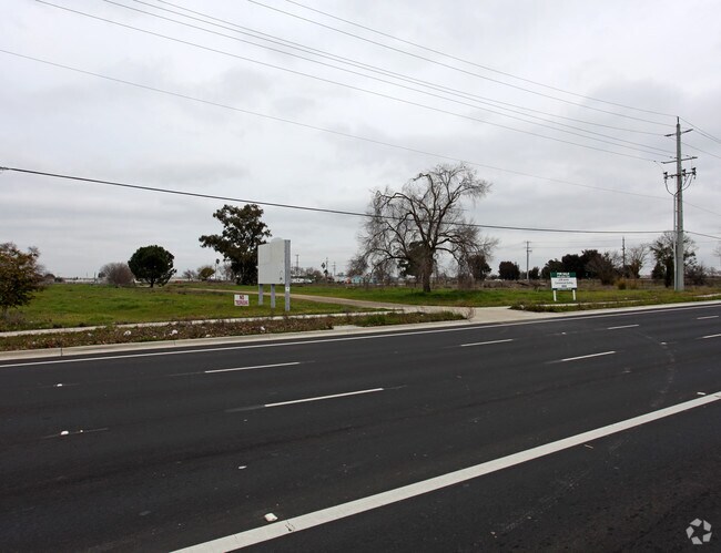
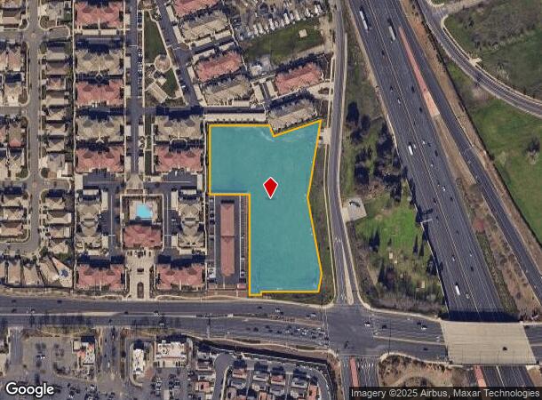
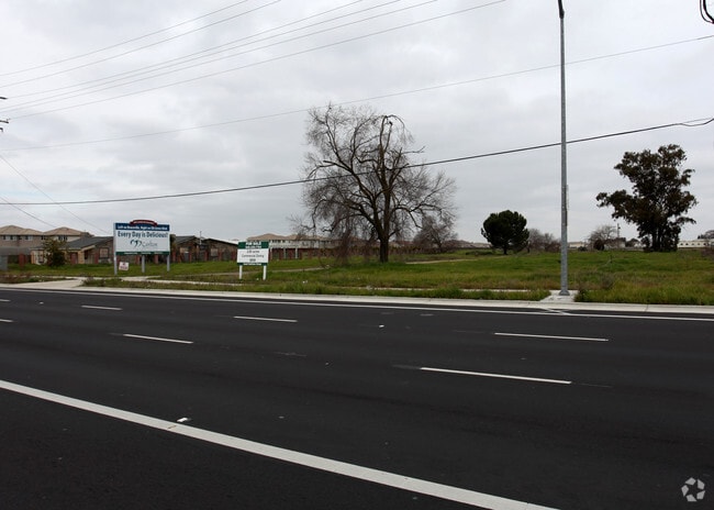
Sheldon Rd, Elk Grove, CA 95758
NEARBY LISTINGS FOR SALE OR LEASE
Property Detail
Sheldon Rd
Sacramento--Roseville--Arden-Arcade, CA
River Park Un 03
117-0220-019
PORTION LOTS10-13
Recreationalacreage
Sacramento
X
California
06067C0309H
328
2024
3.66 AC
2025
South Sacramento
009616
Sacramento
DEMOGRAPHICS near Sheldon Rd
1 Mile
3 Mile
5 Mile
2024 Total Population
19,555
169,551
348,901
2029 Population
19,657
170,158
351,352
Pop Growth 2024-2029
+ 0.52%
+ 0.36%
+ 0.70%
Average Age
37
38
38
2024 Total Households
5,702
52,385
105,760
HH Growth 2024-2029
+ 0.51%
+ 0.31%
+ 0.66%
Median Household Inc
$91,423
$90,042
$90,100
Avg Household Size
3.30
3.10
3.20
2024 Avg HH Vehicles
2.00
2.00
2.00
Median Home Value
$474,026
$462,504
$469,740
Median Year Built
2003
1993
1994
Nearby Places
- Restaurants
- Banks
- Shops
- Fitness
- Groceries
PUBLIC TRANSPORTATION
AIRPORT
Sacramento International
DRIVE
WALK
Distance
Sacramento International
33 min
23.9 mi
Freight Ports
Port of Stockton
DRIVE
WALK
Distance
Port of Stockton
50 min
39.3 mi
Nearby Properties
Address
Land Use
TOTAL SIZE
Lot Size
Zoning
Address
Land Use
TOTAL SIZE
Lot Size
Zoning
728,235 SF
29.15 AC
H-R
Address
Land Use
TOTAL SIZE
Lot Size
Zoning
25,000 SF
13.42 AC
RD-30
Address
Land Use
TOTAL SIZE
Lot Size
Zoning
303,529 SF
10.28 AC
R-3A-PUD R
Address
Land Use
TOTAL SIZE
Lot Size
Zoning
268,881 SF
12.25 AC
RD-20
Address
Land Use
TOTAL SIZE
Lot Size
Zoning
169,610 SF
11.49 AC
H-PUD
Address
Land Use
TOTAL SIZE
Lot Size
Zoning
7.65 AC
RD-20
Address
Land Use
TOTAL SIZE
Lot Size
Zoning
10.35 AC
SC
Address
Land Use
TOTAL SIZE
Lot Size
Zoning
281,404 SF
21.43 AC
M-2
Address
Land Use
TOTAL SIZE
Lot Size
Zoning
Address
Land Use
TOTAL SIZE
Lot Size
Zoning
249,868 SF
15.23 AC
R-2B-R
Address
Land Use
TOTAL SIZE
Lot Size
Zoning
433,006 SF
4.55 AC
R-2B C-2-R
Address
Land Use
TOTAL SIZE
Lot Size
Zoning
0.12 AC
SPA
Address
Land Use
TOTAL SIZE
Lot Size
Zoning
4.98 AC
RD-20
Address
Land Use
TOTAL SIZE
Lot Size
Zoning
102,085 SF
10.26 AC
BP
Address
Land Use
TOTAL SIZE
Lot Size
Zoning
147,920 SF
18.20 AC
SC
Address
Land Use
TOTAL SIZE
Lot Size
Zoning
152,217 SF
17.42 AC
SC
Address
Land Use
TOTAL SIZE
Lot Size
Zoning
433,006 SF
8.70 AC
R-2B C-2-R
Address
Land Use
TOTAL SIZE
Lot Size
Zoning
179,487 SF
9.83 AC
R-2B-R-PUD
Address
Land Use
TOTAL SIZE
Lot Size
Zoning
242,577 SF
0.10 AC
RD-20
Address
Land Use
TOTAL SIZE
Lot Size
Zoning
105,511 SF
4.79 AC
BP
Address
Land Use
TOTAL SIZE
Lot Size
Zoning
105,511 SF
6.67 AC
BP
Address
Land Use
TOTAL SIZE
Lot Size
Zoning
135,197 SF
15.70 AC
LC
Address
Land Use
TOTAL SIZE
Lot Size
Zoning
195,101 SF
12.21 AC
BP
Address
Land Use
TOTAL SIZE
Lot Size
Zoning
92,120 SF
6.91 AC
GC
Address
Land Use
TOTAL SIZE
Lot Size
Zoning
76,090 SF
3.32 AC
RD-25
Address
Land Use
TOTAL SIZE
Lot Size
Zoning
148,007 SF
9.09 AC
RD-20
Address
Land Use
TOTAL SIZE
Lot Size
Zoning
108,843 SF
4.14 AC
RD-30
Address
Land Use
TOTAL SIZE
Lot Size
Zoning
185,300 SF
11.63 AC
RD-20
Address
Land Use
TOTAL SIZE
Lot Size
Zoning
86,094 SF
6.17 AC
H-PUD
Address
Land Use
TOTAL SIZE
Lot Size
Zoning
3.88 AC
RD-20
The World's #1 Commercial Real Estate Marketplace
Connect with us
© 2025 CoStar Group
The information above has been obtained from sources believed reliable. While we do not doubt its accuracy we have not verified it and make no guarantee, warranty or representation about it. It is your responsibility to independently confirm its accuracy and completeness. Any projections, opinions, assumptions, or estimates used are for example only and do not represent the current or future performance of the property. The value of this transaction to you depends on tax and other factors which should be evaluated by your tax, financial, and legal advisors. You and your advisors should conduct a careful, independent investigation of the property to determine to your satisfaction the suitability of the property for your needs.