Property Record
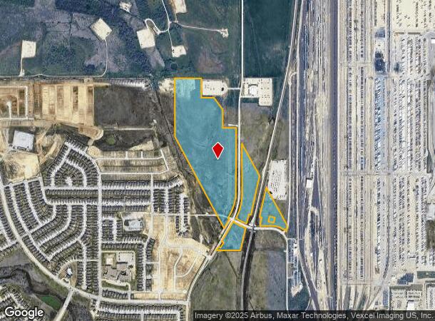
Westport Keller Haslet Rd, Haslet, TX 76052

Property Detail
Westport Keller Haslet Rd
Dallas-Fort Worth-Arlington, TX
Overton
R68085
A0972A OVERTON,TR 9, 88.2023
Agriculturalland
Denton
A
Texas
48121C0630G
88.20 AC
2024
Alliance
2025
Dallas/Ft Worth
114111
NEARBY LISTINGS FOR SALE OR LEASE
DEMOGRAPHICS near Westport Keller Haslet Rd
1 mile
3 mile
5 mile
2024 Total Population
4,917
16,548
65,430
2029 Population
5,659
18,324
72,714
Pop Growth 2024-2029
+ 15.09%
+ 10.73%
+ 11.13%
Average Age
31
33
34
2024 Total Households
1,491
5,071
20,971
HH Growth 2024-2029
+ 15.36%
+ 10.98%
+ 11.20%
Median Household Inc
$117,420
$140,912
$114,191
Avg Household Size
3.30
3.20
3.10
2024 Avg HH Vehicles
2.00
2.00
2.00
Median Home Value
$290,801
$327,272
$317,496
Median Year Built
2011
2010
2010
Nearby Places
Map Layers
Map Styles
 Street
 Aerial
Transit
 Traffic
 Biking
Places
Listings with unknown addresses are not visible on the map
- Restaurants
- Banks
- Shops
- Fitness
- Groceries
PUBLIC TRANSPORTATION
AIRPORT
Dallas-Fort Worth International
Drive
Walk
Distance
Dallas-Fort Worth International
40 min
26.2 mi
Freight Ports
Port of Shreveport
Drive
Walk
Distance
Port of Shreveport
268 min
239.8 mi
SALE & LEASE HISTORY
LISTING DATE
SALE/LEASE

Nov 10, 2022
For Sale
Nearby Properties
Address
Land Use
TOTAL SIZE
Lot Size
Zoning
Address
Land Use
TOTAL SIZE
Lot Size
Zoning
348,270 SF
39.34 AC
Address
Land Use
TOTAL SIZE
Lot Size
Zoning
830,399 SF
11.02 AC
Address
Land Use
TOTAL SIZE
Lot Size
Zoning
564,806 SF
162.94 AC
Address
Land Use
TOTAL SIZE
Lot Size
Zoning
1,228,350 SF
64.51 AC
Address
Land Use
TOTAL SIZE
Lot Size
Zoning
1,150,000 SF
117.10 AC
Address
Land Use
TOTAL SIZE
Lot Size
Zoning
1,141,133 SF
67.79 AC
Address
Land Use
TOTAL SIZE
Lot Size
Zoning
1,179,900 SF
73.58 AC
Address
Land Use
TOTAL SIZE
Lot Size
Zoning
882,565 SF
56.65 AC
Address
Land Use
TOTAL SIZE
Lot Size
Zoning
1,030,050 SF
95.93 AC
Address
Land Use
TOTAL SIZE
Lot Size
Zoning
1,071,600 SF
74.77 AC
Address
Land Use
TOTAL SIZE
Lot Size
Zoning
1,001,600 SF
58.47 AC
Address
Land Use
TOTAL SIZE
Lot Size
Zoning
1,075,256 SF
127.44 AC
Address
Land Use
TOTAL SIZE
Lot Size
Zoning
1,140,525 SF
45.79 AC
Address
Land Use
TOTAL SIZE
Lot Size
Zoning
202.10 AC
Address
Land Use
TOTAL SIZE
Lot Size
Zoning
1,004,400 SF
90.50 AC
Address
Land Use
TOTAL SIZE
Lot Size
Zoning
807,229 SF
46.10 AC
Address
Land Use
TOTAL SIZE
Lot Size
Zoning
804,270 SF
58.79 AC
Address
Land Use
TOTAL SIZE
Lot Size
Zoning
295,161 SF
257.32 AC
Address
Land Use
TOTAL SIZE
Lot Size
Zoning
752,250 SF
37.89 AC
Address
Land Use
TOTAL SIZE
Lot Size
Zoning
714,000 SF
39.12 AC
Address
Land Use
TOTAL SIZE
Lot Size
Zoning
708,400 SF
85.97 AC
Address
Land Use
TOTAL SIZE
Lot Size
Zoning
672,150 SF
36.62 AC
Address
Land Use
TOTAL SIZE
Lot Size
Zoning
634,042 SF
35.88 AC
Address
Land Use
TOTAL SIZE
Lot Size
Zoning
562,500 SF
29.64 AC
Address
Land Use
TOTAL SIZE
Lot Size
Zoning
499,700 SF
32.04 AC
Address
Land Use
TOTAL SIZE
Lot Size
Zoning
731,548 SF
56.18 AC
Address
Land Use
TOTAL SIZE
Lot Size
Zoning
184,400 SF
19.75 AC
Address
Land Use
TOTAL SIZE
Lot Size
Zoning
403,000 SF
30.49 AC
Address
Land Use
TOTAL SIZE
Lot Size
Zoning
436,589 SF
32.43 AC
Address
Land Use
TOTAL SIZE
Lot Size
Zoning
433,500 SF
27.58 AC
The World's #1 Commercial Real Estate Marketplace
Connect with us
© 2026 CoStar Group
The information above has been obtained from sources believed reliable. While we do not doubt its accuracy we have not verified it and make no guarantee, warranty or representation about it. It is your responsibility to independently confirm its accuracy and completeness. Any projections, opinions, assumptions, or estimates used are for example only and do not represent the current or future performance of the property. The value of this transaction to you depends on tax and other factors which should be evaluated by your tax, financial, and legal advisors. You and your advisors should conduct a careful, independent investigation of the property to determine to your satisfaction the suitability of the property for your needs.