Property Record
Westside Rd, Statesboro, GA 30458

NEARBY LISTINGS FOR SALE OR LEASE
Property Detail
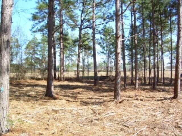
Westside Rd
Statesboro, GA
32.995 AC/LOTS 1, 2
MS30000030-000
Bulloch
Residentialacreage
Georgia
X
1,2
13031C0205D
33 AC
2024
Georgia South Area
2025
Other Market Areas
110401
DEMOGRAPHICS near Westside Rd
1 Mile
3 Mile
5 Mile
2024 Total Population
545
23,084
47,600
2029 Population
603
25,156
51,836
Pop Growth 2024-2029
+ 10.64%
+ 8.98%
+ 8.90%
Average Age
40
34
33
2024 Total Households
205
8,098
17,688
HH Growth 2024-2029
+ 11.22%
+ 10.00%
+ 9.73%
Median Household Inc
$64,913
$55,166
$50,717
Avg Household Size
2.60
2.30
2.30
2024 Avg HH Vehicles
2.00
2.00
2.00
Median Home Value
$191,249
$203,307
$196,129
Median Year Built
1981
1986
1990
Nearby Places
Map Layers
Map Styles
 Street
 Aerial
- Restaurants
- Banks
- Shops
- Fitness
- Groceries
SALE & LEASE HISTORY
LISTING DATE
SALE/LEASE

Sep 24, 2016
For Sale
Nearby Properties
Address
Land Use
TOTAL SIZE
Lot Size
Zoning
Address
Land Use
TOTAL SIZE
Lot Size
Zoning
612.82 AC
EXPT
Address
Land Use
TOTAL SIZE
Lot Size
Zoning
15,334 SF
1.67 AC
CR
Address
Land Use
TOTAL SIZE
Lot Size
Zoning
10,228 SF
24.06 AC
R4
Address
Land Use
TOTAL SIZE
Lot Size
Zoning
11,490 SF
10.01 AC
R4
Address
Land Use
TOTAL SIZE
Lot Size
Zoning
7,470 SF
39.71 AC
CR
Address
Land Use
TOTAL SIZE
Lot Size
Zoning
37,918 SF
9.93 AC
R4
Address
Land Use
TOTAL SIZE
Lot Size
Zoning
60,537 SF
8.76 AC
CR
Address
Land Use
TOTAL SIZE
Lot Size
Zoning
58,176 SF
2.10 AC
HOC
Address
Land Use
TOTAL SIZE
Lot Size
Zoning
13 AC
R20
Address
Land Use
TOTAL SIZE
Lot Size
Zoning
12,010 SF
21.14 AC
HC
Address
Land Use
TOTAL SIZE
Lot Size
Zoning
21.05 AC
PUD/R4
Address
Land Use
TOTAL SIZE
Lot Size
Zoning
149.70 AC
AG-5/R-40
Address
Land Use
TOTAL SIZE
Lot Size
Zoning
19.41 AC
R10/R15
Address
Land Use
TOTAL SIZE
Lot Size
Zoning
3,195 SF
22.67 AC
PUD/R4
Address
Land Use
TOTAL SIZE
Lot Size
Zoning
28.73 AC
EXPT
Address
Land Use
TOTAL SIZE
Lot Size
Zoning
21,382 SF
13.51 AC
CR
Address
Land Use
TOTAL SIZE
Lot Size
Zoning
16,800 SF
8.72 AC
CR
Address
Land Use
TOTAL SIZE
Lot Size
Zoning
19,554 SF
7.84 AC
R4
Address
Land Use
TOTAL SIZE
Lot Size
Zoning
70,000 SF
12 AC
R4/HOC
Address
Land Use
TOTAL SIZE
Lot Size
Zoning
18,862 SF
291.80 AC
R-40/R-25
Address
Land Use
TOTAL SIZE
Lot Size
Zoning
23,392 SF
4.75 AC
CR
Address
Land Use
TOTAL SIZE
Lot Size
Zoning
29,004 SF
5.39 AC
LI
Address
Land Use
TOTAL SIZE
Lot Size
Zoning
75,000 SF
19.30 AC
LI
Address
Land Use
TOTAL SIZE
Lot Size
Zoning
53,676 SF
6.07 AC
R4
Address
Land Use
TOTAL SIZE
Lot Size
Zoning
88,014 SF
9.64 AC
CR
Address
Land Use
TOTAL SIZE
Lot Size
Zoning
20 AC
R15
Address
Land Use
TOTAL SIZE
Lot Size
Zoning
49,581 SF
3.61 AC
HOC
Address
Land Use
TOTAL SIZE
Lot Size
Zoning
2.36 AC
HOC
Address
Land Use
TOTAL SIZE
Lot Size
Zoning
1.42 AC
CBD
Address
Land Use
TOTAL SIZE
Lot Size
Zoning
25,728 SF
5.46 AC
HC/PUD
The World's #1 Commercial Real Estate Marketplace
Connect with us
© 2026 CoStar Group
The information above has been obtained from sources believed reliable. While we do not doubt its accuracy we have not verified it and make no guarantee, warranty or representation about it. It is your responsibility to independently confirm its accuracy and completeness. Any projections, opinions, assumptions, or estimates used are for example only and do not represent the current or future performance of the property. The value of this transaction to you depends on tax and other factors which should be evaluated by your tax, financial, and legal advisors. You and your advisors should conduct a careful, independent investigation of the property to determine to your satisfaction the suitability of the property for your needs.