Property Record
White Gate Dr, Columbia, MO 65202

Save to a Folder
{{folder.Name}}
{{folder.ListingIds.length}} Properties
{{folder.ListingIds.length}} Property
Create a New Folder
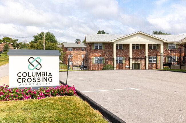
Property Detail
White Gate Dr
17-110-00-11-001-00-01
WHITE GATE VILLAGE CONDO LOT 5 BLK 2-ALL LAND & UNITS (IN 17-111)
Clubslodgesprofessionalassociations
BOONE
R4
Missouri
B and X Area of moderate flood hazard, usually the area between the limits of the 100-year and 500-year floods.
5
2025
9.41 AC
2025
Columbia/Jefferson City
001508
Other Market Areas
3,078 SF
Columbia, MO
NEARBY LISTINGS FOR SALE OR LEASE
DEMOGRAPHICS near White Gate Dr
1 mile
3 mile
5 mile
2025 Total Population
6,676
69,291
121,892
2030 Population
6,942
71,997
126,783
Pop Growth 2025-2030
+ 3.98%
+ 3.91%
+ 4.01%
Average Age
36
34
36
2025 Total Households
3,134
27,275
50,463
HH Growth 2025-2030
+ 4.15%
+ 4.31%
+ 4.30%
Median Household Inc
$64,087
$54,972
$61,193
Avg Household Size
2.10
2.20
2.20
2025 Avg HH Vehicles
1.00
2.00
2.00
Median Home Value
$197,639
$200,706
$236,530
Median Year Built
1976
1987
1989
Nearby Places
Map Layers
Map Styles
 Street
 Aerial
Layers
 Traffic
 Biking
Places
Listings with unknown addresses are not visible on the map
- Restaurants
- Banks
- Shops
- Fitness
- Groceries
PUBLIC TRANSPORTATION
AIRPORT
Columbia Regional
Drive
Walk
Distance
Columbia Regional
18 min
13.2 mi
Freight Ports
Tulsa Port of Inola
Drive
Walk
Distance
Tulsa Port of Inola
379 min
335.9 mi
Nearby Properties
Address
Land Use
TOTAL SIZE
Lot Size
Zoning
Address
Land Use
TOTAL SIZE
Lot Size
Zoning
321,295 SF
79.83 AC
Address
Land Use
TOTAL SIZE
Lot Size
Zoning
171,157 SF
5.60 AC
O1
Address
Land Use
TOTAL SIZE
Lot Size
Zoning
149,686 SF
15.26 AC
MC
Address
Land Use
TOTAL SIZE
Lot Size
Zoning
6,390 SF
28.23 AC
Address
Land Use
TOTAL SIZE
Lot Size
Zoning
40,016 SF
2.13 AC
O1
Address
Land Use
TOTAL SIZE
Lot Size
Zoning
3,808 SF
0.39 AC
C2
Address
Land Use
TOTAL SIZE
Lot Size
Zoning
234,111 SF
2.27 AC
Address
Land Use
TOTAL SIZE
Lot Size
Zoning
50,304 SF
8.78 AC
C1
Address
Land Use
TOTAL SIZE
Lot Size
Zoning
11,760 SF
22.98 AC
Address
Land Use
TOTAL SIZE
Lot Size
Zoning
159,169 SF
1.26 AC
R3
Address
Land Use
TOTAL SIZE
Lot Size
Zoning
89,638 SF
6.42 AC
C3
Address
Land Use
TOTAL SIZE
Lot Size
Zoning
57,520 SF
56.57 AC
Address
Land Use
TOTAL SIZE
Lot Size
Zoning
134,625 SF
0.79 AC
C2
Address
Land Use
TOTAL SIZE
Lot Size
Zoning
45,750 SF
0.66 AC
R3
Address
Land Use
TOTAL SIZE
Lot Size
Zoning
12,098 SF
45.85 AC
Address
Land Use
TOTAL SIZE
Lot Size
Zoning
38,500 SF
3.10 AC
O1
Address
Land Use
TOTAL SIZE
Lot Size
Zoning
87,060 SF
0.37 AC
R3
Address
Land Use
TOTAL SIZE
Lot Size
Zoning
125,487 SF
3.36 AC
Address
Land Use
TOTAL SIZE
Lot Size
Zoning
97,092 SF
1.56 AC
Address
Land Use
TOTAL SIZE
Lot Size
Zoning
33,732 SF
3.34 AC
O1
Address
Land Use
TOTAL SIZE
Lot Size
Zoning
136,448 SF
0.78 AC
C2
Address
Land Use
TOTAL SIZE
Lot Size
Zoning
264,960 SF
40.01 AC
R1
Address
Land Use
TOTAL SIZE
Lot Size
Zoning
68,408 SF
4.38 AC
O1
Address
Land Use
TOTAL SIZE
Lot Size
Zoning
184,413 SF
17.63 AC
CP
Address
Land Use
TOTAL SIZE
Lot Size
Zoning
17,589 SF
0.52 AC
C2
Address
Land Use
TOTAL SIZE
Lot Size
Zoning
70,783 SF
5.07 AC
O1
Address
Land Use
TOTAL SIZE
Lot Size
Zoning
125,907 SF
22.59 AC
C3
Address
Land Use
TOTAL SIZE
Lot Size
Zoning
26,544 SF
1.24 AC
R1
Address
Land Use
TOTAL SIZE
Lot Size
Zoning
56,305 SF
12 AC
CP
Address
Land Use
TOTAL SIZE
Lot Size
Zoning
68,117 SF
9.13 AC
O1
The World's #1 Commercial Real Estate Marketplace
Connect with us
© 2026 CoStar Group
The information above has been obtained from sources believed reliable. While we do not doubt its accuracy we have not verified it and make no guarantee, warranty or representation about it. It is your responsibility to independently confirm its accuracy and completeness. Any projections, opinions, assumptions, or estimates used are for example only and do not represent the current or future performance of the property. The value of this transaction to you depends on tax and other factors which should be evaluated by your tax, financial, and legal advisors. You and your advisors should conduct a careful, independent investigation of the property to determine to your satisfaction the suitability of the property for your needs.