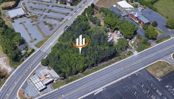
Property Record
White Horse Rd, , SC
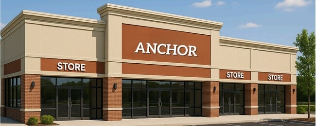


Current Lease Availabilities
Property Detail
White Horse Rd
Greenville-Anderson-Greer, SC
MAP B005.02; 6
B005.02-01-021.00
GREENVILLE
Residentialacreage
South Carolina
C1
021.00
B and X Area of moderate flood hazard, usually the area between the limits of the 100-year and 500-year floods.
1.99 AC
2025
White Horse Corridor
2025
Greenville/Spartanburg
003701
NEARBY LISTINGS FOR SALE OR LEASE
DEMOGRAPHICS near White Horse Rd
1 mile
3 mile
5 mile
2025 Total Population
4,280
37,796
100,562
2030 Population
4,647
40,764
108,943
Pop Growth 2025-2030
+ 8.57%
+ 7.85%
+ 8.33%
Average Age
41
39
39
2025 Total Households
1,715
14,953
40,513
HH Growth 2025-2030
+ 8.80%
+ 8.07%
+ 8.80%
Median Household Inc
$52,389
$52,026
$58,299
Avg Household Size
2.40
2.40
2.30
2025 Avg HH Vehicles
2.00
2.00
2.00
Median Home Value
$218,528
$237,037
$261,282
Median Year Built
1984
1982
1985
Nearby Places
Map Layers
Map Styles
 Street
 Aerial
Transit
 Traffic
 Biking
Places
Listings with unknown addresses are not visible on the map
- Restaurants
- Banks
- Shops
- Fitness
- Groceries
PUBLIC TRANSPORTATION
COMMUTER RAIL
Greenville Amtrak Station (Crescent - Amtrak)
Drive
Walk
Distance
Greenville Amtrak Station (Crescent - Amtrak)
9 min
4.4 mi
AIRPORT
Greenville Spartanburg International
Drive
Walk
Distance
Greenville Spartanburg International
32 min
18.9 mi
Freight Ports
North Charleston Terminal
Drive
Walk
Distance
North Charleston Terminal
239 min
209.5 mi
Nearby Properties
Address
Land Use
TOTAL SIZE
Lot Size
Zoning
Address
Land Use
TOTAL SIZE
Lot Size
Zoning
703.30 AC
RS
Address
Land Use
TOTAL SIZE
Lot Size
Zoning
14.41 AC
R15
Address
Land Use
TOTAL SIZE
Lot Size
Zoning
14.30 AC
RM
Address
Land Use
TOTAL SIZE
Lot Size
Zoning
10.10 AC
RM
Address
Land Use
TOTAL SIZE
Lot Size
Zoning
10.17 AC
RM
Address
Land Use
TOTAL SIZE
Lot Size
Zoning
168 SF
10.10 AC
RM
Address
Land Use
TOTAL SIZE
Lot Size
Zoning
13.87 AC
RM20
Address
Land Use
TOTAL SIZE
Lot Size
Zoning
4.97 AC
RM20
Address
Land Use
TOTAL SIZE
Lot Size
Zoning
165.20 AC
RS
Address
Land Use
TOTAL SIZE
Lot Size
Zoning
3.30 AC
RM
Address
Land Use
TOTAL SIZE
Lot Size
Zoning
1.70 AC
RM20
Address
Land Use
TOTAL SIZE
Lot Size
Zoning
11.62 AC
RS
Address
Land Use
TOTAL SIZE
Lot Size
Zoning
100 AC
RS
Address
Land Use
TOTAL SIZE
Lot Size
Zoning
1.77 AC
RMA
Address
Land Use
TOTAL SIZE
Lot Size
Zoning
63.70 AC
RS
Address
Land Use
TOTAL SIZE
Lot Size
Zoning
153.11 AC
R10
Address
Land Use
TOTAL SIZE
Lot Size
Zoning
18.22 AC
RM
Address
Land Use
TOTAL SIZE
Lot Size
Zoning
0.14 AC
C3
Address
Land Use
TOTAL SIZE
Lot Size
Zoning
22.92 AC
R10
Address
Land Use
TOTAL SIZE
Lot Size
Zoning
1.43 AC
C1N
Address
Land Use
TOTAL SIZE
Lot Size
Zoning
Address
Land Use
TOTAL SIZE
Lot Size
Zoning
5.05 AC
C2
Address
Land Use
TOTAL SIZE
Lot Size
Zoning
1,291 SF
6.34 AC
RM
Address
Land Use
TOTAL SIZE
Lot Size
Zoning
8.20 AC
C3,RM
Address
Land Use
TOTAL SIZE
Lot Size
Zoning
122.40 AC
RS
Address
Land Use
TOTAL SIZE
Lot Size
Zoning
30.87 AC
R10
Address
Land Use
TOTAL SIZE
Lot Size
Zoning
5.10 AC
C2
Address
Land Use
TOTAL SIZE
Lot Size
Zoning
1,410 SF
10.17 AC
R10
Address
Land Use
TOTAL SIZE
Lot Size
Zoning
44.40 AC
I1
Address
Land Use
TOTAL SIZE
Lot Size
Zoning
15.82 AC
The World's #1 Commercial Real Estate Marketplace
Connect with us
© 2026 CoStar Group
The information above has been obtained from sources believed reliable. While we do not doubt its accuracy we have not verified it and make no guarantee, warranty or representation about it. It is your responsibility to independently confirm its accuracy and completeness. Any projections, opinions, assumptions, or estimates used are for example only and do not represent the current or future performance of the property. The value of this transaction to you depends on tax and other factors which should be evaluated by your tax, financial, and legal advisors. You and your advisors should conduct a careful, independent investigation of the property to determine to your satisfaction the suitability of the property for your needs.