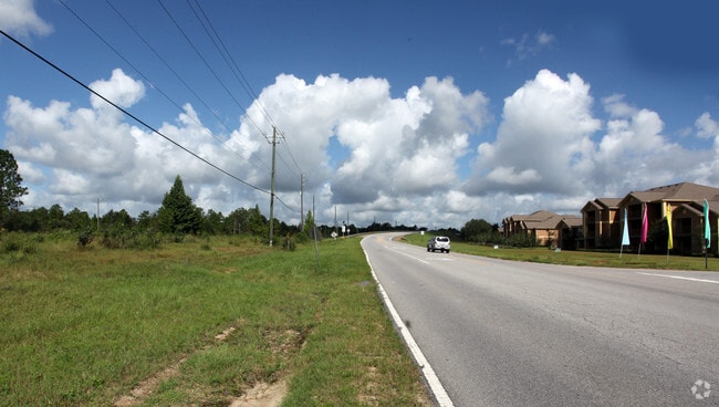
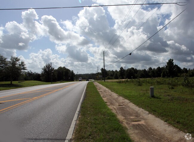
Property Record
Whitehurst Ln, Crestview, FL 32536

Property Detail
Whitehurst Ln
Crestview-Fort Walton Beach-Destin, FL
NW1/4 OF SW1/4 S OF ANTIOCH RD ANNEXED PER ORD #867 LESS PART LYING IN NW 1/4 OF SW1/4 S OF P J ADAMS PKWY & N OF WHITEHURST LN LESS PORTION TAKEN BY DOT FOR BYPASS. DETAILS IN LAND SCREEN NOTES
36-3N-24-0000-0001-0030
OKALOOSA
Miscellaneous
Florida
R-2
30
B and X Area of moderate flood hazard, usually the area between the limits of the 100-year and 500-year floods.
16.28 AC
2025
Fort Walton Beach
2025
Other Market Areas
020500
NEARBY LISTINGS FOR SALE OR LEASE
DEMOGRAPHICS near Whitehurst Ln
1 mile
3 mile
5 mile
2024 Total Population
3,852
12,308
37,425
2029 Population
3,897
12,451
38,543
Pop Growth 2024-2029
+ 1.17%
+ 1.16%
+ 2.99%
Average Age
34
35
36
2024 Total Households
1,418
4,477
13,243
HH Growth 2024-2029
+ 0.78%
+ 0.89%
+ 2.88%
Median Household Inc
$97,878
$91,944
$78,898
Avg Household Size
2.70
2.70
2.60
2024 Avg HH Vehicles
2.00
2.00
2.00
Median Home Value
$343,994
$334,016
$315,220
Median Year Built
2003
2001
2000
Nearby Places
Map Layers
Map Styles
 Street
 Aerial
Transit
 Traffic
 Biking
Places
Listings with unknown addresses are not visible on the map
- Restaurants
- Banks
- Shops
- Fitness
- Groceries
PUBLIC TRANSPORTATION
AIRPORT
Eglin AFB/Destin-Ft Walton Beach
Drive
Walk
Distance
Eglin AFB/Destin-Ft Walton Beach
44 min
24.5 mi
Freight Ports
Port of Panama City
Drive
Walk
Distance
Port of Panama City
112 min
86.8 mi
Nearby Properties
Address
Land Use
TOTAL SIZE
Lot Size
Zoning
Address
Land Use
TOTAL SIZE
Lot Size
Zoning
124,093 SF
6.94 AC
R-2
Address
Land Use
TOTAL SIZE
Lot Size
Zoning
97,538 SF
7.21 AC
Address
Land Use
TOTAL SIZE
Lot Size
Zoning
233,285 SF
11.45 AC
C-1
Address
Land Use
TOTAL SIZE
Lot Size
Zoning
61,672 SF
5.65 AC
Address
Land Use
TOTAL SIZE
Lot Size
Zoning
7,615 SF
70.60 AC
Address
Land Use
TOTAL SIZE
Lot Size
Zoning
99,035 SF
3.47 AC
Address
Land Use
TOTAL SIZE
Lot Size
Zoning
24,868 SF
2.03 AC
Address
Land Use
TOTAL SIZE
Lot Size
Zoning
87,672 SF
15.69 AC
Address
Land Use
TOTAL SIZE
Lot Size
Zoning
179,963 SF
22.48 AC
Address
Land Use
TOTAL SIZE
Lot Size
Zoning
26,634 SF
2.72 AC
Address
Land Use
TOTAL SIZE
Lot Size
Zoning
54,986 SF
2.84 AC
Address
Land Use
TOTAL SIZE
Lot Size
Zoning
51,432 SF
3.95 AC
Address
Land Use
TOTAL SIZE
Lot Size
Zoning
139,185 SF
14.95 AC
Address
Land Use
TOTAL SIZE
Lot Size
Zoning
28,363 SF
2.34 AC
Address
Land Use
TOTAL SIZE
Lot Size
Zoning
113,123 SF
20.45 AC
C-1
Address
Land Use
TOTAL SIZE
Lot Size
Zoning
73,736 SF
6.24 AC
Address
Land Use
TOTAL SIZE
Lot Size
Zoning
230,189 SF
23.11 AC
Address
Land Use
TOTAL SIZE
Lot Size
Zoning
26,514 SF
1.49 AC
Address
Land Use
TOTAL SIZE
Lot Size
Zoning
45,468 SF
5.53 AC
Address
Land Use
TOTAL SIZE
Lot Size
Zoning
29,482 SF
7.77 AC
Address
Land Use
TOTAL SIZE
Lot Size
Zoning
19,788 SF
2.97 AC
Address
Land Use
TOTAL SIZE
Lot Size
Zoning
7,647 SF
2.96 AC
Address
Land Use
TOTAL SIZE
Lot Size
Zoning
15,363 SF
1.76 AC
C-1
Address
Land Use
TOTAL SIZE
Lot Size
Zoning
48,150 SF
2.42 AC
Address
Land Use
TOTAL SIZE
Lot Size
Zoning
26,730 SF
5.03 AC
Address
Land Use
TOTAL SIZE
Lot Size
Zoning
27,932 SF
5.09 AC
Address
Land Use
TOTAL SIZE
Lot Size
Zoning
54,620 SF
1.42 AC
Address
Land Use
TOTAL SIZE
Lot Size
Zoning
29,276 SF
3.17 AC
Address
Land Use
TOTAL SIZE
Lot Size
Zoning
35,329 SF
6.15 AC
Address
Land Use
TOTAL SIZE
Lot Size
Zoning
9,619 SF
The World's #1 Commercial Real Estate Marketplace
Connect with us
© 2026 CoStar Group
The information above has been obtained from sources believed reliable. While we do not doubt its accuracy we have not verified it and make no guarantee, warranty or representation about it. It is your responsibility to independently confirm its accuracy and completeness. Any projections, opinions, assumptions, or estimates used are for example only and do not represent the current or future performance of the property. The value of this transaction to you depends on tax and other factors which should be evaluated by your tax, financial, and legal advisors. You and your advisors should conduct a careful, independent investigation of the property to determine to your satisfaction the suitability of the property for your needs.