Property Record
Willis Rd, Millbrook, AL 36054


Property Detail
Willis Rd
26-05-16-0-001-007000-0
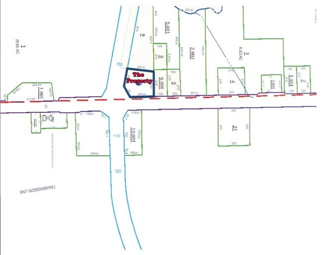
PART OF SE1/4 NE1/4 SEC 16 T17N R17E: BEG AT INT OF W ROW MAIN ST AND N ROW COBBS FORD RD; SW 63.76' ALONG ROW FLARE; W 175.7
Autorepair
ELMORE
AE The base floodplain where base flood elevations are provided. AE Zones are now used on new format FIRMs instead of A1-A30 Zones.
Alabama
2025
1.17 AC
2025
Prattville/Millbrook
031001
Montgomery
11,972 SF
Montgomery, AL
NEARBY LISTINGS FOR SALE OR LEASE
-
-
View all Millbrook listings for sale on LoopNet.com
DEMOGRAPHICS near Willis Rd
1 mile
3 mile
5 mile
2025 Total Population
690
6,592
39,546
2030 Population
699
6,715
40,320
Pop Growth 2025-2030
+ 1.30%
+ 1.87%
+ 1.96%
Average Age
42
39
39
2025 Total Households
280
2,699
15,557
HH Growth 2025-2030
+ 1.07%
+ 1.93%
+ 1.85%
Median Household Inc
$76,042
$69,621
$68,673
Avg Household Size
2.40
2.40
2.50
2025 Avg HH Vehicles
2.00
2.00
2.00
Median Home Value
$129,310
$179,495
$205,620
Median Year Built
1975
1988
1994
Nearby Places
Map Layers
Map Styles
 Street
 Aerial
Layers
 Traffic
 Biking
Places
Listings with unknown addresses are not visible on the map
- Restaurants
- Banks
- Shops
- Fitness
- Groceries
PUBLIC TRANSPORTATION
AIRPORT
Montgomery Regional (Dannelly Field)
Drive
Walk
Distance
Montgomery Regional (Dannelly Field)
21 min
14.8 mi
SALE & LEASE HISTORY
LISTING DATE
SALE/LEASE

Sep 24, 2016
For Sale
Nearby Properties
Address
Land Use
TOTAL SIZE
Lot Size
Zoning
Address
Land Use
TOTAL SIZE
Lot Size
Zoning
40,962 SF
122.97 AC
Address
Land Use
TOTAL SIZE
Lot Size
Zoning
3,852 SF
24 AC
Address
Land Use
TOTAL SIZE
Lot Size
Zoning
136,080 SF
26.42 AC
Address
Land Use
TOTAL SIZE
Lot Size
Zoning
24,160 SF
10.45 AC
Address
Land Use
TOTAL SIZE
Lot Size
Zoning
9,176 SF
11.39 AC
Address
Land Use
TOTAL SIZE
Lot Size
Zoning
128,384 SF
9.07 AC
Address
Land Use
TOTAL SIZE
Lot Size
Zoning
136,297 SF
16.32 AC
Address
Land Use
TOTAL SIZE
Lot Size
Zoning
1,750 SF
14.61 AC
Address
Land Use
TOTAL SIZE
Lot Size
Zoning
57,954 SF
8.15 AC
Address
Land Use
TOTAL SIZE
Lot Size
Zoning
75,571 SF
17.63 AC
Address
Land Use
TOTAL SIZE
Lot Size
Zoning
56,900 SF
2.20 AC
Address
Land Use
TOTAL SIZE
Lot Size
Zoning
60,727 SF
2.41 AC
Address
Land Use
TOTAL SIZE
Lot Size
Zoning
29,094 SF
14.90 AC
Address
Land Use
TOTAL SIZE
Lot Size
Zoning
44,892 SF
2.18 AC
Address
Land Use
TOTAL SIZE
Lot Size
Zoning
104,965 SF
10.13 AC
Address
Land Use
TOTAL SIZE
Lot Size
Zoning
57,782 SF
3.30 AC
Address
Land Use
TOTAL SIZE
Lot Size
Zoning
18,384 SF
2.40 AC
Address
Land Use
TOTAL SIZE
Lot Size
Zoning
75,646 SF
32.01 AC
Address
Land Use
TOTAL SIZE
Lot Size
Zoning
39,155 SF
3.61 AC
Address
Land Use
TOTAL SIZE
Lot Size
Zoning
60,838 SF
Address
Land Use
TOTAL SIZE
Lot Size
Zoning
4,050 SF
34.10 AC
Address
Land Use
TOTAL SIZE
Lot Size
Zoning
19,832 SF
5.90 AC
Address
Land Use
TOTAL SIZE
Lot Size
Zoning
44,834 SF
2 AC
Address
Land Use
TOTAL SIZE
Lot Size
Zoning
45,584 SF
2.35 AC
Address
Land Use
TOTAL SIZE
Lot Size
Zoning
97,498 SF
9.08 AC
Address
Land Use
TOTAL SIZE
Lot Size
Zoning
105,581 SF
2.80 AC
Address
Land Use
TOTAL SIZE
Lot Size
Zoning
64,502 SF
5.01 AC
Address
Land Use
TOTAL SIZE
Lot Size
Zoning
43,139 SF
7.96 AC
Address
Land Use
TOTAL SIZE
Lot Size
Zoning
38,886 SF
1.68 AC
Address
Land Use
TOTAL SIZE
Lot Size
Zoning
16,664 SF
3.16 AC
The World's #1 Commercial Real Estate Marketplace
Connect with us
© 2026 CoStar Group
The information above has been obtained from sources believed reliable. While we do not doubt its accuracy we have not verified it and make no guarantee, warranty or representation about it. It is your responsibility to independently confirm its accuracy and completeness. Any projections, opinions, assumptions, or estimates used are for example only and do not represent the current or future performance of the property. The value of this transaction to you depends on tax and other factors which should be evaluated by your tax, financial, and legal advisors. You and your advisors should conduct a careful, independent investigation of the property to determine to your satisfaction the suitability of the property for your needs.