Property Record
Willis Rd, Willis, MI 48191

Property Detail
Willis Rd
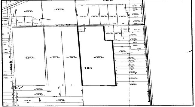
20-12-100-021
BNDRY ADJST PER SURVEY 01/06/11 AU 12-5A COM AT NE COR SEC 12, TH N 89-02-50 W 844.05 FT TO A POB, TH S 00-51-44 W 660.00 FT,
Residentialacreage
WASHTENAW
BLANK
Michigan
B and X Area of moderate flood hazard, usually the area between the limits of the 100-year and 500-year floods.
38.47 AC
2025
Washtenaw E of 23
2025
Detroit
420200
Ann Arbor, MI
NEARBY LISTINGS FOR SALE OR LEASE
-
-
View all Willis listings for sale on LoopNet.com
DEMOGRAPHICS near Willis Rd
1 mile
3 mile
5 mile
2025 Total Population
2,054
14,806
50,912
2030 Population
2,226
15,056
51,078
Pop Growth 2025-2030
+ 8.37%
+ 1.69%
+ 0.33%
Average Age
44
41
40
2025 Total Households
824
5,567
20,475
HH Growth 2025-2030
+ 8.25%
+ 1.81%
+ 0.33%
Median Household Inc
$71,354
$75,496
$81,243
Avg Household Size
2.50
2.60
2.40
2025 Avg HH Vehicles
2.00
2.00
2.00
Median Home Value
$207,330
$243,815
$262,671
Median Year Built
2001
1992
1986
Nearby Places
Map Layers
Map Styles
 Street
 Aerial
Layers
 Traffic
 Biking
Places
Listings with unknown addresses are not visible on the map
- Restaurants
- Banks
- Shops
- Fitness
- Groceries
PUBLIC TRANSPORTATION
AIRPORT
Detroit Metro Wayne County
Drive
Walk
Distance
Detroit Metro Wayne County
23 min
16.7 mi
Freight Ports
Port of Toledo
Drive
Walk
Distance
Port of Toledo
71 min
50.5 mi
Nearby Properties
Address
Land Use
TOTAL SIZE
Lot Size
Zoning
Address
Land Use
TOTAL SIZE
Lot Size
Zoning
2,700 SF
75.82 AC
Address
Land Use
TOTAL SIZE
Lot Size
Zoning
1,744 SF
41.75 AC
BI
Address
Land Use
TOTAL SIZE
Lot Size
Zoning
54.32 AC
RMH MOB
Address
Land Use
TOTAL SIZE
Lot Size
Zoning
80.11 AC
Address
Land Use
TOTAL SIZE
Lot Size
Zoning
36,200 SF
15.23 AC
Address
Land Use
TOTAL SIZE
Lot Size
Zoning
4,442 SF
42.38 AC
RMH MOB
Address
Land Use
TOTAL SIZE
Lot Size
Zoning
6,000 SF
15 AC
DI
Address
Land Use
TOTAL SIZE
Lot Size
Zoning
20 AC
DI
Address
Land Use
TOTAL SIZE
Lot Size
Zoning
8,580 SF
28.50 AC
Address
Land Use
TOTAL SIZE
Lot Size
Zoning
5,515 SF
89.67 AC
BLANK
Address
Land Use
TOTAL SIZE
Lot Size
Zoning
9,310 SF
38.46 AC
Address
Land Use
TOTAL SIZE
Lot Size
Zoning
15,540 SF
52.16 AC
Address
Land Use
TOTAL SIZE
Lot Size
Zoning
45,550 SF
4.91 AC
Address
Land Use
TOTAL SIZE
Lot Size
Zoning
12,000 SF
4.25 AC
II
Address
Land Use
TOTAL SIZE
Lot Size
Zoning
11,000 SF
35.61 AC
Address
Land Use
TOTAL SIZE
Lot Size
Zoning
1,320 SF
29.19 AC
AG
Address
Land Use
TOTAL SIZE
Lot Size
Zoning
24,000 SF
4.92 AC
II
Address
Land Use
TOTAL SIZE
Lot Size
Zoning
952 SF
4.92 AC
II
Address
Land Use
TOTAL SIZE
Lot Size
Zoning
69.94 AC
BI
Address
Land Use
TOTAL SIZE
Lot Size
Zoning
12,400 SF
12.81 AC
M2 GEN
Address
Land Use
TOTAL SIZE
Lot Size
Zoning
3,943 SF
0.88 AC
C1 GEN
Address
Land Use
TOTAL SIZE
Lot Size
Zoning
10,400 SF
16.96 AC
M1 LIG
Address
Land Use
TOTAL SIZE
Lot Size
Zoning
231.77 AC
BLANK
Address
Land Use
TOTAL SIZE
Lot Size
Zoning
38,710 SF
4.57 AC
BLANK
Address
Land Use
TOTAL SIZE
Lot Size
Zoning
6.02 AC
Address
Land Use
TOTAL SIZE
Lot Size
Zoning
4,500 SF
14.79 AC
M2 GEN
Address
Land Use
TOTAL SIZE
Lot Size
Zoning
6,670 SF
2.43 AC
BLANK
Address
Land Use
TOTAL SIZE
Lot Size
Zoning
39.61 AC
Address
Land Use
TOTAL SIZE
Lot Size
Zoning
25,292 SF
20.54 AC
Address
Land Use
TOTAL SIZE
Lot Size
Zoning
1,568 SF
10.10 AC
BI
The World's #1 Commercial Real Estate Marketplace
Connect with us
© 2026 CoStar Group
The information above has been obtained from sources believed reliable. While we do not doubt its accuracy we have not verified it and make no guarantee, warranty or representation about it. It is your responsibility to independently confirm its accuracy and completeness. Any projections, opinions, assumptions, or estimates used are for example only and do not represent the current or future performance of the property. The value of this transaction to you depends on tax and other factors which should be evaluated by your tax, financial, and legal advisors. You and your advisors should conduct a careful, independent investigation of the property to determine to your satisfaction the suitability of the property for your needs.