Property Record
22638 Wilters St, Robertsdale, AL 36567
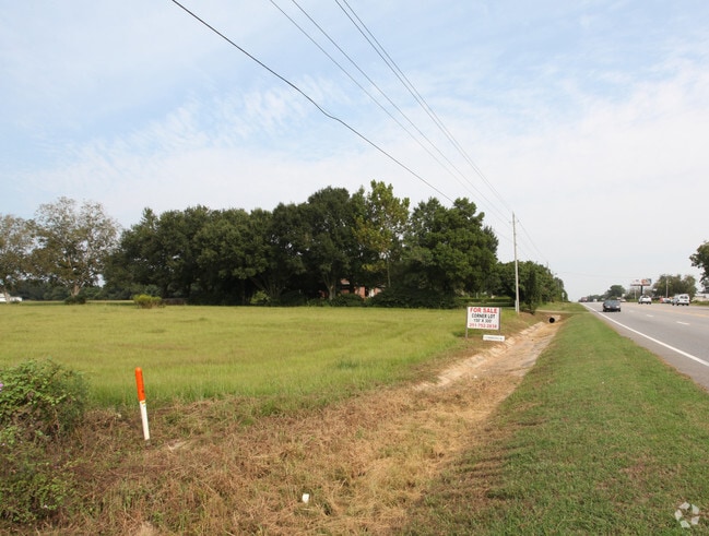
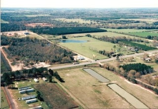
Property Detail
22638 Wilters St
Daphne-Fairhope-Foley, AL
65 AC(C) FM THE NW COR SEC 3 RUN S 1300'(S) TO POB, TH E 1499'(S), TH SE 72'(S), TH E 649'(S), TH S 1328'(S), TH W 2186'(S),
48-02-04-0-000-002.002
BALDWIN
Residentialacreage
Alabama
AE The base floodplain where base flood elevations are provided. AE Zones are now used on new format FIRMs instead of A1-A30 Zones.
15.40 AC
2025
Baldwin County
2025
Mobile
010904
NEARBY LISTINGS FOR SALE OR LEASE
DEMOGRAPHICS near 22638 Wilters St
1 mile
3 mile
5 mile
2025 Total Population
565
8,426
16,443
2030 Population
612
9,115
17,854
Pop Growth 2025-2030
+ 8.32%
+ 8.18%
+ 8.58%
Average Age
40
39
39
2025 Total Households
206
3,082
6,041
HH Growth 2025-2030
+ 8.25%
+ 8.14%
+ 8.57%
Median Household Inc
$69,722
$59,199
$66,471
Avg Household Size
2.60
2.60
2.70
2025 Avg HH Vehicles
2.00
2.00
2.00
Median Home Value
$237,500
$231,727
$236,410
Median Year Built
1995
1997
1998
Nearby Places
Map Layers
Map Styles
 Street
 Aerial
Layers
 Traffic
 Biking
Places
Listings with unknown addresses are not visible on the map
- Restaurants
- Banks
- Shops
- Fitness
- Groceries
PUBLIC TRANSPORTATION
AIRPORT
Mobile International
Drive
Walk
Distance
Mobile International
42 min
33.5 mi
Pensacola International
Drive
Walk
Distance
Pensacola International
51 min
34.6 mi
Freight Ports
Port of Mobile
Drive
Walk
Distance
Port of Mobile
37 min
30.1 mi
Nearby Properties
Address
Land Use
TOTAL SIZE
Lot Size
Zoning
Address
Land Use
TOTAL SIZE
Lot Size
Zoning
129,533 SF
17 AC
Address
Land Use
TOTAL SIZE
Lot Size
Zoning
Address
Land Use
TOTAL SIZE
Lot Size
Zoning
39,816 SF
3.80 AC
Address
Land Use
TOTAL SIZE
Lot Size
Zoning
9,272 SF
8.30 AC
Address
Land Use
TOTAL SIZE
Lot Size
Zoning
33,925 SF
4.40 AC
Address
Land Use
TOTAL SIZE
Lot Size
Zoning
52,339 SF
5.20 AC
Address
Land Use
TOTAL SIZE
Lot Size
Zoning
44,289 SF
8.30 AC
Address
Land Use
TOTAL SIZE
Lot Size
Zoning
32,361 SF
8.50 AC
Address
Land Use
TOTAL SIZE
Lot Size
Zoning
31,359 SF
19 AC
Address
Land Use
TOTAL SIZE
Lot Size
Zoning
13,140 SF
20 AC
Address
Land Use
TOTAL SIZE
Lot Size
Zoning
11,553 SF
9.20 AC
Address
Land Use
TOTAL SIZE
Lot Size
Zoning
12,774 SF
11.20 AC
Address
Land Use
TOTAL SIZE
Lot Size
Zoning
53,144 SF
13 AC
Address
Land Use
TOTAL SIZE
Lot Size
Zoning
58,099 SF
6.70 AC
Address
Land Use
TOTAL SIZE
Lot Size
Zoning
11,825 SF
6.60 AC
Address
Land Use
TOTAL SIZE
Lot Size
Zoning
6,427 SF
2.10 AC
Address
Land Use
TOTAL SIZE
Lot Size
Zoning
15,017 SF
3.95 AC
Address
Land Use
TOTAL SIZE
Lot Size
Zoning
13,721 SF
1.04 AC
Address
Land Use
TOTAL SIZE
Lot Size
Zoning
8,922 SF
3.72 AC
Address
Land Use
TOTAL SIZE
Lot Size
Zoning
51,241 SF
20 AC
Address
Land Use
TOTAL SIZE
Lot Size
Zoning
50,000 SF
Address
Land Use
TOTAL SIZE
Lot Size
Zoning
21,082 SF
0.36 AC
Address
Land Use
TOTAL SIZE
Lot Size
Zoning
13,036 SF
4.99 AC
Address
Land Use
TOTAL SIZE
Lot Size
Zoning
36,639 SF
19 AC
Address
Land Use
TOTAL SIZE
Lot Size
Zoning
30,104 SF
9.30 AC
Address
Land Use
TOTAL SIZE
Lot Size
Zoning
11,090 SF
3.30 AC
Address
Land Use
TOTAL SIZE
Lot Size
Zoning
2,909 SF
3 AC
Address
Land Use
TOTAL SIZE
Lot Size
Zoning
2,064 SF
3.90 AC
Address
Land Use
TOTAL SIZE
Lot Size
Zoning
16,899 SF
0.46 AC
Address
Land Use
TOTAL SIZE
Lot Size
Zoning
9,450 SF
4.77 AC
The World's #1 Commercial Real Estate Marketplace
Connect with us
© 2026 CoStar Group
The information above has been obtained from sources believed reliable. While we do not doubt its accuracy we have not verified it and make no guarantee, warranty or representation about it. It is your responsibility to independently confirm its accuracy and completeness. Any projections, opinions, assumptions, or estimates used are for example only and do not represent the current or future performance of the property. The value of this transaction to you depends on tax and other factors which should be evaluated by your tax, financial, and legal advisors. You and your advisors should conduct a careful, independent investigation of the property to determine to your satisfaction the suitability of the property for your needs.