Property Record
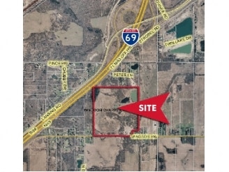
Windsor Hwy, Dimondale, MI 48821

Property Detail
Windsor Hwy
080-017-200-122-00
S 2/3 OF W 3/4 OF NE 1/4 EXCEPT W 346 FT & ALSO EXCEPT E 217.8 FT OF S 200 FT. SEC.17, T3N,R3W, WINDSOR TWP 1990
Commercialacreage
EATON
A-1
Michigan
B and X Area of moderate flood hazard, usually the area between the limits of the 100-year and 500-year floods.
66.03 AC
2024
Outlying Eaton County
2025
West Michigan
021402
Lansing-East Lansing, MI
NEARBY LISTINGS FOR SALE OR LEASE
DEMOGRAPHICS near Windsor Hwy
1 mile
3 mile
5 mile
2025 Total Population
447
6,764
19,317
2030 Population
458
6,808
19,401
Pop Growth 2025-2030
+ 2.46%
+ 0.65%
+ 0.43%
Average Age
45
45
42
2025 Total Households
193
2,796
7,677
HH Growth 2025-2030
+ 2.07%
+ 0.72%
+ 0.35%
Median Household Inc
$95,833
$89,326
$76,393
Avg Household Size
2.30
2.40
2.50
2025 Avg HH Vehicles
2.00
2.00
2.00
Median Home Value
$257,499
$246,887
$227,384
Median Year Built
1987
1978
1978
Nearby Places
Map Layers
Map Styles
 Street
 Aerial
Transit
 Traffic
 Biking
Places
Listings with unknown addresses are not visible on the map
- Restaurants
- Banks
- Shops
- Fitness
- Groceries
PUBLIC TRANSPORTATION
AIRPORT
Capital Region International
Drive
Walk
Distance
Capital Region International
22 min
12.8 mi
Freight Ports
Port of Toledo
Drive
Walk
Distance
Port of Toledo
154 min
130.8 mi
Nearby Properties
Address
Land Use
TOTAL SIZE
Lot Size
Zoning
Address
Land Use
TOTAL SIZE
Lot Size
Zoning
545,421 SF
120.99 AC
I-1 INDUST
Address
Land Use
TOTAL SIZE
Lot Size
Zoning
144,630 SF
11.51 AC
M-1
Address
Land Use
TOTAL SIZE
Lot Size
Zoning
48,948 SF
2.10 AC
M-1
Address
Land Use
TOTAL SIZE
Lot Size
Zoning
89,356 SF
49.53 AC
Address
Land Use
TOTAL SIZE
Lot Size
Zoning
50 AC
R-1M
Address
Land Use
TOTAL SIZE
Lot Size
Zoning
38,338 SF
2.12 AC
B-2
Address
Land Use
TOTAL SIZE
Lot Size
Zoning
437,864 SF
Address
Land Use
TOTAL SIZE
Lot Size
Zoning
31,600 SF
3.05 AC
M-1
Address
Land Use
TOTAL SIZE
Lot Size
Zoning
21,200 SF
2.43 AC
B-2
Address
Land Use
TOTAL SIZE
Lot Size
Zoning
53,004 SF
5.31 AC
M-1
Address
Land Use
TOTAL SIZE
Lot Size
Zoning
119 AC
R-1M
Address
Land Use
TOTAL SIZE
Lot Size
Zoning
30,074 SF
3.43 AC
M-1
Address
Land Use
TOTAL SIZE
Lot Size
Zoning
36,000 SF
15 AC
NONE
Address
Land Use
TOTAL SIZE
Lot Size
Zoning
5,954 SF
1.25 AC
R-1C
Address
Land Use
TOTAL SIZE
Lot Size
Zoning
4,160 SF
11.88 AC
LA
Address
Land Use
TOTAL SIZE
Lot Size
Zoning
16.55 AC
NONE
Address
Land Use
TOTAL SIZE
Lot Size
Zoning
21,080 SF
3.17 AC
B-1
Address
Land Use
TOTAL SIZE
Lot Size
Zoning
2,137 SF
157.95 AC
LA
Address
Land Use
TOTAL SIZE
Lot Size
Zoning
17,600 SF
6 AC
M-1
Address
Land Use
TOTAL SIZE
Lot Size
Zoning
239.56 AC
LA
Address
Land Use
TOTAL SIZE
Lot Size
Zoning
39,698 SF
12.32 AC
B-2
Address
Land Use
TOTAL SIZE
Lot Size
Zoning
9,100 SF
2.30 AC
B-1
Address
Land Use
TOTAL SIZE
Lot Size
Zoning
36.67 AC
Address
Land Use
TOTAL SIZE
Lot Size
Zoning
78.18 AC
Address
Land Use
TOTAL SIZE
Lot Size
Zoning
14,896 SF
5.93 AC
M-1
Address
Land Use
TOTAL SIZE
Lot Size
Zoning
17,200 SF
2.87 AC
M-1
Address
Land Use
TOTAL SIZE
Lot Size
Zoning
78.18 AC
R-1M
Address
Land Use
TOTAL SIZE
Lot Size
Zoning
22,049 SF
5.79 AC
B-1
Address
Land Use
TOTAL SIZE
Lot Size
Zoning
186 AC
A-1
Address
Land Use
TOTAL SIZE
Lot Size
Zoning
1,292 SF
159.47 AC
A-1
The World's #1 Commercial Real Estate Marketplace
Connect with us
© 2026 CoStar Group
The information above has been obtained from sources believed reliable. While we do not doubt its accuracy we have not verified it and make no guarantee, warranty or representation about it. It is your responsibility to independently confirm its accuracy and completeness. Any projections, opinions, assumptions, or estimates used are for example only and do not represent the current or future performance of the property. The value of this transaction to you depends on tax and other factors which should be evaluated by your tax, financial, and legal advisors. You and your advisors should conduct a careful, independent investigation of the property to determine to your satisfaction the suitability of the property for your needs.