Property Record
Wiscold Dr, Rochelle, IL 61068
Save to a Folder
{{folder.Name}}
{{folder.ListingIds.length}} Properties
{{folder.ListingIds.length}} Property
Create a New Folder
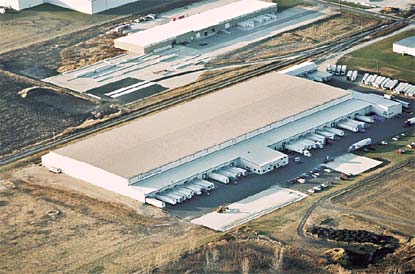
Property Detail
Wiscold Dr
Rochelle, IL
RNG/BLK:2 TWP:40 SECT/LOT:29 PT SE4 SW4 ANNEX ORD# 04-3241
25-29-300-019
OGLE
Industrialacreage
Illinois
AE The base floodplain where base flood elevations are provided. AE Zones are now used on new format FIRMs instead of A1-A30 Zones.
29
2025
21.07 AC
2025
I-39 Corr/Ogle Cnty
961200
Chicago
NEARBY LISTINGS FOR SALE OR LEASE
DEMOGRAPHICS near Wiscold Dr
1 mile
3 mile
5 mile
2025 Total Population
10
8,977
12,598
2030 Population
9
8,953
12,499
Pop Growth 2025-2030
(10.00%)
(0.27%)
(0.79%)
Average Age
35
39
39
2025 Total Households
4
3,638
4,968
HH Growth 2025-2030
(25.00%)
(0.30%)
(0.81%)
Median Household Inc
$5,000
$65,055
$69,590
Avg Household Size
2.00
2.40
2.50
2025 Avg HH Vehicles
1.00
2.00
2.00
Median Home Value
$150,000
$165,860
$173,986
Median Year Built
1949
1968
1969
Nearby Places
Map Layers
Map Styles
 Street
 Aerial
Layers
 Traffic
 Biking
Places
Listings with unknown addresses are not visible on the map
- Restaurants
- Banks
- Shops
- Fitness
- Groceries
PUBLIC TRANSPORTATION
AIRPORT
Chicago/Rockford International
Drive
Walk
Distance
Chicago/Rockford International
42 min
22.9 mi
Freight Ports
Port Milwaukee
Drive
Walk
Distance
Port Milwaukee
144 min
118.2 mi
Nearby Properties
Address
Land Use
TOTAL SIZE
Lot Size
Zoning
Address
Land Use
TOTAL SIZE
Lot Size
Zoning
24.14 AC
Address
Land Use
TOTAL SIZE
Lot Size
Zoning
39.59 AC
Address
Land Use
TOTAL SIZE
Lot Size
Zoning
45.20 AC
Address
Land Use
TOTAL SIZE
Lot Size
Zoning
26.63 AC
Address
Land Use
TOTAL SIZE
Lot Size
Zoning
47.91 AC
Address
Land Use
TOTAL SIZE
Lot Size
Zoning
20.21 AC
Address
Land Use
TOTAL SIZE
Lot Size
Zoning
22.16 AC
Address
Land Use
TOTAL SIZE
Lot Size
Zoning
18.14 AC
Address
Land Use
TOTAL SIZE
Lot Size
Zoning
14.66 AC
Address
Land Use
TOTAL SIZE
Lot Size
Zoning
Address
Land Use
TOTAL SIZE
Lot Size
Zoning
14.33 AC
Address
Land Use
TOTAL SIZE
Lot Size
Zoning
34.90 AC
Address
Land Use
TOTAL SIZE
Lot Size
Zoning
20,000 SF
12 AC
Address
Land Use
TOTAL SIZE
Lot Size
Zoning
Address
Land Use
TOTAL SIZE
Lot Size
Zoning
14.13 AC
Address
Land Use
TOTAL SIZE
Lot Size
Zoning
25.19 AC
Address
Land Use
TOTAL SIZE
Lot Size
Zoning
14.90 AC
Address
Land Use
TOTAL SIZE
Lot Size
Zoning
55.67 AC
Address
Land Use
TOTAL SIZE
Lot Size
Zoning
20,200 SF
5.10 AC
Address
Land Use
TOTAL SIZE
Lot Size
Zoning
10,260 SF
17.06 AC
Address
Land Use
TOTAL SIZE
Lot Size
Zoning
23.94 AC
Address
Land Use
TOTAL SIZE
Lot Size
Zoning
41.28 AC
Address
Land Use
TOTAL SIZE
Lot Size
Zoning
68,447 SF
2.04 AC
Address
Land Use
TOTAL SIZE
Lot Size
Zoning
9.55 AC
Address
Land Use
TOTAL SIZE
Lot Size
Zoning
2.64 AC
Address
Land Use
TOTAL SIZE
Lot Size
Zoning
176,200 SF
15.72 AC
Address
Land Use
TOTAL SIZE
Lot Size
Zoning
58,473 SF
2.13 AC
Address
Land Use
TOTAL SIZE
Lot Size
Zoning
21,000 SF
4.81 AC
Address
Land Use
TOTAL SIZE
Lot Size
Zoning
55,200 SF
1.74 AC
The World's #1 Commercial Real Estate Marketplace
Connect with us
© 2026 CoStar Group
The information above has been obtained from sources believed reliable. While we do not doubt its accuracy we have not verified it and make no guarantee, warranty or representation about it. It is your responsibility to independently confirm its accuracy and completeness. Any projections, opinions, assumptions, or estimates used are for example only and do not represent the current or future performance of the property. The value of this transaction to you depends on tax and other factors which should be evaluated by your tax, financial, and legal advisors. You and your advisors should conduct a careful, independent investigation of the property to determine to your satisfaction the suitability of the property for your needs.