Property Record
Woodbine Rd, Pace, FL 32571
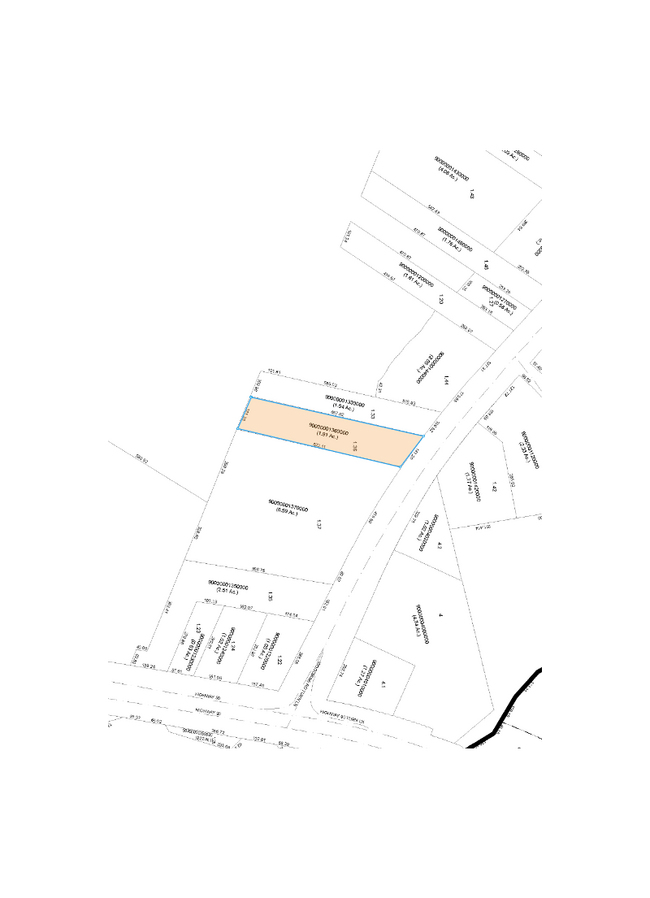

Property Detail
Woodbine Rd
22-1N-29-0000-00136-0000
**NEWLY DESCRIBED FOR 2024 PER OR 4469 PG 603 FOR 2024** COM AT NW CORN OF 22-1N-29W TH N S01*5224E 2191.12 FT THN S 21*5224E 512 FT THN N48*290 5E 1080.39 FT THN S53*2725E 2152.68 FT TO W BNDRY LI OF PARCEL DES IN OR 2287 PG 99 SAID PT BEING TH POB
Commercialacreage
SANTA ROSA
HCD
Florida
AE The base floodplain where base flood elevations are provided. AE Zones are now used on new format FIRMs instead of A1-A30 Zones.
4.28 AC
2024
Gonzalez/SW Santa Rosa
2025
Pensacola
010301
Pensacola-Ferry Pass-Brent, FL
NEARBY LISTINGS FOR SALE OR LEASE
DEMOGRAPHICS near Woodbine Rd
1 mile
3 mile
5 mile
2025 Total Population
1,867
15,247
48,901
2030 Population
2,022
16,499
52,419
Pop Growth 2025-2030
+ 8.30%
+ 8.21%
+ 7.19%
Average Age
40
40
40
2025 Total Households
690
5,643
17,898
HH Growth 2025-2030
+ 8.12%
+ 7.99%
+ 7.02%
Median Household Inc
$71,725
$77,278
$85,660
Avg Household Size
2.70
2.70
2.60
2025 Avg HH Vehicles
2.00
2.00
2.00
Median Home Value
$247,976
$284,695
$314,079
Median Year Built
1990
1993
1996
Nearby Places
Map Layers
Map Styles
 Street
 Aerial
Transit
 Traffic
 Biking
Places
Listings with unknown addresses are not visible on the map
- Restaurants
- Banks
- Shops
- Fitness
- Groceries
PUBLIC TRANSPORTATION
AIRPORT
Pensacola International
Drive
Walk
Distance
Pensacola International
21 min
11.5 mi
Freight Ports
Port of Mobile
Drive
Walk
Distance
Port of Mobile
72 min
60.3 mi
Nearby Properties
Address
Land Use
TOTAL SIZE
Lot Size
Zoning
Address
Land Use
TOTAL SIZE
Lot Size
Zoning
47.05 AC
AG-RR
Address
Land Use
TOTAL SIZE
Lot Size
Zoning
81,123 SF
8.78 AC
HCD
Address
Land Use
TOTAL SIZE
Lot Size
Zoning
60,129 SF
0.11 AC
HCD
Address
Land Use
TOTAL SIZE
Lot Size
Zoning
13.70 AC
HCD
Address
Land Use
TOTAL SIZE
Lot Size
Zoning
76,674 SF
2.80 AC
HCD
Address
Land Use
TOTAL SIZE
Lot Size
Zoning
93,476 SF
7.43 AC
HCD
Address
Land Use
TOTAL SIZE
Lot Size
Zoning
389.54 AC
AG-RR
Address
Land Use
TOTAL SIZE
Lot Size
Zoning
112,196 SF
343.01 AC
HCD
Address
Land Use
TOTAL SIZE
Lot Size
Zoning
50,616 SF
2.56 AC
R3
Address
Land Use
TOTAL SIZE
Lot Size
Zoning
30,564 SF
11.12 AC
HCD
Address
Land Use
TOTAL SIZE
Lot Size
Zoning
23,668 SF
2.30 AC
HCD
Address
Land Use
TOTAL SIZE
Lot Size
Zoning
13,560 SF
5.93 AC
HCD
Address
Land Use
TOTAL SIZE
Lot Size
Zoning
45,485 SF
6.49 AC
HCD
Address
Land Use
TOTAL SIZE
Lot Size
Zoning
62,174 SF
4 AC
HCD
Address
Land Use
TOTAL SIZE
Lot Size
Zoning
63,181 SF
6.61 AC
R2
Address
Land Use
TOTAL SIZE
Lot Size
Zoning
40,250 SF
2.19 AC
HCD
Address
Land Use
TOTAL SIZE
Lot Size
Zoning
35,878 SF
10 AC
HCD
Address
Land Use
TOTAL SIZE
Lot Size
Zoning
198,945 SF
358 AC
M2
Address
Land Use
TOTAL SIZE
Lot Size
Zoning
16,596 SF
1.29 AC
HCD
Address
Land Use
TOTAL SIZE
Lot Size
Zoning
27,839 SF
4 AC
AG-RR
Address
Land Use
TOTAL SIZE
Lot Size
Zoning
15,573 SF
1.65 AC
HCD
Address
Land Use
TOTAL SIZE
Lot Size
Zoning
16,675 SF
2 AC
HCD
Address
Land Use
TOTAL SIZE
Lot Size
Zoning
41,800 SF
3.81 AC
HCD
Address
Land Use
TOTAL SIZE
Lot Size
Zoning
24,061 SF
1.95 AC
HCD
Address
Land Use
TOTAL SIZE
Lot Size
Zoning
26,310 SF
120 AC
AG-RR
Address
Land Use
TOTAL SIZE
Lot Size
Zoning
13,974 SF
1.76 AC
HCD
Address
Land Use
TOTAL SIZE
Lot Size
Zoning
6,452 SF
4.82 AC
HCD
Address
Land Use
TOTAL SIZE
Lot Size
Zoning
2,324 SF
19.68 AC
HCD
Address
Land Use
TOTAL SIZE
Lot Size
Zoning
12,333 SF
3.67 AC
HCD
The World's #1 Commercial Real Estate Marketplace
Connect with us
© 2026 CoStar Group
The information above has been obtained from sources believed reliable. While we do not doubt its accuracy we have not verified it and make no guarantee, warranty or representation about it. It is your responsibility to independently confirm its accuracy and completeness. Any projections, opinions, assumptions, or estimates used are for example only and do not represent the current or future performance of the property. The value of this transaction to you depends on tax and other factors which should be evaluated by your tax, financial, and legal advisors. You and your advisors should conduct a careful, independent investigation of the property to determine to your satisfaction the suitability of the property for your needs.