Property Record
Woods Chapel Rd, Duncan, SC 29334

NEARBY LISTINGS FOR SALE OR LEASE
Property Detail
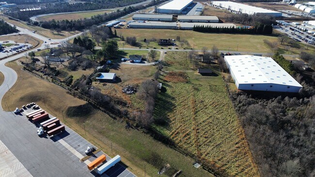
Woods Chapel Rd
Spartanburg, SC
Wayne K Morris Prop
5-24-00-147.00
E SIDE WOODS CHAPEL RD S OF ROBINSON DR PB 164-675 DB 148G-323
Residentialacreage
Spartanburg
X
South Carolina
45045C0366E
2.07 AC
2024
Rt 101 Corridor
2025
Greenville/Spartanburg
023101
DEMOGRAPHICS near Woods Chapel Rd
1 Mile
3 Mile
5 Mile
2024 Total Population
354
13,358
65,752
2029 Population
401
15,241
74,666
Pop Growth 2024-2029
+ 13.28%
+ 14.10%
+ 13.56%
Average Age
39
37
38
2024 Total Households
139
4,960
24,868
HH Growth 2024-2029
+ 12.95%
+ 14.35%
+ 13.67%
Median Household Inc
$67,321
$63,145
$66,380
Avg Household Size
2.50
2.60
2.60
2024 Avg HH Vehicles
2.00
2.00
2.00
Median Home Value
$176,595
$199,920
$222,987
Median Year Built
1995
2000
1999
Nearby Places
Map Layers
Map Styles
 Street
 Aerial
- Restaurants
- Banks
- Shops
- Fitness
- Groceries
PUBLIC TRANSPORTATION
AIRPORT
Greenville Spartanburg International
DRIVE
WALK
Distance
Greenville Spartanburg International
11 min
3.9 mi
Freight Ports
North Charleston Terminal
DRIVE
WALK
Distance
North Charleston Terminal
231 min
200.6 mi
SALE & LEASE HISTORY
LISTING DATE
SALE/LEASE

Mar 16, 2020
For Sale
Jun 10, 2021
For Sale
Dec 04, 2024
For Lease
Nearby Properties
Address
Land Use
TOTAL SIZE
Lot Size
Zoning
Address
Land Use
TOTAL SIZE
Lot Size
Zoning
227,627 SF
21.37 AC
Address
Land Use
TOTAL SIZE
Lot Size
Zoning
241,696 SF
15.12 AC
Address
Land Use
TOTAL SIZE
Lot Size
Zoning
235,600 SF
14.48 AC
Address
Land Use
TOTAL SIZE
Lot Size
Zoning
95.88 AC
Address
Land Use
TOTAL SIZE
Lot Size
Zoning
1,320,000 SF
130.98 AC
Address
Land Use
TOTAL SIZE
Lot Size
Zoning
86,884 SF
5.31 AC
Address
Land Use
TOTAL SIZE
Lot Size
Zoning
Address
Land Use
TOTAL SIZE
Lot Size
Zoning
2,528 SF
14.74 AC
Address
Land Use
TOTAL SIZE
Lot Size
Zoning
111.08 AC
Address
Land Use
TOTAL SIZE
Lot Size
Zoning
66.99 AC
Address
Land Use
TOTAL SIZE
Lot Size
Zoning
2,417 SF
115.88 AC
Address
Land Use
TOTAL SIZE
Lot Size
Zoning
1,281 SF
41.23 AC
Address
Land Use
TOTAL SIZE
Lot Size
Zoning
710,705 SF
34.03 AC
Address
Land Use
TOTAL SIZE
Lot Size
Zoning
16,592 SF
15.43 AC
Address
Land Use
TOTAL SIZE
Lot Size
Zoning
177,675 SF
39.88 AC
Address
Land Use
TOTAL SIZE
Lot Size
Zoning
1,218 SF
34.73 AC
Address
Land Use
TOTAL SIZE
Lot Size
Zoning
42.27 AC
Address
Land Use
TOTAL SIZE
Lot Size
Zoning
2,497 SF
12.36 AC
Address
Land Use
TOTAL SIZE
Lot Size
Zoning
26,472 SF
3.90 AC
Address
Land Use
TOTAL SIZE
Lot Size
Zoning
1,111,000 SF
Address
Land Use
TOTAL SIZE
Lot Size
Zoning
2,088 SF
40.12 AC
Address
Land Use
TOTAL SIZE
Lot Size
Zoning
736,169 SF
24.99 AC
Address
Land Use
TOTAL SIZE
Lot Size
Zoning
15.17 AC
Address
Land Use
TOTAL SIZE
Lot Size
Zoning
33.34 AC
Address
Land Use
TOTAL SIZE
Lot Size
Zoning
33.40 AC
Address
Land Use
TOTAL SIZE
Lot Size
Zoning
1,798 SF
9.63 AC
Address
Land Use
TOTAL SIZE
Lot Size
Zoning
274,050 SF
Address
Land Use
TOTAL SIZE
Lot Size
Zoning
234,220 SF
Address
Land Use
TOTAL SIZE
Lot Size
Zoning
1,176 SF
20.13 AC
Address
Land Use
TOTAL SIZE
Lot Size
Zoning
107.32 AC
The World's #1 Commercial Real Estate Marketplace
Connect with us
© 2026 CoStar Group
The information above has been obtained from sources believed reliable. While we do not doubt its accuracy we have not verified it and make no guarantee, warranty or representation about it. It is your responsibility to independently confirm its accuracy and completeness. Any projections, opinions, assumptions, or estimates used are for example only and do not represent the current or future performance of the property. The value of this transaction to you depends on tax and other factors which should be evaluated by your tax, financial, and legal advisors. You and your advisors should conduct a careful, independent investigation of the property to determine to your satisfaction the suitability of the property for your needs.