Property Record
Woolston Dr, Morrisville, PA 19067

NEARBY LISTINGS FOR SALE OR LEASE
-
-
View all Morrisville listings for sale on LoopNet.com
Property Detail
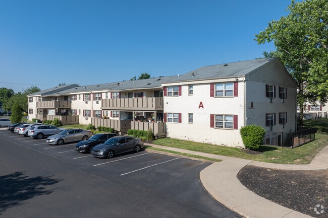
Woolston Dr
Philadelphia-Camden-Wilmington, PA-NJ-DE-MD
Viking Assoc Plan
13-028-012-001
1.5543 AC LOT #1 VIKING ASSOC PLAN 232 ON W TRENTON AVE
Apartment
Bucks
X
Pennsylvania
42017C0454K
1
2024
27.89 AC
2025
Lower Bucks County
105801
Philadelphia
35,542 SF
DEMOGRAPHICS near Woolston Dr
1 Mile
3 Mile
5 Mile
2024 Total Population
9,021
75,786
249,070
2029 Population
8,944
75,441
246,717
Pop Growth 2024-2029
(0.85%)
(0.46%)
(0.94%)
Average Age
41
42
40
2024 Total Households
3,328
29,028
90,739
HH Growth 2024-2029
(0.93%)
(0.51%)
(0.94%)
Median Household Inc
$102,841
$94,188
$76,813
Avg Household Size
2.60
2.50
2.60
2024 Avg HH Vehicles
2.00
2.00
2.00
Median Home Value
$363,732
$325,005
$273,649
Median Year Built
1966
1958
1956
Nearby Places
Map Layers
Map Styles
 Street
 Aerial
- Restaurants
- Banks
- Shops
- Fitness
- Groceries
PUBLIC TRANSPORTATION
COMMUTER RAIL
Yardley (R3 - Southeastern Pennsylvania Transportation Authority Regional Rail (SEPTA Regional Rail))
DRIVE
WALK
Distance
Yardley (R3 - Southeastern Pennsylvania Transportation Authority Regional Rail (SEPTA Regional Rail))
7 min
3.1 mi
Trenton Transit Center (Trenton Line - SEPTA)
DRIVE
WALK
Distance
Trenton Transit Center (Trenton Line - SEPTA)
8 min
4.6 mi
AIRPORT
Trenton Mercer
DRIVE
WALK
Distance
Trenton Mercer
16 min
8.3 mi
Freight Ports
Port of Philadelphia
DRIVE
WALK
Distance
Port of Philadelphia
37 min
25.4 mi
Nearby Properties
Address
Land Use
TOTAL SIZE
Lot Size
Zoning
Address
Land Use
TOTAL SIZE
Lot Size
Zoning
26 AC
HIST
Address
Land Use
TOTAL SIZE
Lot Size
Zoning
125,000 SF
3.68 AC
MU
Address
Land Use
TOTAL SIZE
Lot Size
Zoning
41,000 SF
0.91 AC
HIST
Address
Land Use
TOTAL SIZE
Lot Size
Zoning
2.60 AC
BA
Address
Land Use
TOTAL SIZE
Lot Size
Zoning
96,530 SF
3.19 AC
0000
Address
Land Use
TOTAL SIZE
Lot Size
Zoning
96,530 SF
3.49 AC
0000
Address
Land Use
TOTAL SIZE
Lot Size
Zoning
96,530 SF
3.05 AC
0000
Address
Land Use
TOTAL SIZE
Lot Size
Zoning
2.33 AC
HIST
Address
Land Use
TOTAL SIZE
Lot Size
Zoning
6.44 AC
RB
Address
Land Use
TOTAL SIZE
Lot Size
Zoning
1.31 AC
RB
Address
Land Use
TOTAL SIZE
Lot Size
Zoning
143,388 SF
2 AC
0000
Address
Land Use
TOTAL SIZE
Lot Size
Zoning
1.31 AC
RB
Address
Land Use
TOTAL SIZE
Lot Size
Zoning
81,624 SF
4.97 AC
MU
Address
Land Use
TOTAL SIZE
Lot Size
Zoning
66,448 SF
0.81 AC
HIST
Address
Land Use
TOTAL SIZE
Lot Size
Zoning
178,770 SF
0.82 AC
HIST
Address
Land Use
TOTAL SIZE
Lot Size
Zoning
1.37 AC
RB
Address
Land Use
TOTAL SIZE
Lot Size
Zoning
2.42 AC
RB
Address
Land Use
TOTAL SIZE
Lot Size
Zoning
109,106 SF
5 AC
0000
Address
Land Use
TOTAL SIZE
Lot Size
Zoning
4.67 AC
BA
Address
Land Use
TOTAL SIZE
Lot Size
Zoning
10,404 SF
5 AC
RB
Address
Land Use
TOTAL SIZE
Lot Size
Zoning
2.61 AC
HIST
Address
Land Use
TOTAL SIZE
Lot Size
Zoning
356,045 SF
7.67 AC
MOZ1
Address
Land Use
TOTAL SIZE
Lot Size
Zoning
108,780 SF
0.90 AC
RB
Address
Land Use
TOTAL SIZE
Lot Size
Zoning
35,542 SF
27.89 AC
NC
Address
Land Use
TOTAL SIZE
Lot Size
Zoning
38,041 SF
0.47 AC
MU
Address
Land Use
TOTAL SIZE
Lot Size
Zoning
396,000 SF
36.71 AC
PIP
Address
Land Use
TOTAL SIZE
Lot Size
Zoning
22,552 SF
0.77 AC
BB
Address
Land Use
TOTAL SIZE
Lot Size
Zoning
2.56 AC
BA
Address
Land Use
TOTAL SIZE
Lot Size
Zoning
2,108,894 SF
95.90 AC
LI
Address
Land Use
TOTAL SIZE
Lot Size
Zoning
18,600 SF
0.84 AC
HIST
The World's #1 Commercial Real Estate Marketplace
Connect with us
© 2025 CoStar Group
The information above has been obtained from sources believed reliable. While we do not doubt its accuracy we have not verified it and make no guarantee, warranty or representation about it. It is your responsibility to independently confirm its accuracy and completeness. Any projections, opinions, assumptions, or estimates used are for example only and do not represent the current or future performance of the property. The value of this transaction to you depends on tax and other factors which should be evaluated by your tax, financial, and legal advisors. You and your advisors should conduct a careful, independent investigation of the property to determine to your satisfaction the suitability of the property for your needs.