Property Record
Worrell Rd, Antioch, CA 94509

Property Detail
Worrell Rd
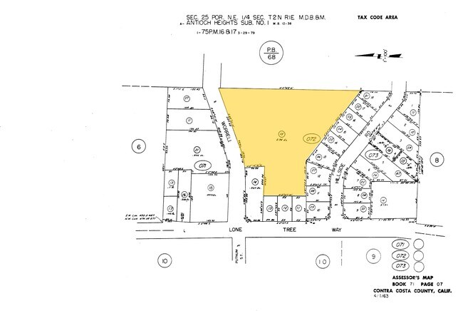
071-072-015-2
POR SEC 25 T2N R1E
Apartment
CONTRA COSTA
R1
California
B and X Area of moderate flood hazard, usually the area between the limits of the 100-year and 500-year floods.
2.94 AC
2025
Antioch/Pittsburg
2025
East Bay/Oakland
307102
Oakland-Fremont-Berkeley, CA
6,594 SF
NEARBY LISTINGS FOR SALE OR LEASE
DEMOGRAPHICS near Worrell Rd
1 mile
3 mile
5 mile
2025 Total Population
20,568
103,575
179,015
2030 Population
20,694
104,564
181,425
Pop Growth 2025-2030
+ 0.61%
+ 0.95%
+ 1.35%
Average Age
39
39
39
2025 Total Households
6,709
32,292
55,830
HH Growth 2025-2030
+ 0.63%
+ 0.97%
+ 1.38%
Median Household Inc
$78,802
$90,564
$97,921
Avg Household Size
3.00
3.10
3.10
2025 Avg HH Vehicles
2.00
2.00
2.00
Median Home Value
$608,510
$681,113
$689,172
Median Year Built
1971
1982
1985
Nearby Places
Map Layers
Map Styles
 Street
 Aerial
Transit
 Traffic
 Biking
Places
Listings with unknown addresses are not visible on the map
- Restaurants
- Banks
- Shops
- Fitness
- Groceries
PUBLIC TRANSPORTATION
AIRPORT
Stockton Metro
Drive
Walk
Distance
Stockton Metro
60 min
40.4 mi
Metro Oakland International
Drive
Walk
Distance
Metro Oakland International
58 min
44.4 mi
Freight Ports
Port of Oakland
Drive
Walk
Distance
Port of Oakland
47 min
37.2 mi
Nearby Properties
Address
Land Use
TOTAL SIZE
Lot Size
Zoning
Address
Land Use
TOTAL SIZE
Lot Size
Zoning
109,536 SF
24.93 AC
Address
Land Use
TOTAL SIZE
Lot Size
Zoning
24,286 SF
13.89 AC
Address
Land Use
TOTAL SIZE
Lot Size
Zoning
57.12 AC
Address
Land Use
TOTAL SIZE
Lot Size
Zoning
198,470 SF
13.49 AC
Address
Land Use
TOTAL SIZE
Lot Size
Zoning
3,472 SF
11.68 AC
Address
Land Use
TOTAL SIZE
Lot Size
Zoning
28,078 SF
6.46 AC
Address
Land Use
TOTAL SIZE
Lot Size
Zoning
35,995 SF
91.24 AC
Address
Land Use
TOTAL SIZE
Lot Size
Zoning
228,334 SF
30.34 AC
HI
Address
Land Use
TOTAL SIZE
Lot Size
Zoning
497,235 SF
26.26 AC
Address
Land Use
TOTAL SIZE
Lot Size
Zoning
2,352 SF
7.29 AC
Address
Land Use
TOTAL SIZE
Lot Size
Zoning
161,131 SF
15.97 AC
Address
Land Use
TOTAL SIZE
Lot Size
Zoning
6,284 SF
5.75 AC
Address
Land Use
TOTAL SIZE
Lot Size
Zoning
47,307 SF
6.70 AC
Address
Land Use
TOTAL SIZE
Lot Size
Zoning
16,775 SF
25.31 AC
Address
Land Use
TOTAL SIZE
Lot Size
Zoning
4,240 SF
11.04 AC
Address
Land Use
TOTAL SIZE
Lot Size
Zoning
2.06 AC
Address
Land Use
TOTAL SIZE
Lot Size
Zoning
91,344 SF
4.79 AC
R4
Address
Land Use
TOTAL SIZE
Lot Size
Zoning
77,491 SF
4.25 AC
Address
Land Use
TOTAL SIZE
Lot Size
Zoning
5,584 SF
10.47 AC
Address
Land Use
TOTAL SIZE
Lot Size
Zoning
75,119 SF
3.26 AC
Address
Land Use
TOTAL SIZE
Lot Size
Zoning
137,208 SF
10.37 AC
Address
Land Use
TOTAL SIZE
Lot Size
Zoning
60,707 SF
6.06 AC
Address
Land Use
TOTAL SIZE
Lot Size
Zoning
62,140 SF
3.27 AC
Address
Land Use
TOTAL SIZE
Lot Size
Zoning
59,513 SF
5.71 AC
Address
Land Use
TOTAL SIZE
Lot Size
Zoning
82,077 SF
4.64 AC
Address
Land Use
TOTAL SIZE
Lot Size
Zoning
159,218 SF
3.68 AC
Address
Land Use
TOTAL SIZE
Lot Size
Zoning
105,308 SF
5.12 AC
Address
Land Use
TOTAL SIZE
Lot Size
Zoning
4,500 SF
4.74 AC
Address
Land Use
TOTAL SIZE
Lot Size
Zoning
239,730 SF
12.59 AC
The World's #1 Commercial Real Estate Marketplace
Connect with us
© 2026 CoStar Group
The information above has been obtained from sources believed reliable. While we do not doubt its accuracy we have not verified it and make no guarantee, warranty or representation about it. It is your responsibility to independently confirm its accuracy and completeness. Any projections, opinions, assumptions, or estimates used are for example only and do not represent the current or future performance of the property. The value of this transaction to you depends on tax and other factors which should be evaluated by your tax, financial, and legal advisors. You and your advisors should conduct a careful, independent investigation of the property to determine to your satisfaction the suitability of the property for your needs.