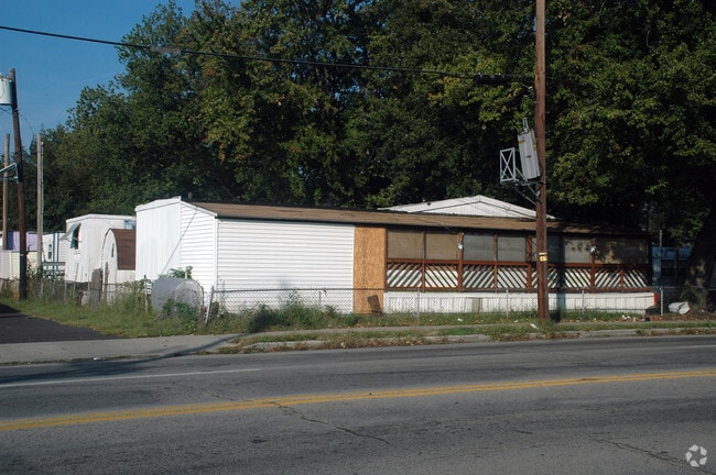
Property Record
Ws Mt Ephraim 305S Ferry # 305S Mt, Camden, NJ 08104
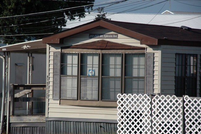

NEARBY LISTINGS FOR SALE OR LEASE
-
-
-
-
-
-
-
No Photo
-
View all Camden listings for sale on LoopNet.com
Property Detail
Ws Mt Ephraim 305S Ferry # 305S Mt
08-00588-0000-00002
Camden
Commercialnec
New Jersey
X
6
34007C0036F
6.93 AC
2024
Centerville
2025
Philadelphia
601700
Philadelphia-Camden-Wilmington, PA-NJ-DE-MD
640 SF
DEMOGRAPHICS near Ws Mt Ephraim 305S Ferry # 305S Mt
1 Mile
3 Mile
5 Mile
2024 Total Population
30,032
180,151
593,027
2029 Population
30,656
179,769
584,935
Pop Growth 2024-2029
+ 2.08%
(0.21%)
(1.36%)
Average Age
35
38
38
2024 Total Households
11,150
69,232
258,567
HH Growth 2024-2029
+ 2.07%
(0.38%)
(1.70%)
Median Household Inc
$36,164
$61,376
$77,225
Avg Household Size
2.60
2.50
2.20
2024 Avg HH Vehicles
1.00
1.00
1.00
Median Home Value
$125,919
$231,024
$290,617
Median Year Built
1950
1948
1950
Nearby Places
Map Layers
Map Styles
 Street
 Aerial
- Restaurants
- Banks
- Shops
- Fitness
- Groceries
PUBLIC TRANSPORTATION
TRANSIT/SUBWAY
Ferry Avenue (PATCO Speedline - Port Authority Transit Corporation Speedline (PATCO Speedline))
DRIVE
WALK
Distance
Ferry Avenue (PATCO Speedline - Port Authority Transit Corporation Speedline (PATCO Speedline))
2 min
16 min
0.9 mi
COMMUTER RAIL
Cherry Hill (Atlantic City Line - NJ Transit Commuter Rail (NJ Transit))
DRIVE
WALK
Distance
Cherry Hill (Atlantic City Line - NJ Transit Commuter Rail (NJ Transit))
8 min
4.6 mi
Market East (R1 - Southeastern Pennsylvania Transportation Authority Regional Rail (SEPTA Regional Rail), R2 - Southeastern Pennsylvania Transportation Authority Regional Rail (SEPTA Regional Rail), R3 - Southeastern Pennsylvania Transportation Authority Regional Rail (SEPTA Regional Rail), R5 - Southeastern Pennsylvania Transportation Authority Regional Rail (SEPTA Regional Rail), R6 - Southeastern Pennsylvania Transportation Authority Regional Rail (SEPTA Regional Rail), R7 - Southeastern Pennsylvania Transportation Authority Regional Rail (SEPTA Regional Rail), R8 - Southeastern Pennsylvania Transportation Authority Regional Rail (SEPTA Regional Rail))
DRIVE
WALK
Distance
Market East (R1 - Southeastern Pennsylvania Transportation Authority Regional Rail (SEPTA Regional Rail), R2 - Southeastern Pennsylvania Transportation Authority Regional Rail (SEPTA Regional Rail), R3 - Southeastern Pennsylvania Transportation Authority Regional Rail (SEPTA Regional Rail), R5 - Southeastern Pennsylvania Transportation Authority Regional Rail (SEPTA Regional Rail), R6 - Southeastern Pennsylvania Transportation Authority Regional Rail (SEPTA Regional Rail), R7 - Southeastern Pennsylvania Transportation Authority Regional Rail (SEPTA Regional Rail), R8 - Southeastern Pennsylvania Transportation Authority Regional Rail (SEPTA Regional Rail))
10 min
5.1 mi
AIRPORT
Philadelphia International
DRIVE
WALK
Distance
Philadelphia International
22 min
11.9 mi
Trenton Mercer
DRIVE
WALK
Distance
Trenton Mercer
53 min
36.6 mi
Freight Ports
Broadway Terminal - Pier 5
DRIVE
WALK
Distance
Broadway Terminal - Pier 5
4 min
1.7 mi
Nearby Properties
Address
Land Use
TOTAL SIZE
Lot Size
Zoning
Address
Land Use
TOTAL SIZE
Lot Size
Zoning
1.17 AC
Address
Land Use
TOTAL SIZE
Lot Size
Zoning
7.17 AC
Address
Land Use
TOTAL SIZE
Lot Size
Zoning
124.13 AC
Address
Land Use
TOTAL SIZE
Lot Size
Zoning
Address
Land Use
TOTAL SIZE
Lot Size
Zoning
80,064 SF
51.52 AC
I3
Address
Land Use
TOTAL SIZE
Lot Size
Zoning
12.53 AC
Address
Land Use
TOTAL SIZE
Lot Size
Zoning
1.62 AC
Address
Land Use
TOTAL SIZE
Lot Size
Zoning
Address
Land Use
TOTAL SIZE
Lot Size
Zoning
11.06 AC
CMX3
Address
Land Use
TOTAL SIZE
Lot Size
Zoning
289,664 SF
0.22 AC
CMX3
Address
Land Use
TOTAL SIZE
Lot Size
Zoning
289,664 SF
0.22 AC
CMX3
Address
Land Use
TOTAL SIZE
Lot Size
Zoning
2.32 AC
Address
Land Use
TOTAL SIZE
Lot Size
Zoning
7.11 AC
Address
Land Use
TOTAL SIZE
Lot Size
Zoning
8.50 AC
Address
Land Use
TOTAL SIZE
Lot Size
Zoning
441,600 SF
1.68 AC
CMX4
Address
Land Use
TOTAL SIZE
Lot Size
Zoning
256,280 SF
2.54 AC
CMX3
Address
Land Use
TOTAL SIZE
Lot Size
Zoning
1.88 AC
Address
Land Use
TOTAL SIZE
Lot Size
Zoning
1.68 AC
Address
Land Use
TOTAL SIZE
Lot Size
Zoning
6.43 AC
Address
Land Use
TOTAL SIZE
Lot Size
Zoning
Address
Land Use
TOTAL SIZE
Lot Size
Zoning
31.99 AC
Address
Land Use
TOTAL SIZE
Lot Size
Zoning
47.20 AC
I3
Address
Land Use
TOTAL SIZE
Lot Size
Zoning
272,918 SF
23.03 AC
CA2
Address
Land Use
TOTAL SIZE
Lot Size
Zoning
16,872 SF
RH
Address
Land Use
TOTAL SIZE
Lot Size
Zoning
1,504 SF
61.44 AC
Address
Land Use
TOTAL SIZE
Lot Size
Zoning
4,431 SF
18.60 AC
C2
Address
Land Use
TOTAL SIZE
Lot Size
Zoning
1.48 AC
PCR
Address
Land Use
TOTAL SIZE
Lot Size
Zoning
17.62 AC
Address
Land Use
TOTAL SIZE
Lot Size
Zoning
35 AC
R1
Address
Land Use
TOTAL SIZE
Lot Size
Zoning
21.13 AC
The World's #1 Commercial Real Estate Marketplace
Connect with us
© 2025 CoStar Group
The information above has been obtained from sources believed reliable. While we do not doubt its accuracy we have not verified it and make no guarantee, warranty or representation about it. It is your responsibility to independently confirm its accuracy and completeness. Any projections, opinions, assumptions, or estimates used are for example only and do not represent the current or future performance of the property. The value of this transaction to you depends on tax and other factors which should be evaluated by your tax, financial, and legal advisors. You and your advisors should conduct a careful, independent investigation of the property to determine to your satisfaction the suitability of the property for your needs.