Property Record
X8 Vac Vic Avenue X8/258 Ste, Llano, CA 93544

NEARBY LISTINGS FOR SALE OR LEASE
-
-
View all Llano listings for sale on LoopNet.com
Property Detail
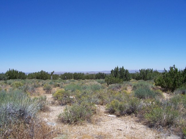
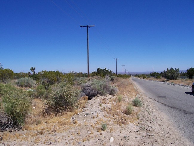
X8 Vac Vic Avenue X8/258 Ste
Los Angeles-Long Beach-Glendale, CA
160 ACS SW 1/4 OF SEC 36 T 5N R 8W
3088-006-002
Los Angeles
Desertorbarrenland
California
X
36
06037C1000F
160.55 AC
2024
East LA County Outlying
2025
Los Angeles
911001
DEMOGRAPHICS near X8 Vac Vic Avenue X8/258 Ste
1 Mile
3 Mile
5 Mile
2024 Total Population
143
912
5,286
2029 Population
138
872
5,054
Pop Growth 2024-2029
(3.50%)
(4.39%)
(4.39%)
Average Age
41
41
41
2024 Total Households
46
309
1,804
HH Growth 2024-2029
(4.35%)
(4.53%)
(4.60%)
Median Household Inc
$62,045
$56,346
$60,314
Avg Household Size
3.20
2.90
2.90
2024 Avg HH Vehicles
2.00
2.00
2.00
Median Home Value
$346,153
$350,000
$360,742
Median Year Built
1992
1988
1988
Nearby Places
Map Layers
Map Styles
 Street
 Aerial
- Restaurants
- Banks
- Shops
- Fitness
- Groceries
PUBLIC TRANSPORTATION
AIRPORT
Ontario International
DRIVE
WALK
Distance
Ontario International
57 min
43.0 mi
Freight Ports
Port of Long Beach
DRIVE
WALK
Distance
Port of Long Beach
118 min
95.1 mi
Nearby Properties
Address
Land Use
TOTAL SIZE
Lot Size
Zoning
Address
Land Use
TOTAL SIZE
Lot Size
Zoning
9,037 SF
1.79 AC
PHCG
Address
Land Use
TOTAL SIZE
Lot Size
Zoning
147.78 AC
PHIC
Address
Land Use
TOTAL SIZE
Lot Size
Zoning
6,000 SF
2.09 AC
PHRM
Address
Land Use
TOTAL SIZE
Lot Size
Zoning
4,895 SF
0.73 AC
PHCG
Address
Land Use
TOTAL SIZE
Lot Size
Zoning
15.14 AC
PHCG
Address
Land Use
TOTAL SIZE
Lot Size
Zoning
9,910 SF
1.18 AC
PHCG
Address
Land Use
TOTAL SIZE
Lot Size
Zoning
298.38 AC
LCA11*
Address
Land Use
TOTAL SIZE
Lot Size
Zoning
4,608 SF
2.25 AC
PHRM
Address
Land Use
TOTAL SIZE
Lot Size
Zoning
79.27 AC
LCA12*
Address
Land Use
TOTAL SIZE
Lot Size
Zoning
5,496 SF
1.40 AC
PHCG
Address
Land Use
TOTAL SIZE
Lot Size
Zoning
8.78 AC
PHCG
Address
Land Use
TOTAL SIZE
Lot Size
Zoning
152.34 AC
LA11*
Address
Land Use
TOTAL SIZE
Lot Size
Zoning
115.56 AC
LCA11*
Address
Land Use
TOTAL SIZE
Lot Size
Zoning
3,744 SF
2.36 AC
PHRL
Address
Land Use
TOTAL SIZE
Lot Size
Zoning
161.23 AC
LCA11*
Address
Land Use
TOTAL SIZE
Lot Size
Zoning
74.19 AC
LCM11/2*
Address
Land Use
TOTAL SIZE
Lot Size
Zoning
3,750 SF
2.37 AC
PHRM
Address
Land Use
TOTAL SIZE
Lot Size
Zoning
79.14 AC
LCA11*
Address
Land Use
TOTAL SIZE
Lot Size
Zoning
4,072 SF
1.60 AC
PHRM
Address
Land Use
TOTAL SIZE
Lot Size
Zoning
1,904 SF
1.52 AC
PHCG
Address
Land Use
TOTAL SIZE
Lot Size
Zoning
156.14 AC
LCA11*
Address
Land Use
TOTAL SIZE
Lot Size
Zoning
39.25 AC
PHRL
Address
Land Use
TOTAL SIZE
Lot Size
Zoning
6.15 AC
PHCG
Address
Land Use
TOTAL SIZE
Lot Size
Zoning
2,371 SF
1.95 AC
PHCN
Address
Land Use
TOTAL SIZE
Lot Size
Zoning
19.85 AC
LCA11*
Address
Land Use
TOTAL SIZE
Lot Size
Zoning
2,227 SF
0.83 AC
PHCG
Address
Land Use
TOTAL SIZE
Lot Size
Zoning
155.82 AC
LCA11*
Address
Land Use
TOTAL SIZE
Lot Size
Zoning
10 AC
PHRL
Address
Land Use
TOTAL SIZE
Lot Size
Zoning
45.38 AC
PHRL
The World's #1 Commercial Real Estate Marketplace
Connect with us
© 2026 CoStar Group
The information above has been obtained from sources believed reliable. While we do not doubt its accuracy we have not verified it and make no guarantee, warranty or representation about it. It is your responsibility to independently confirm its accuracy and completeness. Any projections, opinions, assumptions, or estimates used are for example only and do not represent the current or future performance of the property. The value of this transaction to you depends on tax and other factors which should be evaluated by your tax, financial, and legal advisors. You and your advisors should conduct a careful, independent investigation of the property to determine to your satisfaction the suitability of the property for your needs.