Property Record
Xxx Unassigned, Saint Francis, MN 55070

NEARBY LISTINGS FOR SALE OR LEASE
-
-
View all Saint Francis listings for sale on LoopNet.com
Property Detail
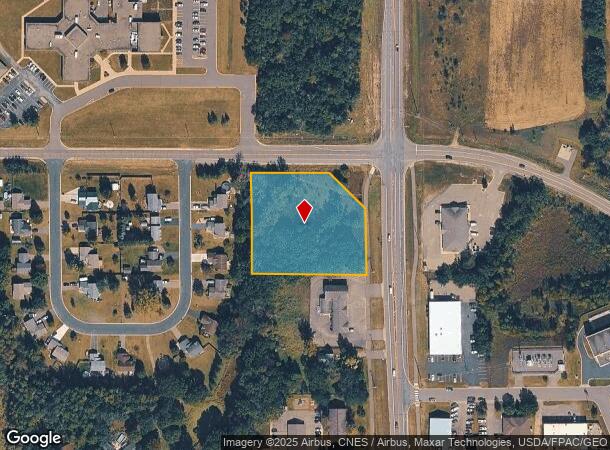
Xxx Unassigned
31-34-24-11-0023
THAT PRT OF E 396 FT OF N1/2 OF NE1/4 OF NE1/4 SEC 31-34-24 LYG NLY OF S 330 FT THEREOF; EX RD; SUBJ TO EASE OF REC
Commercialacreage
Anoka
X
Minnesota
27003C0065E
2.89 AC
2025
Anoka County Outlying
2025
Minneapolis/St Paul
050108
Minneapolis-St. Paul-Bloomington, MN-WI
DEMOGRAPHICS near Xxx Unassigned
1 Mile
3 Mile
5 Mile
2024 Total Population
3,419
10,311
17,402
2029 Population
3,573
10,773
18,188
Pop Growth 2024-2029
+ 4.50%
+ 4.48%
+ 4.52%
Average Age
37
38
39
2024 Total Households
1,250
3,676
6,116
HH Growth 2024-2029
+ 4.56%
+ 4.54%
+ 4.61%
Median Household Inc
$78,761
$90,867
$98,871
Avg Household Size
2.70
2.80
2.80
2024 Avg HH Vehicles
2.00
2.00
3.00
Median Home Value
$254,913
$284,531
$322,504
Median Year Built
1996
1996
1994
Nearby Places
Map Layers
Map Styles
 Street
 Aerial
- Restaurants
- Banks
- Shops
- Fitness
- Groceries
Nearby Properties
Address
Land Use
TOTAL SIZE
Lot Size
Zoning
Address
Land Use
TOTAL SIZE
Lot Size
Zoning
228,826 SF
56.32 AC
Address
Land Use
TOTAL SIZE
Lot Size
Zoning
68,136 SF
26.79 AC
Address
Land Use
TOTAL SIZE
Lot Size
Zoning
2,720 SF
2.03 AC
Address
Land Use
TOTAL SIZE
Lot Size
Zoning
Address
Land Use
TOTAL SIZE
Lot Size
Zoning
45,652 SF
38.11 AC
Address
Land Use
TOTAL SIZE
Lot Size
Zoning
60,159 SF
6.42 AC
Address
Land Use
TOTAL SIZE
Lot Size
Zoning
61,276 SF
1.84 AC
Address
Land Use
TOTAL SIZE
Lot Size
Zoning
894 SF
4 AC
Address
Land Use
TOTAL SIZE
Lot Size
Zoning
1,512 SF
5.01 AC
Address
Land Use
TOTAL SIZE
Lot Size
Zoning
16,213 SF
1.85 AC
Address
Land Use
TOTAL SIZE
Lot Size
Zoning
20,138 SF
2.61 AC
Address
Land Use
TOTAL SIZE
Lot Size
Zoning
1,292 SF
16.10 AC
Address
Land Use
TOTAL SIZE
Lot Size
Zoning
19,752 SF
2.09 AC
Address
Land Use
TOTAL SIZE
Lot Size
Zoning
24,438 SF
1.25 AC
Address
Land Use
TOTAL SIZE
Lot Size
Zoning
7,294 SF
Address
Land Use
TOTAL SIZE
Lot Size
Zoning
20,535 SF
1.15 AC
Address
Land Use
TOTAL SIZE
Lot Size
Zoning
30,732 SF
2.44 AC
Address
Land Use
TOTAL SIZE
Lot Size
Zoning
Address
Land Use
TOTAL SIZE
Lot Size
Zoning
13,580 SF
1.71 AC
Address
Land Use
TOTAL SIZE
Lot Size
Zoning
11,264 SF
1.85 AC
Address
Land Use
TOTAL SIZE
Lot Size
Zoning
1,632 SF
257 AC
Address
Land Use
TOTAL SIZE
Lot Size
Zoning
7,451 SF
1.55 AC
Address
Land Use
TOTAL SIZE
Lot Size
Zoning
2,021 SF
61 AC
Address
Land Use
TOTAL SIZE
Lot Size
Zoning
17,204 SF
5.90 AC
Address
Land Use
TOTAL SIZE
Lot Size
Zoning
12,204 SF
0.82 AC
Address
Land Use
TOTAL SIZE
Lot Size
Zoning
12,204 SF
0.87 AC
Address
Land Use
TOTAL SIZE
Lot Size
Zoning
9,100 SF
1.20 AC
Address
Land Use
TOTAL SIZE
Lot Size
Zoning
Address
Land Use
TOTAL SIZE
Lot Size
Zoning
10,640 SF
Address
Land Use
TOTAL SIZE
Lot Size
Zoning
11,170 SF
1.66 AC
The World's #1 Commercial Real Estate Marketplace
Connect with us
© 2025 CoStar Group
The information above has been obtained from sources believed reliable. While we do not doubt its accuracy we have not verified it and make no guarantee, warranty or representation about it. It is your responsibility to independently confirm its accuracy and completeness. Any projections, opinions, assumptions, or estimates used are for example only and do not represent the current or future performance of the property. The value of this transaction to you depends on tax and other factors which should be evaluated by your tax, financial, and legal advisors. You and your advisors should conduct a careful, independent investigation of the property to determine to your satisfaction the suitability of the property for your needs.