Property Record
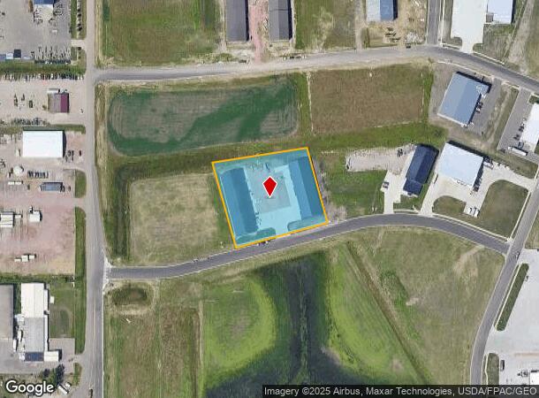
2010 Venture St, Tea, SD 57064
NEARBY LISTINGS FOR SALE OR LEASE
Property Detail
2010 Venture St
Sioux Falls, SD
1St Add
240.64.03.002
TEA - BAKKER LANDING 1ST ADD - LOT 2 - BLK 3
Commercialnec
Lincoln
X
South Dakota
46083C0150D
2
2024
1.89 AC
2024
Sioux Falls
010115
Other Market Areas
DEMOGRAPHICS near 2010 Venture St
1 Mile
3 Mile
5 Mile
2024 Total Population
33
33,228
85,657
2029 Population
40
39,528
98,535
Pop Growth 2024-2029
+ 21.21%
+ 18.96%
+ 15.03%
Average Age
35
35
38
2024 Total Households
11
12,490
34,334
HH Growth 2024-2029
+ 27.27%
+ 19.16%
+ 15.00%
Median Household Inc
$137,500
$87,137
$82,875
Avg Household Size
2.60
2.60
2.40
2024 Avg HH Vehicles
3.00
2.00
2.00
Median Home Value
$350,000
$265,071
$279,884
Median Year Built
2008
2004
2001
Nearby Places
Map Layers
Map Styles
 Street
 Aerial
- Restaurants
- Banks
- Shops
- Fitness
- Groceries
PUBLIC TRANSPORTATION
AIRPORT
Joe Foss Field
DRIVE
WALK
Distance
Joe Foss Field
29 min
12.4 mi
Freight Ports
Port Milwaukee
DRIVE
WALK
Distance
Port Milwaukee
556 min
511.9 mi
SALE & LEASE HISTORY
LISTING DATE
SALE/LEASE

May 06, 2020
For Lease
Nearby Properties
Address
Land Use
TOTAL SIZE
Lot Size
Zoning
Address
Land Use
TOTAL SIZE
Lot Size
Zoning
14.81 AC
MUNICIPALI
Address
Land Use
TOTAL SIZE
Lot Size
Zoning
8.89 AC
MUNICIPALI
Address
Land Use
TOTAL SIZE
Lot Size
Zoning
8.80 AC
MUNICIPALI
Address
Land Use
TOTAL SIZE
Lot Size
Zoning
8.51 AC
MUNICIPALI
Address
Land Use
TOTAL SIZE
Lot Size
Zoning
15.40 AC
MUNICIPALI
Address
Land Use
TOTAL SIZE
Lot Size
Zoning
10.75 AC
MUNICIPALI
Address
Land Use
TOTAL SIZE
Lot Size
Zoning
9.45 AC
MUNICIPALI
Address
Land Use
TOTAL SIZE
Lot Size
Zoning
9.57 AC
MUNICIPALI
Address
Land Use
TOTAL SIZE
Lot Size
Zoning
8.57 AC
MUNICIPALI
Address
Land Use
TOTAL SIZE
Lot Size
Zoning
11.13 AC
MUNICIPALI
Address
Land Use
TOTAL SIZE
Lot Size
Zoning
8.65 AC
MUNICIPALI
Address
Land Use
TOTAL SIZE
Lot Size
Zoning
4.61 AC
MUNICIPALI
Address
Land Use
TOTAL SIZE
Lot Size
Zoning
9.56 AC
MUNICIPALI
Address
Land Use
TOTAL SIZE
Lot Size
Zoning
16.45 AC
MUNICIPALI
Address
Land Use
TOTAL SIZE
Lot Size
Zoning
7.07 AC
MUNICIPALI
Address
Land Use
TOTAL SIZE
Lot Size
Zoning
7.09 AC
MUNICIPALI
Address
Land Use
TOTAL SIZE
Lot Size
Zoning
9.27 AC
MUNICIPALI
Address
Land Use
TOTAL SIZE
Lot Size
Zoning
9.16 AC
MUNICIPALI
Address
Land Use
TOTAL SIZE
Lot Size
Zoning
6.51 AC
MUNICIPALI
Address
Land Use
TOTAL SIZE
Lot Size
Zoning
4.87 AC
MUNICIPALI
Address
Land Use
TOTAL SIZE
Lot Size
Zoning
5.27 AC
MUNICIPALI
Address
Land Use
TOTAL SIZE
Lot Size
Zoning
4.36 AC
MUNICIPALI
Address
Land Use
TOTAL SIZE
Lot Size
Zoning
13.83 AC
MUNICIPALI
Address
Land Use
TOTAL SIZE
Lot Size
Zoning
11.80 AC
I-1 LIGHT
Address
Land Use
TOTAL SIZE
Lot Size
Zoning
2.45 AC
MUNICIPALI
Address
Land Use
TOTAL SIZE
Lot Size
Zoning
6.11 AC
MUNICIPALI
Address
Land Use
TOTAL SIZE
Lot Size
Zoning
4.78 AC
MUNICIPALI
Address
Land Use
TOTAL SIZE
Lot Size
Zoning
11.07 AC
MUNICIPALI
Address
Land Use
TOTAL SIZE
Lot Size
Zoning
3.06 AC
MUNICIPALI
Address
Land Use
TOTAL SIZE
Lot Size
Zoning
0.57 AC
MUNICIPALI
The World's #1 Commercial Real Estate Marketplace
Connect with us
© 2025 CoStar Group
The information above has been obtained from sources believed reliable. While we do not doubt its accuracy we have not verified it and make no guarantee, warranty or representation about it. It is your responsibility to independently confirm its accuracy and completeness. Any projections, opinions, assumptions, or estimates used are for example only and do not represent the current or future performance of the property. The value of this transaction to you depends on tax and other factors which should be evaluated by your tax, financial, and legal advisors. You and your advisors should conduct a careful, independent investigation of the property to determine to your satisfaction the suitability of the property for your needs.