Property Record
Yacht Club Rd, Oak Point, TX 75068

Property Detail
Yacht Club Rd
Dallas-Fort Worth-Arlington, TX
HUNTERS RIDGE LOT 18 OLD DCAD A331 TR17A(1)
R184835
DENTON
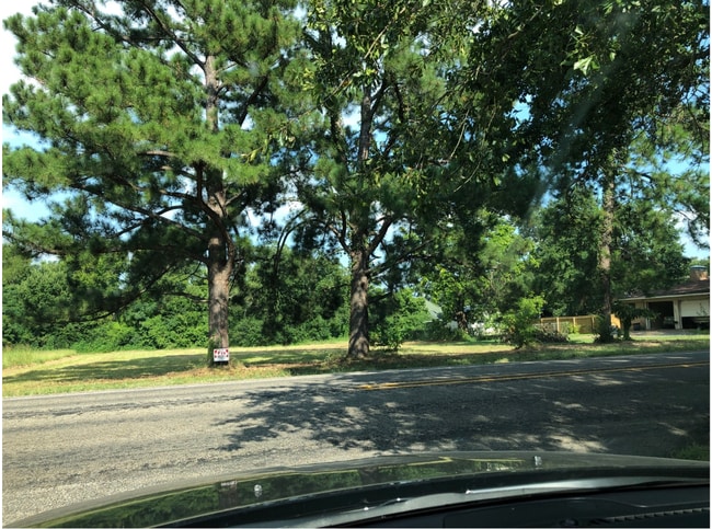
Vacantlandnec
Texas
B and X Area of moderate flood hazard, usually the area between the limits of the 100-year and 500-year floods.
18
0
55.15 AC
2025
Outlying Denton County
020119
Dallas/Ft Worth
NEARBY LISTINGS FOR SALE OR LEASE
DEMOGRAPHICS near Yacht Club Rd
1 mile
3 mile
5 mile
2025 Total Population
4,929
30,303
125,211
2030 Population
5,658
34,887
141,459
Pop Growth 2025-2030
+ 14.79%
+ 15.13%
+ 12.98%
Average Age
37
38
38
2025 Total Households
1,591
10,466
42,878
HH Growth 2025-2030
+ 15.08%
+ 15.44%
+ 13.28%
Median Household Inc
$108,378
$114,096
$109,169
Avg Household Size
3.10
2.90
2.90
2025 Avg HH Vehicles
2.00
2.00
2.00
Median Home Value
$431,369
$464,195
$410,642
Median Year Built
2009
2010
2010
Nearby Places
Map Layers
Map Styles
 Street
 Aerial
Layers
 Traffic
 Biking
Places
Listings with unknown addresses are not visible on the map
- Restaurants
- Banks
- Shops
- Fitness
- Groceries
PUBLIC TRANSPORTATION
AIRPORT
Dallas-Fort Worth International
Drive
Walk
Distance
Dallas-Fort Worth International
38 min
26.4 mi
Dallas Love Field
Drive
Walk
Distance
Dallas Love Field
50 min
35.4 mi
Freight Ports
Port of Shreveport
Drive
Walk
Distance
Port of Shreveport
256 min
230.8 mi
SALE & LEASE HISTORY
LISTING DATE
SALE/LEASE

Jun 03, 2020
For Sale
Jul 29, 2019
For Sale
Nearby Properties
Address
Land Use
TOTAL SIZE
Lot Size
Zoning
Address
Land Use
TOTAL SIZE
Lot Size
Zoning
194,000 SF
39.03 AC
Address
Land Use
TOTAL SIZE
Lot Size
Zoning
500,000 SF
57.47 AC
Address
Land Use
TOTAL SIZE
Lot Size
Zoning
325,000 SF
5.83 AC
Address
Land Use
TOTAL SIZE
Lot Size
Zoning
181,674 SF
49.62 AC
Address
Land Use
TOTAL SIZE
Lot Size
Zoning
271,742 SF
Address
Land Use
TOTAL SIZE
Lot Size
Zoning
52,000 SF
12.36 AC
Address
Land Use
TOTAL SIZE
Lot Size
Zoning
156,498 SF
12.20 AC
Address
Land Use
TOTAL SIZE
Lot Size
Zoning
84,187 SF
15.84 AC
Address
Land Use
TOTAL SIZE
Lot Size
Zoning
135,664 SF
10.60 AC
Address
Land Use
TOTAL SIZE
Lot Size
Zoning
142,919 SF
9.46 AC
Address
Land Use
TOTAL SIZE
Lot Size
Zoning
74,475 SF
9.07 AC
Address
Land Use
TOTAL SIZE
Lot Size
Zoning
78.32 AC
Address
Land Use
TOTAL SIZE
Lot Size
Zoning
39,474 SF
3.52 AC
Address
Land Use
TOTAL SIZE
Lot Size
Zoning
82,415 SF
5.30 AC
Address
Land Use
TOTAL SIZE
Lot Size
Zoning
45,500 SF
4.86 AC
Address
Land Use
TOTAL SIZE
Lot Size
Zoning
72,755 SF
3.83 AC
Address
Land Use
TOTAL SIZE
Lot Size
Zoning
10,400 SF
1.60 AC
Address
Land Use
TOTAL SIZE
Lot Size
Zoning
6.42 AC
Address
Land Use
TOTAL SIZE
Lot Size
Zoning
17,344 SF
4.71 AC
Address
Land Use
TOTAL SIZE
Lot Size
Zoning
31,058 SF
3.91 AC
Address
Land Use
TOTAL SIZE
Lot Size
Zoning
14,478 SF
2.48 AC
Address
Land Use
TOTAL SIZE
Lot Size
Zoning
49,457 SF
2.94 AC
Address
Land Use
TOTAL SIZE
Lot Size
Zoning
15,594 SF
0.21 AC
Address
Land Use
TOTAL SIZE
Lot Size
Zoning
19,500 SF
4.79 AC
Address
Land Use
TOTAL SIZE
Lot Size
Zoning
16,819 SF
4.90 AC
Address
Land Use
TOTAL SIZE
Lot Size
Zoning
12,800 SF
1.69 AC
Address
Land Use
TOTAL SIZE
Lot Size
Zoning
17,447 SF
1.71 AC
Address
Land Use
TOTAL SIZE
Lot Size
Zoning
75,193 SF
4.70 AC
Address
Land Use
TOTAL SIZE
Lot Size
Zoning
11,677 SF
1.87 AC
Address
Land Use
TOTAL SIZE
Lot Size
Zoning
8,986 SF
1.93 AC
The World's #1 Commercial Real Estate Marketplace
Connect with us
© 2026 CoStar Group
The information above has been obtained from sources believed reliable. While we do not doubt its accuracy we have not verified it and make no guarantee, warranty or representation about it. It is your responsibility to independently confirm its accuracy and completeness. Any projections, opinions, assumptions, or estimates used are for example only and do not represent the current or future performance of the property. The value of this transaction to you depends on tax and other factors which should be evaluated by your tax, financial, and legal advisors. You and your advisors should conduct a careful, independent investigation of the property to determine to your satisfaction the suitability of the property for your needs.