Property Record
Yerby Rd, Summerville, SC 29483
NEARBY LISTINGS FOR SALE OR LEASE
Property Detail
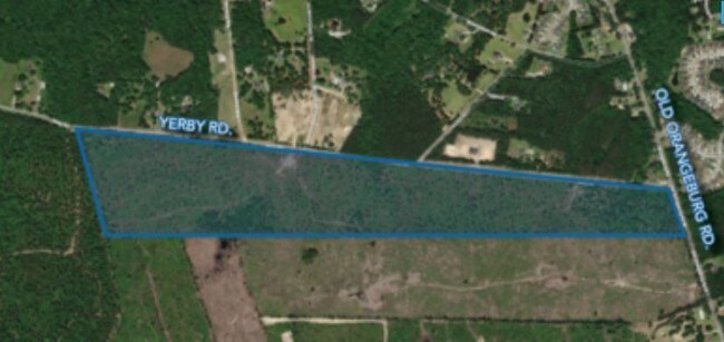
Yerby Rd
128-00-00-076
TRACT B
Vacantlandnec
Dorchester
X
South Carolina
45035C0317E
66.44 AC
2025
Dorchester County
2025
Charleston/N Charleston
010604
Charleston-North Charleston, SC
DEMOGRAPHICS near Yerby Rd
1 Mile
3 Mile
5 Mile
2024 Total Population
6,648
39,104
80,579
2029 Population
7,294
42,640
88,003
Pop Growth 2024-2029
+ 9.72%
+ 9.04%
+ 9.21%
Average Age
38
38
39
2024 Total Households
2,335
14,170
29,787
HH Growth 2024-2029
+ 9.64%
+ 8.87%
+ 9.04%
Median Household Inc
$77,225
$72,435
$72,222
Avg Household Size
2.80
2.70
2.70
2024 Avg HH Vehicles
2.00
2.00
2.00
Median Home Value
$311,595
$284,531
$283,061
Median Year Built
2005
2001
1999
Nearby Places
Map Layers
Map Styles
 Street
 Aerial
- Restaurants
- Banks
- Shops
- Fitness
- Groceries
PUBLIC TRANSPORTATION
AIRPORT
Charleston AFB/International
DRIVE
WALK
Distance
Charleston AFB/International
28 min
18.2 mi
Freight Ports
North Charleston Terminal
DRIVE
WALK
Distance
North Charleston Terminal
36 min
23.1 mi
SALE & LEASE HISTORY
LISTING DATE
SALE/LEASE

Feb 15, 2019
For Sale
Nearby Properties
Address
Land Use
TOTAL SIZE
Lot Size
Zoning
Address
Land Use
TOTAL SIZE
Lot Size
Zoning
605.46 AC
R-2_DC
Address
Land Use
TOTAL SIZE
Lot Size
Zoning
2,772 SF
30.24 AC
I_DC
Address
Land Use
TOTAL SIZE
Lot Size
Zoning
621,920 SF
87.29 AC
I_DC
Address
Land Use
TOTAL SIZE
Lot Size
Zoning
528,320 SF
38.11 AC
I_DC
Address
Land Use
TOTAL SIZE
Lot Size
Zoning
324,880 SF
50.65 AC
I_DC
Address
Land Use
TOTAL SIZE
Lot Size
Zoning
231,400 SF
24.14 AC
I_DC
Address
Land Use
TOTAL SIZE
Lot Size
Zoning
158,340 SF
28.93 AC
I_DC
Address
Land Use
TOTAL SIZE
Lot Size
Zoning
80,465 SF
19.07 AC
I_DC
Address
Land Use
TOTAL SIZE
Lot Size
Zoning
395,074 SF
21.33 AC
I_DC
Address
Land Use
TOTAL SIZE
Lot Size
Zoning
161,548 SF
16.56 AC
I_DC
Address
Land Use
TOTAL SIZE
Lot Size
Zoning
121,500 SF
40.85 AC
I_DC
Address
Land Use
TOTAL SIZE
Lot Size
Zoning
128,000 SF
10.95 AC
I_DC
Address
Land Use
TOTAL SIZE
Lot Size
Zoning
62,777 SF
9.62 AC
CG_DC
Address
Land Use
TOTAL SIZE
Lot Size
Zoning
281,313 SF
17.55 AC
I_DC
Address
Land Use
TOTAL SIZE
Lot Size
Zoning
43,352 SF
7.14 AC
G-B_SV
Address
Land Use
TOTAL SIZE
Lot Size
Zoning
110,000 SF
7.76 AC
I_DC
Address
Land Use
TOTAL SIZE
Lot Size
Zoning
17,783 SF
16.96 AC
CG_DC
Address
Land Use
TOTAL SIZE
Lot Size
Zoning
2,400 SF
24.57 AC
I_DC
Address
Land Use
TOTAL SIZE
Lot Size
Zoning
35,000 SF
4.15 AC
CG_DC
Address
Land Use
TOTAL SIZE
Lot Size
Zoning
97,678 SF
14.45 AC
I_DC
Address
Land Use
TOTAL SIZE
Lot Size
Zoning
61,751 SF
5.85 AC
I_DC
Address
Land Use
TOTAL SIZE
Lot Size
Zoning
229,734 SF
47.52 AC
I_DC
Address
Land Use
TOTAL SIZE
Lot Size
Zoning
536.07 AC
AR_DC
Address
Land Use
TOTAL SIZE
Lot Size
Zoning
3,898 SF
28.27 AC
OSR
Address
Land Use
TOTAL SIZE
Lot Size
Zoning
179,400 SF
38.56 AC
I_DC
Address
Land Use
TOTAL SIZE
Lot Size
Zoning
80 AC
CG_DC
Address
Land Use
TOTAL SIZE
Lot Size
Zoning
34.19 AC
I_DC
Address
Land Use
TOTAL SIZE
Lot Size
Zoning
23,983 SF
5.62 AC
TRM_DC
Address
Land Use
TOTAL SIZE
Lot Size
Zoning
14,618 SF
2.42 AC
CG_DC
Address
Land Use
TOTAL SIZE
Lot Size
Zoning
128.11 AC
MUC_DC
The World's #1 Commercial Real Estate Marketplace
Connect with us
© 2025 CoStar Group
The information above has been obtained from sources believed reliable. While we do not doubt its accuracy we have not verified it and make no guarantee, warranty or representation about it. It is your responsibility to independently confirm its accuracy and completeness. Any projections, opinions, assumptions, or estimates used are for example only and do not represent the current or future performance of the property. The value of this transaction to you depends on tax and other factors which should be evaluated by your tax, financial, and legal advisors. You and your advisors should conduct a careful, independent investigation of the property to determine to your satisfaction the suitability of the property for your needs.