No Photo
Property Record
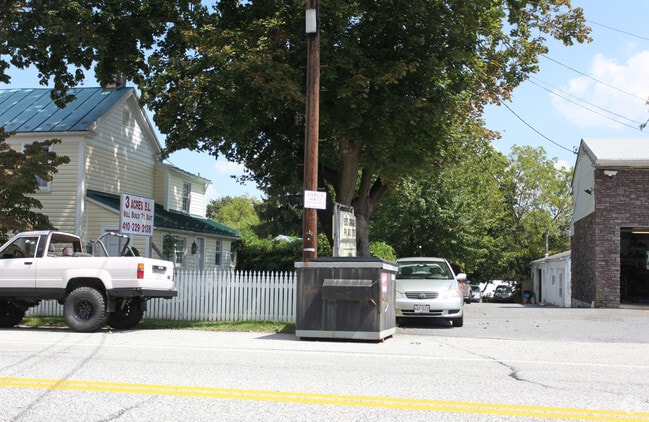
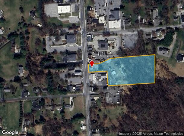
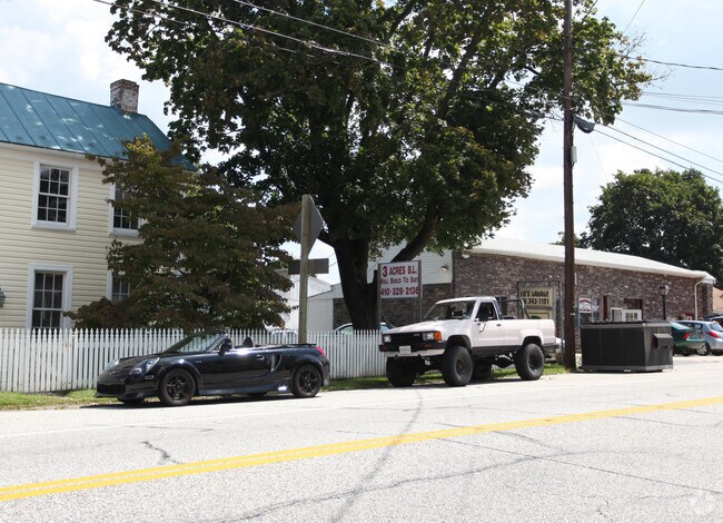
16909 York Rd, Monkton, MD 21111
NEARBY LISTINGS FOR SALE OR LEASE
-
-
View all Monkton listings for sale on LoopNet.com
Property Detail
16909 York Rd
07-0713021240
3.69 AC
Commercialnec
Baltimore
X
Maryland
2400100110G
3.68 AC
2024
Route 83 Corridor North
2025
Baltimore
407001
Baltimore-Columbia-Towson, MD
1,576 SF
DEMOGRAPHICS near 16909 York Rd
1 mile
3 mile
5 mile
2024 Total Population
849
4,207
12,824
2029 Population
828
4,099
12,506
Pop Growth 2024-2029
(2.47%)
(2.57%)
(2.48%)
Average Age
43
44
44
2024 Total Households
301
1,518
4,802
HH Growth 2024-2029
(2.33%)
(2.64%)
(2.54%)
Median Household Inc
$110,000
$144,869
$129,264
Avg Household Size
2.70
2.70
2.60
2024 Avg HH Vehicles
2.00
2.00
2.00
Median Home Value
$501,838
$574,871
$552,612
Median Year Built
1985
1981
1982
Nearby Places
Map Layers
Map Styles
 Street
 Aerial
Transit
 Traffic
 Biking
Places
Listings with unknown addresses are not visible on the map
- Restaurants
- Banks
- Shops
- Fitness
- Groceries
PUBLIC TRANSPORTATION
AIRPORT
Baltimore/Washington International Thurgood Marshall
Drive
Walk
Distance
Baltimore/Washington International Thurgood Marshall
51 min
36.5 mi
Freight Ports
Port of Baltimore
Drive
Walk
Distance
Port of Baltimore
38 min
25.5 mi
SALE & LEASE HISTORY
LISTING DATE
SALE/LEASE

Sep 24, 2016
For Sale
Nearby Properties
Address
Land Use
TOTAL SIZE
Lot Size
Zoning
Address
Land Use
TOTAL SIZE
Lot Size
Zoning
230,793 SF
103 AC
Address
Land Use
TOTAL SIZE
Lot Size
Zoning
2,522 SF
100.68 AC
RC4
Address
Land Use
TOTAL SIZE
Lot Size
Zoning
5,000 SF
190.47 AC
ML
Address
Land Use
TOTAL SIZE
Lot Size
Zoning
13,242 SF
12.97 AC
Address
Land Use
TOTAL SIZE
Lot Size
Zoning
11,580 SF
109.66 AC
Address
Land Use
TOTAL SIZE
Lot Size
Zoning
15,168 SF
0.80 AC
BM-CR
Address
Land Use
TOTAL SIZE
Lot Size
Zoning
5,128 SF
2.51 AC
Address
Land Use
TOTAL SIZE
Lot Size
Zoning
2,492 SF
228.70 AC
Address
Land Use
TOTAL SIZE
Lot Size
Zoning
21,988 SF
2 AC
Address
Land Use
TOTAL SIZE
Lot Size
Zoning
223 AC
Address
Land Use
TOTAL SIZE
Lot Size
Zoning
12,580 SF
147.46 AC
Address
Land Use
TOTAL SIZE
Lot Size
Zoning
9,206 SF
14 AC
Address
Land Use
TOTAL SIZE
Lot Size
Zoning
8,971 SF
12.55 AC
Address
Land Use
TOTAL SIZE
Lot Size
Zoning
8,724 SF
27.65 AC
Address
Land Use
TOTAL SIZE
Lot Size
Zoning
11,520 SF
7.90 AC
Address
Land Use
TOTAL SIZE
Lot Size
Zoning
16,343 SF
4.11 AC
Address
Land Use
TOTAL SIZE
Lot Size
Zoning
7,731 SF
4 AC
Address
Land Use
TOTAL SIZE
Lot Size
Zoning
10,152 SF
9.34 AC
Address
Land Use
TOTAL SIZE
Lot Size
Zoning
7,201 SF
4.48 AC
Address
Land Use
TOTAL SIZE
Lot Size
Zoning
7,700 SF
3.01 AC
Address
Land Use
TOTAL SIZE
Lot Size
Zoning
188.19 AC
Address
Land Use
TOTAL SIZE
Lot Size
Zoning
6,354 SF
24.72 AC
Address
Land Use
TOTAL SIZE
Lot Size
Zoning
5,364 SF
4 AC
RC4
Address
Land Use
TOTAL SIZE
Lot Size
Zoning
7,171 SF
3.82 AC
Address
Land Use
TOTAL SIZE
Lot Size
Zoning
11,420 SF
1.38 AC
BM-CR
Address
Land Use
TOTAL SIZE
Lot Size
Zoning
7,843 SF
4.05 AC
Address
Land Use
TOTAL SIZE
Lot Size
Zoning
11,058 SF
1.19 AC
BLCR
Address
Land Use
TOTAL SIZE
Lot Size
Zoning
223.63 AC
Address
Land Use
TOTAL SIZE
Lot Size
Zoning
8,896 SF
34.26 AC
Address
Land Use
TOTAL SIZE
Lot Size
Zoning
9,885 SF
1.69 AC
BR-CR
The World's #1 Commercial Real Estate Marketplace
Connect with us
© 2026 CoStar Group
The information above has been obtained from sources believed reliable. While we do not doubt its accuracy we have not verified it and make no guarantee, warranty or representation about it. It is your responsibility to independently confirm its accuracy and completeness. Any projections, opinions, assumptions, or estimates used are for example only and do not represent the current or future performance of the property. The value of this transaction to you depends on tax and other factors which should be evaluated by your tax, financial, and legal advisors. You and your advisors should conduct a careful, independent investigation of the property to determine to your satisfaction the suitability of the property for your needs.