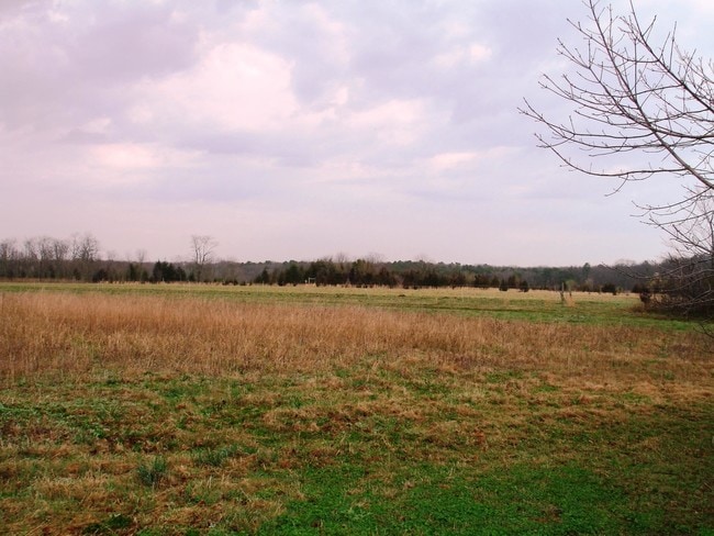
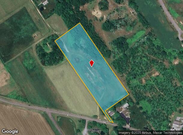
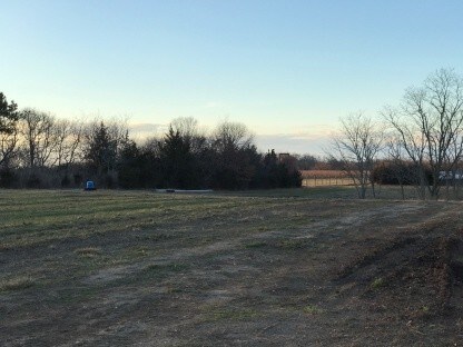
Property Record
Youngs Ave, Calverton, NY 11933
NEARBY LISTINGS FOR SALE OR LEASE
Property Detail
Youngs Ave
0600-080-00-01-00-003-005
Suffolk
Agriculturalland
New York
X
3
36103C0453H
6.02 AC
2024
Eastern Suffolk
2024
Long Island (New York)
169706
Nassau County-Suffolk County, NY
DEMOGRAPHICS near Youngs Ave
1 Mile
3 Mile
5 Mile
2024 Total Population
1,624
14,783
31,483
2029 Population
1,612
14,863
31,521
Pop Growth 2024-2029
(0.74%)
+ 0.54%
+ 0.12%
Average Age
47
47
44
2024 Total Households
651
6,152
11,979
HH Growth 2024-2029
(0.77%)
+ 0.47%
+ 0.03%
Median Household Inc
$72,018
$65,680
$69,443
Avg Household Size
2.50
2.30
2.50
2024 Avg HH Vehicles
2.00
2.00
2.00
Median Home Value
$432,750
$426,790
$416,257
Median Year Built
1991
1988
1983
Nearby Places
- Restaurants
- Banks
- Shops
- Fitness
- Groceries
PUBLIC TRANSPORTATION
COMMUTER RAIL
Riverhead Station (Greenport Branch - Long Island Rail Road)
DRIVE
WALK
Distance
Riverhead Station (Greenport Branch - Long Island Rail Road)
8 min
3.8 mi
AIRPORT
Long Island MacArthur
DRIVE
WALK
Distance
Long Island MacArthur
42 min
27.4 mi
Freight Ports
Port of New Haven
DRIVE
WALK
Distance
Port of New Haven
143 min
56.6 mi
SALE & LEASE HISTORY
LISTING DATE
SALE/LEASE

Sep 04, 2017
For Sale
Jun 14, 2018
For Sale
Dec 07, 2018
For Sale
Nearby Properties
Address
Land Use
TOTAL SIZE
Lot Size
Zoning
Address
Land Use
TOTAL SIZE
Lot Size
Zoning
450,000 SF
8.50 AC
3
Address
Land Use
TOTAL SIZE
Lot Size
Zoning
252,053 SF
31.60 AC
3
Address
Land Use
TOTAL SIZE
Lot Size
Zoning
42.70 AC
9
Address
Land Use
TOTAL SIZE
Lot Size
Zoning
176,704 SF
34.70 AC
3
Address
Land Use
TOTAL SIZE
Lot Size
Zoning
47.30 AC
9
Address
Land Use
TOTAL SIZE
Lot Size
Zoning
127,334 SF
49.72 AC
04
Address
Land Use
TOTAL SIZE
Lot Size
Zoning
109.90 AC
Address
Land Use
TOTAL SIZE
Lot Size
Zoning
2,010 SF
115.10 AC
09
Address
Land Use
TOTAL SIZE
Lot Size
Zoning
25,620 SF
7.03 AC
9
Address
Land Use
TOTAL SIZE
Lot Size
Zoning
9,715 SF
82.50 AC
9
Address
Land Use
TOTAL SIZE
Lot Size
Zoning
13.92 AC
04
Address
Land Use
TOTAL SIZE
Lot Size
Zoning
16,699 SF
24.81 AC
03
Address
Land Use
TOTAL SIZE
Lot Size
Zoning
20.72 AC
09
Address
Land Use
TOTAL SIZE
Lot Size
Zoning
26.39 AC
04
Address
Land Use
TOTAL SIZE
Lot Size
Zoning
92.73 AC
Address
Land Use
TOTAL SIZE
Lot Size
Zoning
108,572 SF
17.30 AC
04
Address
Land Use
TOTAL SIZE
Lot Size
Zoning
13,773 SF
11.65 AC
03
Address
Land Use
TOTAL SIZE
Lot Size
Zoning
36.60 AC
RC
Address
Land Use
TOTAL SIZE
Lot Size
Zoning
1,435 SF
13.20 AC
Address
Land Use
TOTAL SIZE
Lot Size
Zoning
2,860 SF
9.38 AC
3
Address
Land Use
TOTAL SIZE
Lot Size
Zoning
15.40 AC
RA40
Address
Land Use
TOTAL SIZE
Lot Size
Zoning
6,814 SF
349 AC
4
Address
Land Use
TOTAL SIZE
Lot Size
Zoning
1,190 SF
32.16 AC
09
Address
Land Use
TOTAL SIZE
Lot Size
Zoning
45.10 AC
Address
Land Use
TOTAL SIZE
Lot Size
Zoning
15,775 SF
8.20 AC
03
Address
Land Use
TOTAL SIZE
Lot Size
Zoning
50.50 AC
04
Address
Land Use
TOTAL SIZE
Lot Size
Zoning
126,200 SF
14.09 AC
3
Address
Land Use
TOTAL SIZE
Lot Size
Zoning
70,775 SF
13 AC
4
Address
Land Use
TOTAL SIZE
Lot Size
Zoning
7.20 AC
RA40
Address
Land Use
TOTAL SIZE
Lot Size
Zoning
66,340 SF
6.81 AC
BC
The World's #1 Commercial Real Estate Marketplace
Connect with us
© 2025 CoStar Group
The information above has been obtained from sources believed reliable. While we do not doubt its accuracy we have not verified it and make no guarantee, warranty or representation about it. It is your responsibility to independently confirm its accuracy and completeness. Any projections, opinions, assumptions, or estimates used are for example only and do not represent the current or future performance of the property. The value of this transaction to you depends on tax and other factors which should be evaluated by your tax, financial, and legal advisors. You and your advisors should conduct a careful, independent investigation of the property to determine to your satisfaction the suitability of the property for your needs.