Property Record
283 Flower City Park, Rochester, NY 14615


Property Detail
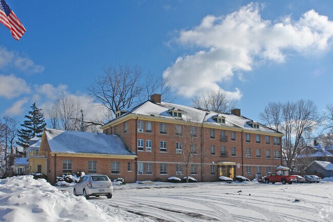
283 Flower City Park
Rochester, NY
MONROE
261400 090.51-2-11.001
New York
Religious
11.001
0
2.37 AC
2025
Greater Rochester
002000
Rochester
16,878 SF
NEARBY LISTINGS FOR SALE OR LEASE
DEMOGRAPHICS near 283 Flower City Park
1 mile
3 mile
5 mile
2025 Total Population
20,515
137,624
325,279
2030 Population
20,313
136,241
321,885
Pop Growth 2025-2030
(0.98%)
(1.00%)
(1.04%)
Average Age
37
38
40
2025 Total Households
8,347
56,928
143,221
HH Growth 2025-2030
(0.99%)
(0.89%)
(1.05%)
Median Household Inc
$42,833
$45,311
$56,201
Avg Household Size
2.40
2.30
2.20
2025 Avg HH Vehicles
1.00
1.00
1.00
Median Home Value
$113,043
$131,655
$157,092
Median Year Built
1947
1950
1951
Nearby Places
Map Layers
Map Styles
 Street
 Aerial
Layers
 Traffic
 Biking
Places
Listings with unknown addresses are not visible on the map
- Restaurants
- Banks
- Shops
- Fitness
- Groceries
PUBLIC TRANSPORTATION
AIRPORT
Frederick Douglass/Greater Rochester International
Drive
Walk
Distance
Frederick Douglass/Greater Rochester International
16 min
9.4 mi
Freight Ports
Albany, NY Port
Drive
Walk
Distance
Albany, NY Port
1 min
200.0 mi
Nearby Properties
Address
Land Use
TOTAL SIZE
Lot Size
Zoning
Address
Land Use
TOTAL SIZE
Lot Size
Zoning
847,728 SF
41.57 AC
Address
Land Use
TOTAL SIZE
Lot Size
Zoning
0.47 AC
Address
Land Use
TOTAL SIZE
Lot Size
Zoning
60,300 SF
59.02 AC
06 - INDUS
Address
Land Use
TOTAL SIZE
Lot Size
Zoning
0.13 AC
Address
Land Use
TOTAL SIZE
Lot Size
Zoning
181,500 SF
57.85 AC
Address
Land Use
TOTAL SIZE
Lot Size
Zoning
64,041 SF
42.66 AC
Address
Land Use
TOTAL SIZE
Lot Size
Zoning
270,150 SF
34.40 AC
02 - SINGL
Address
Land Use
TOTAL SIZE
Lot Size
Zoning
Address
Land Use
TOTAL SIZE
Lot Size
Zoning
13.10 AC
Address
Land Use
TOTAL SIZE
Lot Size
Zoning
373,200 SF
5.42 AC
Address
Land Use
TOTAL SIZE
Lot Size
Zoning
178,321 SF
3.10 AC
Address
Land Use
TOTAL SIZE
Lot Size
Zoning
0.01 AC
Address
Land Use
TOTAL SIZE
Lot Size
Zoning
473,876 SF
1.47 AC
Address
Land Use
TOTAL SIZE
Lot Size
Zoning
342,266 SF
1.44 AC
Address
Land Use
TOTAL SIZE
Lot Size
Zoning
7,200 SF
12.35 AC
Address
Land Use
TOTAL SIZE
Lot Size
Zoning
0.01 AC
Address
Land Use
TOTAL SIZE
Lot Size
Zoning
416,083 SF
0.94 AC
Address
Land Use
TOTAL SIZE
Lot Size
Zoning
119,777 SF
14.38 AC
06 - INDUS
Address
Land Use
TOTAL SIZE
Lot Size
Zoning
0.01 AC
Address
Land Use
TOTAL SIZE
Lot Size
Zoning
491,375 SF
5.90 AC
Address
Land Use
TOTAL SIZE
Lot Size
Zoning
336,447 SF
1.39 AC
Address
Land Use
TOTAL SIZE
Lot Size
Zoning
238,750 SF
17.07 AC
03 - MULTI
Address
Land Use
TOTAL SIZE
Lot Size
Zoning
233,579 SF
1.13 AC
Address
Land Use
TOTAL SIZE
Lot Size
Zoning
410,400 SF
2.88 AC
Address
Land Use
TOTAL SIZE
Lot Size
Zoning
261,960 SF
3.73 AC
Address
Land Use
TOTAL SIZE
Lot Size
Zoning
225,793 SF
32.60 AC
Address
Land Use
TOTAL SIZE
Lot Size
Zoning
227,808 SF
69.10 AC
Address
Land Use
TOTAL SIZE
Lot Size
Zoning
1.06 AC
Address
Land Use
TOTAL SIZE
Lot Size
Zoning
14,219 SF
2.34 AC
Address
Land Use
TOTAL SIZE
Lot Size
Zoning
619,686 SF
2.30 AC
The World's #1 Commercial Real Estate Marketplace
Connect with us
© 2026 CoStar Group
The information above has been obtained from sources believed reliable. While we do not doubt its accuracy we have not verified it and make no guarantee, warranty or representation about it. It is your responsibility to independently confirm its accuracy and completeness. Any projections, opinions, assumptions, or estimates used are for example only and do not represent the current or future performance of the property. The value of this transaction to you depends on tax and other factors which should be evaluated by your tax, financial, and legal advisors. You and your advisors should conduct a careful, independent investigation of the property to determine to your satisfaction the suitability of the property for your needs.