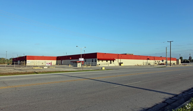
Property Record
3402 Meyer Rd, Fort Wayne, IN 46803

Property Detail
3402 Meyer Rd
02-13-17-276-003.000-077
26.286 AC IRR TR SE COR NE 1/4 SEC 17
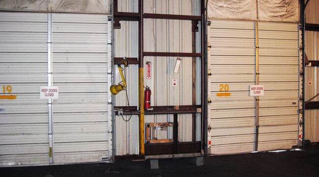
Warehouse
Allen
B and X Area of moderate flood hazard, usually the area between the limits of the 100-year and 500-year floods.
Indiana
2025
262.86 AC
2025
South Fort Wayne
001600
Fort Wayne
432,400 SF
Fort Wayne, IN
NEARBY LISTINGS FOR SALE OR LEASE
DEMOGRAPHICS near 3402 Meyer Rd
1 mile
3 mile
5 mile
2025 Total Population
3,775
62,191
169,626
2030 Population
3,931
64,541
175,060
Pop Growth 2025-2030
+ 4.13%
+ 3.78%
+ 3.20%
Average Age
35
36
37
2025 Total Households
1,430
22,913
67,350
HH Growth 2025-2030
+ 4.34%
+ 3.83%
+ 3.33%
Median Household Inc
$41,847
$41,289
$49,993
Avg Household Size
2.60
2.60
2.40
2025 Avg HH Vehicles
2.00
2.00
2.00
Median Home Value
$115,964
$135,490
$162,616
Median Year Built
1967
1965
1963
Nearby Places
Map Layers
Map Styles
 Street
 Aerial
Layers
 Traffic
 Biking
Places
Listings with unknown addresses are not visible on the map
- Restaurants
- Banks
- Shops
- Fitness
- Groceries
PUBLIC TRANSPORTATION
AIRPORT
Fort Wayne International
Drive
Walk
Distance
Fort Wayne International
23 min
11.9 mi
Freight Ports
Port of Toledo
Drive
Walk
Distance
Port of Toledo
135 min
102.7 mi
SALE & LEASE HISTORY
LISTING DATE
SALE/LEASE

Sep 25, 2016
For Lease
Aug 27, 2020
For Lease
Nearby Properties
Address
Land Use
TOTAL SIZE
Lot Size
Zoning
Address
Land Use
TOTAL SIZE
Lot Size
Zoning
342,000 SF
5,878.37 AC
Address
Land Use
TOTAL SIZE
Lot Size
Zoning
526,184 SF
35.62 AC
Address
Land Use
TOTAL SIZE
Lot Size
Zoning
129,080 SF
15.77 AC
Address
Land Use
TOTAL SIZE
Lot Size
Zoning
23,326 SF
152.70 AC
Address
Land Use
TOTAL SIZE
Lot Size
Zoning
62,666 SF
20.58 AC
Address
Land Use
TOTAL SIZE
Lot Size
Zoning
180,813 SF
246 AC
Address
Land Use
TOTAL SIZE
Lot Size
Zoning
316,421 SF
25.01 AC
Address
Land Use
TOTAL SIZE
Lot Size
Zoning
50,072 SF
8.27 AC
Address
Land Use
TOTAL SIZE
Lot Size
Zoning
243,087 SF
324.91 AC
Address
Land Use
TOTAL SIZE
Lot Size
Zoning
860,503 SF
395.56 AC
Address
Land Use
TOTAL SIZE
Lot Size
Zoning
95,432 SF
386.87 AC
Address
Land Use
TOTAL SIZE
Lot Size
Zoning
154,746 SF
87.54 AC
Address
Land Use
TOTAL SIZE
Lot Size
Zoning
237,829 SF
498.63 AC
Address
Land Use
TOTAL SIZE
Lot Size
Zoning
70,312 SF
25.38 AC
Address
Land Use
TOTAL SIZE
Lot Size
Zoning
48,118 SF
1.56 AC
Address
Land Use
TOTAL SIZE
Lot Size
Zoning
41,424 SF
1.03 AC
Address
Land Use
TOTAL SIZE
Lot Size
Zoning
398,376 SF
31.30 AC
Address
Land Use
TOTAL SIZE
Lot Size
Zoning
149,627 SF
65.32 AC
Address
Land Use
TOTAL SIZE
Lot Size
Zoning
132,289 SF
1.27 AC
Address
Land Use
TOTAL SIZE
Lot Size
Zoning
144,412 SF
9.65 AC
Address
Land Use
TOTAL SIZE
Lot Size
Zoning
27,060 SF
220.99 AC
Address
Land Use
TOTAL SIZE
Lot Size
Zoning
132,448 SF
22.22 AC
Address
Land Use
TOTAL SIZE
Lot Size
Zoning
186,975 SF
14.79 AC
Address
Land Use
TOTAL SIZE
Lot Size
Zoning
89,919 SF
210.10 AC
Address
Land Use
TOTAL SIZE
Lot Size
Zoning
97,280 SF
103 AC
Address
Land Use
TOTAL SIZE
Lot Size
Zoning
2,988 SF
2,633.38 AC
Address
Land Use
TOTAL SIZE
Lot Size
Zoning
60,558 SF
197 AC
Address
Land Use
TOTAL SIZE
Lot Size
Zoning
45,278 SF
9.30 AC
Address
Land Use
TOTAL SIZE
Lot Size
Zoning
234,852 SF
13.41 AC
Address
Land Use
TOTAL SIZE
Lot Size
Zoning
30,400 SF
132.94 AC
The World's #1 Commercial Real Estate Marketplace
Connect with us
© 2026 CoStar Group
The information above has been obtained from sources believed reliable. While we do not doubt its accuracy we have not verified it and make no guarantee, warranty or representation about it. It is your responsibility to independently confirm its accuracy and completeness. Any projections, opinions, assumptions, or estimates used are for example only and do not represent the current or future performance of the property. The value of this transaction to you depends on tax and other factors which should be evaluated by your tax, financial, and legal advisors. You and your advisors should conduct a careful, independent investigation of the property to determine to your satisfaction the suitability of the property for your needs.