Property Record
2100 Roswell Rd, Marietta, GA 30062
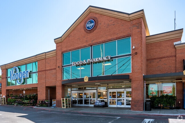


Property Detail
2100 Roswell Rd
16-1060-0-005-0
COBB
Regionalshoppingcenterormallwithanchorstore
Georgia
CRC
133
B and X Area of moderate flood hazard, usually the area between the limits of the 100-year and 500-year floods.
13.40 AC
2025
Town Center/Marietta
2025
Atlanta
030410
Atlanta-Sandy Springs-Roswell, GA
167,727 SF
NEARBY LISTINGS FOR SALE OR LEASE
DEMOGRAPHICS near 2100 Roswell Rd
1 mile
3 mile
5 mile
2025 Total Population
10,081
81,255
199,941
2030 Population
10,263
83,634
205,357
Pop Growth 2025-2030
+ 1.81%
+ 2.93%
+ 2.71%
Average Age
39
39
40
2025 Total Households
4,379
30,774
78,101
HH Growth 2025-2030
+ 1.78%
+ 2.93%
+ 2.76%
Median Household Inc
$83,363
$96,938
$101,205
Avg Household Size
2.30
2.50
2.50
2025 Avg HH Vehicles
2.00
2.00
2.00
Median Home Value
$496,401
$469,298
$503,533
Median Year Built
1983
1981
1982
Nearby Places
Map Layers
Map Styles
 Street
 Aerial
Layers
 Traffic
 Biking
Places
Listings with unknown addresses are not visible on the map
- Restaurants
- Banks
- Shops
- Fitness
- Groceries
PUBLIC TRANSPORTATION
AIRPORT
Hartsfield - Jackson Atlanta International
Drive
Walk
Distance
Hartsfield - Jackson Atlanta International
40 min
27.9 mi
Freight Ports
Georgia Ports - Savannah
Drive
Walk
Distance
Georgia Ports - Savannah
302 min
267.2 mi
SALE & LEASE HISTORY
LISTING DATE
SALE/LEASE

Sep 24, 2016
For Lease
May 31, 2017
For Lease
Nearby Properties
Address
Land Use
TOTAL SIZE
Lot Size
Zoning
Address
Land Use
TOTAL SIZE
Lot Size
Zoning
437,793 SF
41.12 AC
RM-16
Address
Land Use
TOTAL SIZE
Lot Size
Zoning
452,366 SF
27.27 AC
PRD MF
Address
Land Use
TOTAL SIZE
Lot Size
Zoning
494,076 SF
33.30 AC
PRD MF
Address
Land Use
TOTAL SIZE
Lot Size
Zoning
300,105 SF
43.12 AC
RM-8
Address
Land Use
TOTAL SIZE
Lot Size
Zoning
343,570 SF
22.65 AC
PRD MF
Address
Land Use
TOTAL SIZE
Lot Size
Zoning
8,000 SF
9.57 AC
PRD MF
Address
Land Use
TOTAL SIZE
Lot Size
Zoning
284,832 SF
19.56 AC
PRD MF
Address
Land Use
TOTAL SIZE
Lot Size
Zoning
243,574 SF
40.05 AC
RM-8
Address
Land Use
TOTAL SIZE
Lot Size
Zoning
3,406 SF
23.20 AC
R20
Address
Land Use
TOTAL SIZE
Lot Size
Zoning
285,846 SF
19.21 AC
PRD MF
Address
Land Use
TOTAL SIZE
Lot Size
Zoning
8,980 SF
51.17 AC
Address
Land Use
TOTAL SIZE
Lot Size
Zoning
228,652 SF
24.19 AC
RM-12
Address
Land Use
TOTAL SIZE
Lot Size
Zoning
509,792 SF
4.45 AC
OHR
Address
Land Use
TOTAL SIZE
Lot Size
Zoning
226,769 SF
13.40 AC
RM-16
Address
Land Use
TOTAL SIZE
Lot Size
Zoning
190,168 SF
14.60 AC
PRD MF
Address
Land Use
TOTAL SIZE
Lot Size
Zoning
226,810 SF
9.95 AC
PRD MF
Address
Land Use
TOTAL SIZE
Lot Size
Zoning
240,389 SF
18.32 AC
PRD MF
Address
Land Use
TOTAL SIZE
Lot Size
Zoning
240,628 SF
30.90 AC
RM-8
Address
Land Use
TOTAL SIZE
Lot Size
Zoning
232,894 SF
13.88 AC
PRD MF
Address
Land Use
TOTAL SIZE
Lot Size
Zoning
198,488 SF
16.79 AC
RM-12
Address
Land Use
TOTAL SIZE
Lot Size
Zoning
200,238 SF
18.92 AC
RM-12
Address
Land Use
TOTAL SIZE
Lot Size
Zoning
254,242 SF
17.48 AC
RM-8
Address
Land Use
TOTAL SIZE
Lot Size
Zoning
431,575 SF
7.16 AC
OHR
Address
Land Use
TOTAL SIZE
Lot Size
Zoning
29,418 SF
31.68 AC
Address
Land Use
TOTAL SIZE
Lot Size
Zoning
325,227 SF
22.42 AC
RM-12
Address
Land Use
TOTAL SIZE
Lot Size
Zoning
143,422 SF
8.52 AC
PRD MF
Address
Land Use
TOTAL SIZE
Lot Size
Zoning
146,089 SF
10.29 AC
PRD MF
Address
Land Use
TOTAL SIZE
Lot Size
Zoning
175,128 SF
12.21 AC
RM-12
Address
Land Use
TOTAL SIZE
Lot Size
Zoning
200,134 SF
12.60 AC
RM-8
The World's #1 Commercial Real Estate Marketplace
Connect with us
© 2026 CoStar Group
The information above has been obtained from sources believed reliable. While we do not doubt its accuracy we have not verified it and make no guarantee, warranty or representation about it. It is your responsibility to independently confirm its accuracy and completeness. Any projections, opinions, assumptions, or estimates used are for example only and do not represent the current or future performance of the property. The value of this transaction to you depends on tax and other factors which should be evaluated by your tax, financial, and legal advisors. You and your advisors should conduct a careful, independent investigation of the property to determine to your satisfaction the suitability of the property for your needs.