Property Record
3662 Flakes Mill Rd, Decatur, GA 30034


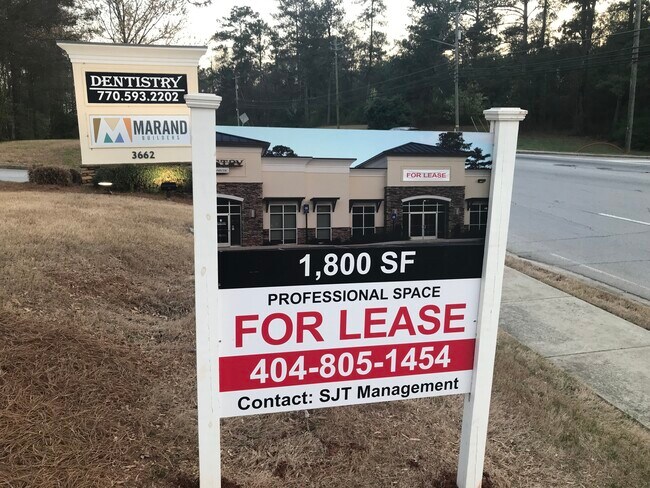
Property Detail
3662 Flakes Mill Rd
Medicalbuilding
DeKalb
C1: LOCAL
Georgia
B and X Area of moderate flood hazard, usually the area between the limits of the 100-year and 500-year floods.
1.20 AC
2025
I-20 East/Conyers
2025
Atlanta
023425
Atlanta-Sandy Springs-Roswell, GA
4,356 SF
15-061-10-035
NEARBY LISTINGS FOR SALE OR LEASE
DEMOGRAPHICS near 3662 Flakes Mill Rd
1 mile
3 mile
5 mile
2025 Total Population
8,766
61,913
170,514
2030 Population
8,811
62,646
173,688
Pop Growth 2025-2030
+ 0.51%
+ 1.18%
+ 1.86%
Average Age
42
41
40
2025 Total Households
3,278
22,480
63,126
HH Growth 2025-2030
+ 0.46%
+ 1.14%
+ 1.80%
Median Household Inc
$79,471
$74,732
$69,684
Avg Household Size
2.60
2.70
2.60
2025 Avg HH Vehicles
2.00
2.00
2.00
Median Home Value
$283,695
$280,036
$273,252
Median Year Built
1981
1988
1986
Nearby Places
Map Layers
Map Styles
 Street
 Aerial
Layers
 Traffic
 Biking
Places
Listings with unknown addresses are not visible on the map
- Restaurants
- Banks
- Shops
- Fitness
- Groceries
PUBLIC TRANSPORTATION
AIRPORT
Hartsfield - Jackson Atlanta International
Drive
Walk
Distance
Hartsfield - Jackson Atlanta International
24 min
14.4 mi
Freight Ports
Georgia Ports - Savannah
Drive
Walk
Distance
Georgia Ports - Savannah
277 min
246.3 mi
SALE & LEASE HISTORY
LISTING DATE
SALE/LEASE

Nov 30, 2019
For Lease
Nov 10, 2023
For Lease
Mar 18, 2023
For Lease
Nearby Properties
Address
Land Use
TOTAL SIZE
Lot Size
Zoning
Address
Land Use
TOTAL SIZE
Lot Size
Zoning
284,650 SF
21.75 AC
R100
Address
Land Use
TOTAL SIZE
Lot Size
Zoning
72,870 SF
12.34 AC
C2
Address
Land Use
TOTAL SIZE
Lot Size
Zoning
253,740 SF
13.33 AC
RM75
Address
Land Use
TOTAL SIZE
Lot Size
Zoning
13,114 SF
17.54 AC
RM100
Address
Land Use
TOTAL SIZE
Lot Size
Zoning
209,022 SF
16.22 AC
RM100
Address
Land Use
TOTAL SIZE
Lot Size
Zoning
235,787 SF
15.43 AC
RM100
Address
Land Use
TOTAL SIZE
Lot Size
Zoning
554,853 SF
42.64 AC
RM75
Address
Land Use
TOTAL SIZE
Lot Size
Zoning
174,027 SF
35.37 AC
R100
Address
Land Use
TOTAL SIZE
Lot Size
Zoning
300,697 SF
21.18 AC
RM85
Address
Land Use
TOTAL SIZE
Lot Size
Zoning
86,140 SF
61.60 AC
R100
Address
Land Use
TOTAL SIZE
Lot Size
Zoning
132,604 SF
19.12 AC
RM100
Address
Land Use
TOTAL SIZE
Lot Size
Zoning
367,452 SF
30.89 AC
RM100
Address
Land Use
TOTAL SIZE
Lot Size
Zoning
217,904 SF
14.84 AC
Address
Land Use
TOTAL SIZE
Lot Size
Zoning
278,272 SF
21 AC
RM100
Address
Land Use
TOTAL SIZE
Lot Size
Zoning
320,450 SF
38.85 AC
M
Address
Land Use
TOTAL SIZE
Lot Size
Zoning
144,950 SF
8.96 AC
RM100
Address
Land Use
TOTAL SIZE
Lot Size
Zoning
272,304 SF
25.70 AC
RM100
Address
Land Use
TOTAL SIZE
Lot Size
Zoning
134,156 SF
12.41 AC
RM100
Address
Land Use
TOTAL SIZE
Lot Size
Zoning
124,603 SF
10.60 AC
M
Address
Land Use
TOTAL SIZE
Lot Size
Zoning
140,779 SF
30.63 AC
X
Address
Land Use
TOTAL SIZE
Lot Size
Zoning
151,804 SF
10.87 AC
RM100
Address
Land Use
TOTAL SIZE
Lot Size
Zoning
84,096 SF
8.85 AC
C1
Address
Land Use
TOTAL SIZE
Lot Size
Zoning
105,100 SF
11.43 AC
C1: LOCAL
Address
Land Use
TOTAL SIZE
Lot Size
Zoning
157,567 SF
16.89 AC
M: INDUSTR
Address
Land Use
TOTAL SIZE
Lot Size
Zoning
93,259 SF
6.32 AC
M
Address
Land Use
TOTAL SIZE
Lot Size
Zoning
71,383 SF
9.05 AC
NS
Address
Land Use
TOTAL SIZE
Lot Size
Zoning
137,557 SF
11.04 AC
RM100
Address
Land Use
TOTAL SIZE
Lot Size
Zoning
38,919 SF
13.23 AC
C1
Address
Land Use
TOTAL SIZE
Lot Size
Zoning
49,112 SF
9.02 AC
M
Address
Land Use
TOTAL SIZE
Lot Size
Zoning
77,304 SF
5.50 AC
C1
The World's #1 Commercial Real Estate Marketplace
Connect with us
© 2026 CoStar Group
The information above has been obtained from sources believed reliable. While we do not doubt its accuracy we have not verified it and make no guarantee, warranty or representation about it. It is your responsibility to independently confirm its accuracy and completeness. Any projections, opinions, assumptions, or estimates used are for example only and do not represent the current or future performance of the property. The value of this transaction to you depends on tax and other factors which should be evaluated by your tax, financial, and legal advisors. You and your advisors should conduct a careful, independent investigation of the property to determine to your satisfaction the suitability of the property for your needs.