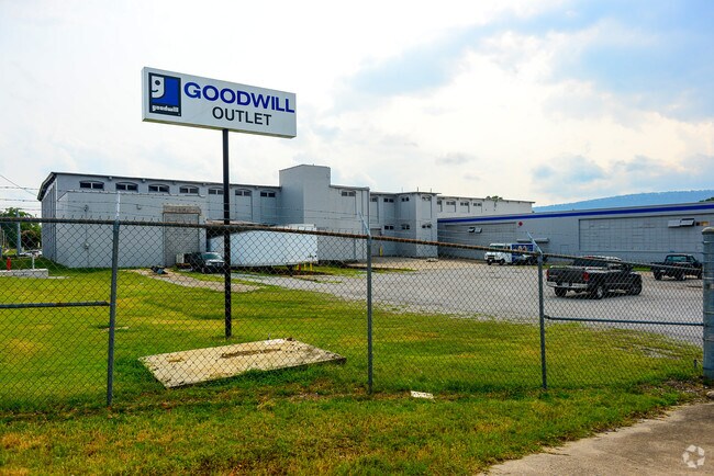
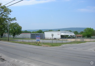
Property Record
3321 Dodds Ave, Chattanooga, TN 37407

Property Detail
3321 Dodds Ave
168B-K-012
LTS 93-108 BLK 13 & LTS 109-124 BLK 14 EAST LAKE MISSION RIDGE LAND CO PB 2 PG 25
Warehouse
Hamilton
M1
Tennessee
B and X Area of moderate flood hazard, usually the area between the limits of the 100-year and 500-year floods.
109-124
0
6 AC
2025
Outlying Chattanooga
002500
Chattanooga
152,488 SF
Chattanooga, TN-GA
NEARBY LISTINGS FOR SALE OR LEASE
DEMOGRAPHICS near 3321 Dodds Ave
1 mile
3 mile
5 mile
2024 Total Population
11,209
75,285
143,345
2029 Population
11,844
79,259
150,182
Pop Growth 2024-2029
+ 5.67%
+ 5.28%
+ 4.77%
Average Age
34
38
39
2024 Total Households
3,835
30,275
59,797
HH Growth 2024-2029
+ 5.76%
+ 5.45%
+ 4.97%
Median Household Inc
$39,198
$54,501
$54,019
Avg Household Size
2.70
2.30
2.30
2024 Avg HH Vehicles
2.00
2.00
2.00
Median Home Value
$181,655
$230,967
$241,363
Median Year Built
1955
1961
1966
Nearby Places
Map Layers
Map Styles
 Street
 Aerial
Transit
 Traffic
 Biking
Places
Listings with unknown addresses are not visible on the map
- Restaurants
- Banks
- Shops
- Fitness
- Groceries
PUBLIC TRANSPORTATION
AIRPORT
Lovell Field
Drive
Walk
Distance
Lovell Field
17 min
7.8 mi
Freight Ports
Georgia Ports - Savannah
Drive
Walk
Distance
Georgia Ports - Savannah
406 min
361.9 mi
Nearby Properties
Address
Land Use
TOTAL SIZE
Lot Size
Zoning
Address
Land Use
TOTAL SIZE
Lot Size
Zoning
728,901 SF
103.09 AC
Address
Land Use
TOTAL SIZE
Lot Size
Zoning
192,000 SF
3.09 AC
R4
Address
Land Use
TOTAL SIZE
Lot Size
Zoning
296,016 SF
13.36 AC
R3
Address
Land Use
TOTAL SIZE
Lot Size
Zoning
170,000 SF
2.25 AC
C3
Address
Land Use
TOTAL SIZE
Lot Size
Zoning
182,932 SF
3.67 AC
M1
Address
Land Use
TOTAL SIZE
Lot Size
Zoning
306,411 SF
6.96 AC
Address
Land Use
TOTAL SIZE
Lot Size
Zoning
308,635 SF
2.24 AC
M1
Address
Land Use
TOTAL SIZE
Lot Size
Zoning
288,371 SF
9.39 AC
Address
Land Use
TOTAL SIZE
Lot Size
Zoning
438,219 SF
17.54 AC
R3
Address
Land Use
TOTAL SIZE
Lot Size
Zoning
52,209 SF
3.43 AC
C2
Address
Land Use
TOTAL SIZE
Lot Size
Zoning
87,337 SF
1.47 AC
9999
Address
Land Use
TOTAL SIZE
Lot Size
Zoning
43,470 SF
1.26 AC
R4
Address
Land Use
TOTAL SIZE
Lot Size
Zoning
262,721 SF
1.55 AC
C3
Address
Land Use
TOTAL SIZE
Lot Size
Zoning
8.42 AC
C3
Address
Land Use
TOTAL SIZE
Lot Size
Zoning
5.05 AC
R3
Address
Land Use
TOTAL SIZE
Lot Size
Zoning
74,798 SF
R1
Address
Land Use
TOTAL SIZE
Lot Size
Zoning
127,128 SF
1.50 AC
C3
Address
Land Use
TOTAL SIZE
Lot Size
Zoning
19,600 SF
14.10 AC
UR
Address
Land Use
TOTAL SIZE
Lot Size
Zoning
58,708 SF
4.10 AC
R3
Address
Land Use
TOTAL SIZE
Lot Size
Zoning
33.19 AC
M1
Address
Land Use
TOTAL SIZE
Lot Size
Zoning
202,748 SF
25.49 AC
M3
Address
Land Use
TOTAL SIZE
Lot Size
Zoning
90,565 SF
18.50 AC
FOR R-2
Address
Land Use
TOTAL SIZE
Lot Size
Zoning
57,660 SF
2.67 AC
C3
Address
Land Use
TOTAL SIZE
Lot Size
Zoning
6.32 AC
M1
Address
Land Use
TOTAL SIZE
Lot Size
Zoning
3.47 AC
R3
Address
Land Use
TOTAL SIZE
Lot Size
Zoning
458,265 SF
62.80 AC
M1
Address
Land Use
TOTAL SIZE
Lot Size
Zoning
45,409 SF
6.83 AC
Address
Land Use
TOTAL SIZE
Lot Size
Zoning
35,740 SF
5.20 AC
R2
Address
Land Use
TOTAL SIZE
Lot Size
Zoning
60,147 SF
1.99 AC
R4
Address
Land Use
TOTAL SIZE
Lot Size
Zoning
50.82 AC
C2
The World's #1 Commercial Real Estate Marketplace
Connect with us
© 2026 CoStar Group
The information above has been obtained from sources believed reliable. While we do not doubt its accuracy we have not verified it and make no guarantee, warranty or representation about it. It is your responsibility to independently confirm its accuracy and completeness. Any projections, opinions, assumptions, or estimates used are for example only and do not represent the current or future performance of the property. The value of this transaction to you depends on tax and other factors which should be evaluated by your tax, financial, and legal advisors. You and your advisors should conduct a careful, independent investigation of the property to determine to your satisfaction the suitability of the property for your needs.