Property Record
475 Wilbanks Dr, Ball Ground, GA 30107
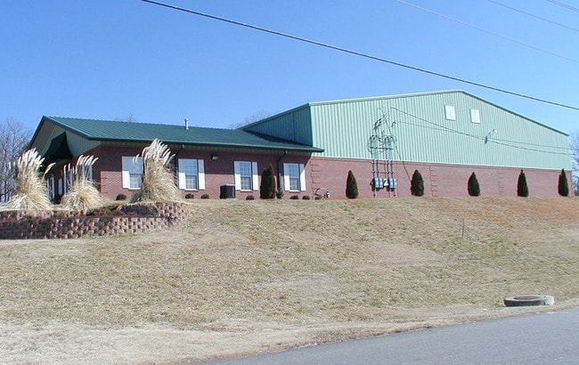


Property Detail
475 Wilbanks Dr
014N26-00000-060-000-0000
LOT 4 WILBANKS IND. PARK PB32/2&3
Warehouse
Cherokee
LI
Georgia
B and X Area of moderate flood hazard, usually the area between the limits of the 100-year and 500-year floods.
4
2025
1.80 AC
2025
Woodstock/Canton
090103
Atlanta
22,212 SF
Atlanta-Sandy Springs-Roswell, GA
NEARBY LISTINGS FOR SALE OR LEASE
DEMOGRAPHICS near 475 Wilbanks Dr
1 mile
3 mile
5 mile
2025 Total Population
196
7,578
25,820
2030 Population
215
8,284
28,344
Pop Growth 2025-2030
+ 9.69%
+ 9.32%
+ 9.78%
Average Age
41
41
41
2025 Total Households
77
2,721
9,250
HH Growth 2025-2030
+ 10.39%
+ 9.37%
+ 9.79%
Median Household Inc
$59,749
$100,533
$102,898
Avg Household Size
2.60
2.80
2.80
2025 Avg HH Vehicles
2.00
2.00
2.00
Median Home Value
$339,130
$486,031
$495,283
Median Year Built
2005
2005
2004
Nearby Places
Map Layers
Map Styles
 Street
 Aerial
Layers
 Traffic
 Biking
Places
Listings with unknown addresses are not visible on the map
- Restaurants
- Banks
- Shops
- Fitness
- Groceries
Nearby Properties
Address
Land Use
TOTAL SIZE
Lot Size
Zoning
Address
Land Use
TOTAL SIZE
Lot Size
Zoning
2,752 SF
959.77 AC
AG
Address
Land Use
TOTAL SIZE
Lot Size
Zoning
548,520 SF
70.10 AC
LI
Address
Land Use
TOTAL SIZE
Lot Size
Zoning
142,837 SF
15.16 AC
TND
Address
Land Use
TOTAL SIZE
Lot Size
Zoning
687,913 SF
24.31 AC
LI
Address
Land Use
TOTAL SIZE
Lot Size
Zoning
296,607 SF
46.53 AC
LI
Address
Land Use
TOTAL SIZE
Lot Size
Zoning
107,556 SF
13.77 AC
TND
Address
Land Use
TOTAL SIZE
Lot Size
Zoning
84,304 SF
18.65 AC
HI
Address
Land Use
TOTAL SIZE
Lot Size
Zoning
9,142 SF
89.03 AC
LI
Address
Land Use
TOTAL SIZE
Lot Size
Zoning
30,816 SF
63.71 AC
LI
Address
Land Use
TOTAL SIZE
Lot Size
Zoning
108,892 SF
16.53 AC
LI
Address
Land Use
TOTAL SIZE
Lot Size
Zoning
82,621 SF
9.63 AC
PD-MU
Address
Land Use
TOTAL SIZE
Lot Size
Zoning
83.99 AC
LI
Address
Land Use
TOTAL SIZE
Lot Size
Zoning
123.28 AC
LI
Address
Land Use
TOTAL SIZE
Lot Size
Zoning
35,530 SF
15.18 AC
TND
Address
Land Use
TOTAL SIZE
Lot Size
Zoning
73,584 SF
10.93 AC
LI
Address
Land Use
TOTAL SIZE
Lot Size
Zoning
1 SF
54.80 AC
AG
Address
Land Use
TOTAL SIZE
Lot Size
Zoning
76,696 SF
5.75 AC
LI
Address
Land Use
TOTAL SIZE
Lot Size
Zoning
21,896 SF
1.63 AC
LI
Address
Land Use
TOTAL SIZE
Lot Size
Zoning
15,748 SF
35.85 AC
HI
Address
Land Use
TOTAL SIZE
Lot Size
Zoning
57,587 SF
5.89 AC
PD-MU
Address
Land Use
TOTAL SIZE
Lot Size
Zoning
24,800 SF
100.45 AC
HI
Address
Land Use
TOTAL SIZE
Lot Size
Zoning
13,754 SF
2.31 AC
TND
Address
Land Use
TOTAL SIZE
Lot Size
Zoning
19.45 AC
LI
Address
Land Use
TOTAL SIZE
Lot Size
Zoning
51.33 AC
LI
Address
Land Use
TOTAL SIZE
Lot Size
Zoning
106,396 SF
12.42 AC
LI
Address
Land Use
TOTAL SIZE
Lot Size
Zoning
85,876 SF
3.96 AC
LI
Address
Land Use
TOTAL SIZE
Lot Size
Zoning
150,280 SF
0.18 AC
LI
Address
Land Use
TOTAL SIZE
Lot Size
Zoning
257,850 SF
4.32 AC
LI
Address
Land Use
TOTAL SIZE
Lot Size
Zoning
45,849 SF
4 AC
LI
Address
Land Use
TOTAL SIZE
Lot Size
Zoning
69.15 AC
LI
The World's #1 Commercial Real Estate Marketplace
Connect with us
© 2026 CoStar Group
The information above has been obtained from sources believed reliable. While we do not doubt its accuracy we have not verified it and make no guarantee, warranty or representation about it. It is your responsibility to independently confirm its accuracy and completeness. Any projections, opinions, assumptions, or estimates used are for example only and do not represent the current or future performance of the property. The value of this transaction to you depends on tax and other factors which should be evaluated by your tax, financial, and legal advisors. You and your advisors should conduct a careful, independent investigation of the property to determine to your satisfaction the suitability of the property for your needs.