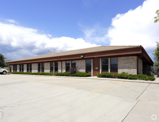
Property Record
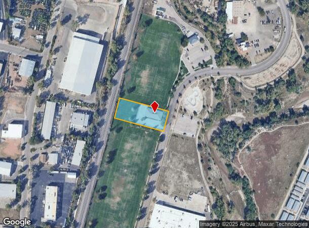
3870 Mark Dabling Blvd, Colorado Springs, CO 80907
NEARBY LISTINGS FOR SALE OR LEASE
Property Detail
3870 Mark Dabling Blvd
Colorado Springs
Interstate Commerce Center
Colorado Springs, CO
LOT 20 BLK 2 INTERSTATE COMMERCE CENTER COLO SPGS
63303-06-003
El Paso
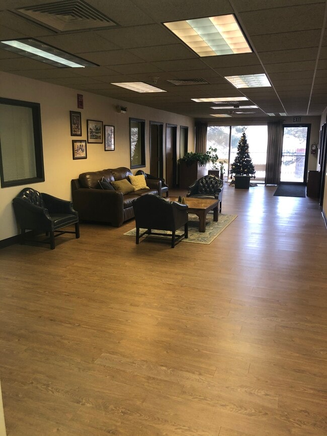
Officebuilding
Colorado
2024
20
2025
0.88 AC
000302
North
4,940 SF
DEMOGRAPHICS near 3870 Mark Dabling Blvd
1 Mile
3 Mile
5 Mile
2024 Total Population
8,343
75,156
211,941
2029 Population
8,673
78,322
220,792
Pop Growth 2024-2029
+ 3.96%
+ 4.21%
+ 4.18%
Average Age
41
42
41
2024 Total Households
3,846
33,123
92,179
HH Growth 2024-2029
+ 4.19%
+ 4.43%
+ 4.43%
Median Household Inc
$49,711
$69,854
$68,484
Avg Household Size
2.10
2.20
2.20
2024 Avg HH Vehicles
2.00
2.00
2.00
Median Home Value
$200,340
$425,787
$393,903
Median Year Built
1976
1978
1977
Nearby Places
Map Layers
Map Styles
 Street
 Aerial
- Restaurants
- Banks
- Shops
- Fitness
- Groceries
PUBLIC TRANSPORTATION
AIRPORT
City of Colorado Springs Municipal
DRIVE
WALK
Distance
City of Colorado Springs Municipal
27 min
12.2 mi
Nearby Properties
Address
Land Use
TOTAL SIZE
Lot Size
Zoning
Address
Land Use
TOTAL SIZE
Lot Size
Zoning
586,419 SF
17.77 AC
R-5 CU
Address
Land Use
TOTAL SIZE
Lot Size
Zoning
107,247 SF
56.98 AC
R-E PF
Address
Land Use
TOTAL SIZE
Lot Size
Zoning
662,208 SF
14.96 AC
BP
Address
Land Use
TOTAL SIZE
Lot Size
Zoning
604,992 SF
28.95 AC
MX-T CU
Address
Land Use
TOTAL SIZE
Lot Size
Zoning
271,048 SF
3.67 AC
FBZ-T2A
Address
Land Use
TOTAL SIZE
Lot Size
Zoning
62,201 SF
5.68 AC
MX-N
Address
Land Use
TOTAL SIZE
Lot Size
Zoning
117,227 SF
12.28 AC
PDZ HS
Address
Land Use
TOTAL SIZE
Lot Size
Zoning
747,294 SF
61.26 AC
BP HS
Address
Land Use
TOTAL SIZE
Lot Size
Zoning
80,802 SF
14.45 AC
PF NNA
Address
Land Use
TOTAL SIZE
Lot Size
Zoning
198,916 SF
31.69 AC
PF/CR SS
Address
Land Use
TOTAL SIZE
Lot Size
Zoning
139,621 SF
403.34 AC
A R-E HS
Address
Land Use
TOTAL SIZE
Lot Size
Zoning
1,223 SF
725.94 AC
PF PK SS
Address
Land Use
TOTAL SIZE
Lot Size
Zoning
74,258 SF
4.60 AC
MX-T CU
Address
Land Use
TOTAL SIZE
Lot Size
Zoning
113,069 SF
44.99 AC
R-E HS
Address
Land Use
TOTAL SIZE
Lot Size
Zoning
89,592 SF
7.60 AC
R-E CU
Address
Land Use
TOTAL SIZE
Lot Size
Zoning
134,592 SF
10.09 AC
MX-L LI CU
Address
Land Use
TOTAL SIZE
Lot Size
Zoning
131,696 SF
9.24 AC
MX-M
Address
Land Use
TOTAL SIZE
Lot Size
Zoning
100,930 SF
7.75 AC
BP CU
Address
Land Use
TOTAL SIZE
Lot Size
Zoning
99,488 SF
13.01 AC
PDZ
Address
Land Use
TOTAL SIZE
Lot Size
Zoning
30,757 SF
6.19 AC
MX-N CU HS
Address
Land Use
TOTAL SIZE
Lot Size
Zoning
34,443 SF
5.14 AC
PF
Address
Land Use
TOTAL SIZE
Lot Size
Zoning
52,302 SF
1.74 AC
R-1 9 CU H
Address
Land Use
TOTAL SIZE
Lot Size
Zoning
49,023 SF
5.68 AC
MX-L NNA
Address
Land Use
TOTAL SIZE
Lot Size
Zoning
57,183 SF
1.83 AC
MX-T
Address
Land Use
TOTAL SIZE
Lot Size
Zoning
83,479 SF
0.03 AC
OC HS ??
Address
Land Use
TOTAL SIZE
Lot Size
Zoning
53,632 SF
3.42 AC
PF SS
Address
Land Use
TOTAL SIZE
Lot Size
Zoning
158,502 SF
5.73 AC
MX-N HS
Address
Land Use
TOTAL SIZE
Lot Size
Zoning
41,015 SF
0.62 AC
BP
Address
Land Use
TOTAL SIZE
Lot Size
Zoning
23,431 SF
0.17 AC
R-E MX-M P
Address
Land Use
TOTAL SIZE
Lot Size
Zoning
301,559 SF
46.67 AC
BP/CR CU H
The World's #1 Commercial Real Estate Marketplace
Connect with us
© 2025 CoStar Group
The information above has been obtained from sources believed reliable. While we do not doubt its accuracy we have not verified it and make no guarantee, warranty or representation about it. It is your responsibility to independently confirm its accuracy and completeness. Any projections, opinions, assumptions, or estimates used are for example only and do not represent the current or future performance of the property. The value of this transaction to you depends on tax and other factors which should be evaluated by your tax, financial, and legal advisors. You and your advisors should conduct a careful, independent investigation of the property to determine to your satisfaction the suitability of the property for your needs.