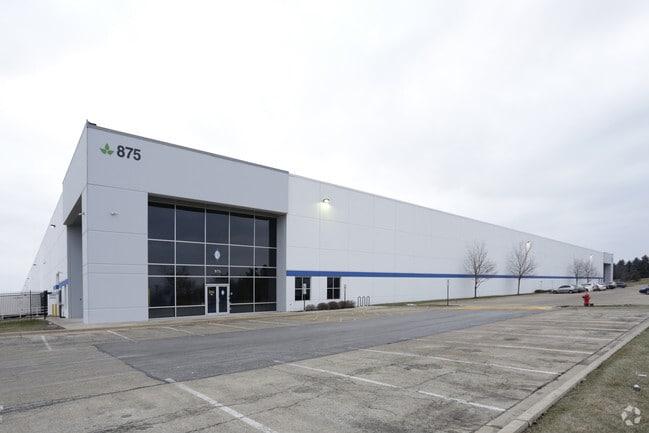
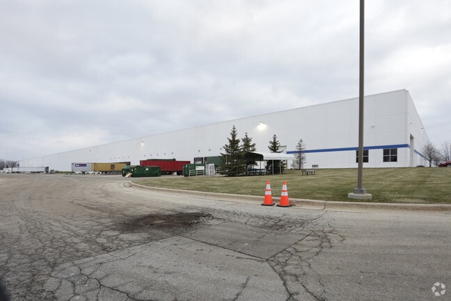
Property Record
875 W Crossroads Pkwy, Romeoville, IL 60446

Property Detail
875 W Crossroads Pkwy
Chicago-Naperville-Elgin, IL-IN
LOT 8 IN PROLOGIS PARK 55 RESUB NO. 3, BEING A RESUB OF LOTS 1 2 IN PROLOGIS PARK 55, A SUB IN THE SW1/4 OF SEC 28, T37N-R10
12-02-28-301-011
WILL
Industrialgeneral
Illinois
B and X Area of moderate flood hazard, usually the area between the limits of the 100-year and 500-year floods.
1,8
2025
24.07 AC
2024
South I-55 Corridor
880202
Chicago
528,732 SF
NEARBY LISTINGS FOR SALE OR LEASE
DEMOGRAPHICS near 875 W Crossroads Pkwy
1 mile
3 mile
5 mile
2025 Total Population
5,138
58,618
154,528
2030 Population
5,260
59,152
155,900
Pop Growth 2025-2030
+ 2.37%
+ 0.91%
+ 0.89%
Average Age
39
40
39
2025 Total Households
1,678
19,628
51,049
HH Growth 2025-2030
+ 2.38%
+ 1.04%
+ 0.99%
Median Household Inc
$108,446
$97,892
$110,136
Avg Household Size
3.00
2.90
3.00
2025 Avg HH Vehicles
2.00
2.00
2.00
Median Home Value
$271,437
$284,302
$319,513
Median Year Built
1976
1992
1993
Nearby Places
Map Layers
Map Styles
 Street
 Aerial
Layers
 Traffic
 Biking
Places
Listings with unknown addresses are not visible on the map
- Restaurants
- Banks
- Shops
- Fitness
- Groceries
PUBLIC TRANSPORTATION
COMMUTER RAIL
Romeoville (Heritage Corridor - Metra)
Drive
Walk
Distance
Romeoville (Heritage Corridor - Metra)
11 min
4.7 mi
Lemont Station (Heritage Corridor Line - Northeast Illinois Regional Commuter Railroad (Metra))
Drive
Walk
Distance
Lemont Station (Heritage Corridor Line - Northeast Illinois Regional Commuter Railroad (Metra))
17 min
8.2 mi
AIRPORT
Chicago Midway International
Drive
Walk
Distance
Chicago Midway International
33 min
21.9 mi
Chicago O'Hare International
Drive
Walk
Distance
Chicago O'Hare International
50 min
33.3 mi
Freight Ports
Port Milwaukee
Drive
Walk
Distance
Port Milwaukee
131 min
105.0 mi
Nearby Properties
Address
Land Use
TOTAL SIZE
Lot Size
Zoning
Address
Land Use
TOTAL SIZE
Lot Size
Zoning
122.95 AC
Address
Land Use
TOTAL SIZE
Lot Size
Zoning
115.36 AC
Address
Land Use
TOTAL SIZE
Lot Size
Zoning
49.82 AC
Address
Land Use
TOTAL SIZE
Lot Size
Zoning
1,107,073 SF
35.03 AC
Address
Land Use
TOTAL SIZE
Lot Size
Zoning
Address
Land Use
TOTAL SIZE
Lot Size
Zoning
48.28 AC
Address
Land Use
TOTAL SIZE
Lot Size
Zoning
747,420 SF
49.43 AC
Address
Land Use
TOTAL SIZE
Lot Size
Zoning
62.35 AC
Address
Land Use
TOTAL SIZE
Lot Size
Zoning
37.47 AC
Address
Land Use
TOTAL SIZE
Lot Size
Zoning
28.82 AC
Address
Land Use
TOTAL SIZE
Lot Size
Zoning
48.48 AC
Address
Land Use
TOTAL SIZE
Lot Size
Zoning
766,789 SF
52.04 AC
Address
Land Use
TOTAL SIZE
Lot Size
Zoning
751,809 SF
36.59 AC
Address
Land Use
TOTAL SIZE
Lot Size
Zoning
806,164 SF
35.45 AC
Address
Land Use
TOTAL SIZE
Lot Size
Zoning
800,000 SF
43.13 AC
Address
Land Use
TOTAL SIZE
Lot Size
Zoning
715,638 SF
35.12 AC
Address
Land Use
TOTAL SIZE
Lot Size
Zoning
172,838 SF
14.76 AC
Address
Land Use
TOTAL SIZE
Lot Size
Zoning
Address
Land Use
TOTAL SIZE
Lot Size
Zoning
698,727 SF
40.97 AC
Address
Land Use
TOTAL SIZE
Lot Size
Zoning
39.75 AC
Address
Land Use
TOTAL SIZE
Lot Size
Zoning
50.08 AC
Address
Land Use
TOTAL SIZE
Lot Size
Zoning
723,073 SF
37.46 AC
Address
Land Use
TOTAL SIZE
Lot Size
Zoning
652,056 SF
26.43 AC
Address
Land Use
TOTAL SIZE
Lot Size
Zoning
691,629 SF
32.73 AC
Address
Land Use
TOTAL SIZE
Lot Size
Zoning
615,239 SF
33.44 AC
Address
Land Use
TOTAL SIZE
Lot Size
Zoning
660,649 SF
29.66 AC
Address
Land Use
TOTAL SIZE
Lot Size
Zoning
23.85 AC
Address
Land Use
TOTAL SIZE
Lot Size
Zoning
Address
Land Use
TOTAL SIZE
Lot Size
Zoning
649,933 SF
31.18 AC
Address
Land Use
TOTAL SIZE
Lot Size
Zoning
The World's #1 Commercial Real Estate Marketplace
Connect with us
© 2026 CoStar Group
The information above has been obtained from sources believed reliable. While we do not doubt its accuracy we have not verified it and make no guarantee, warranty or representation about it. It is your responsibility to independently confirm its accuracy and completeness. Any projections, opinions, assumptions, or estimates used are for example only and do not represent the current or future performance of the property. The value of this transaction to you depends on tax and other factors which should be evaluated by your tax, financial, and legal advisors. You and your advisors should conduct a careful, independent investigation of the property to determine to your satisfaction the suitability of the property for your needs.