Property Record
485 Quentin Roosevelt Rd, San Antonio, TX 78226
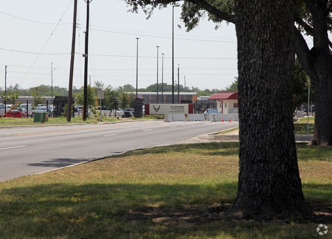


Property Detail
485 Quentin Roosevelt Rd
San Antonio-New Braunfels, TX
NCB 7530 BLDG 171 SUITE 101 (LEASEHOLD ACCT-KELLY AFB)
07530-171-0003
BEXAR
Officebuilding
Texas
B and X Area of moderate flood hazard, usually the area between the limits of the 100-year and 500-year floods.
3
0
44 SF
2025
South
980100
San Antonio
1 SF
NEARBY LISTINGS FOR SALE OR LEASE
DEMOGRAPHICS near 485 Quentin Roosevelt Rd
1 mile
3 mile
5 mile
2024 Total Population
6,931
87,028
306,687
2029 Population
7,383
91,015
323,125
Pop Growth 2024-2029
+ 6.52%
+ 4.58%
+ 5.36%
Average Age
36
37
36
2024 Total Households
2,237
28,431
96,486
HH Growth 2024-2029
+ 6.88%
+ 4.72%
+ 5.55%
Median Household Inc
$43,146
$44,684
$45,306
Avg Household Size
2.90
3.00
3.00
2024 Avg HH Vehicles
2.00
2.00
2.00
Median Home Value
$128,518
$119,974
$135,019
Median Year Built
1958
1960
1965
Nearby Places
Map Layers
Map Styles
 Street
 Aerial
Transit
 Traffic
 Biking
Places
Listings with unknown addresses are not visible on the map
- Restaurants
- Banks
- Shops
- Fitness
- Groceries
PUBLIC TRANSPORTATION
COMMUTER RAIL
San Antonio Amtrak Station (Sunset Limited - Amtrak, Texas Eagle - Amtrak)
Drive
Walk
Distance
San Antonio Amtrak Station (Sunset Limited - Amtrak, Texas Eagle - Amtrak)
14 min
8.4 mi
AIRPORT
San Antonio International
Drive
Walk
Distance
San Antonio International
23 min
14.7 mi
Freight Ports
Port of Corpus Christi
Drive
Walk
Distance
Port of Corpus Christi
154 min
147.1 mi
Nearby Properties
Address
Land Use
TOTAL SIZE
Lot Size
Zoning
Address
Land Use
TOTAL SIZE
Lot Size
Zoning
180,980 SF
1,373.90 AC
Address
Land Use
TOTAL SIZE
Lot Size
Zoning
324,044 SF
16.87 AC
Address
Land Use
TOTAL SIZE
Lot Size
Zoning
442,263 SF
37.97 AC
Address
Land Use
TOTAL SIZE
Lot Size
Zoning
726,948 SF
16.86 AC
Address
Land Use
TOTAL SIZE
Lot Size
Zoning
66,404 SF
44.45 AC
Address
Land Use
TOTAL SIZE
Lot Size
Zoning
352,890 SF
19.97 AC
Address
Land Use
TOTAL SIZE
Lot Size
Zoning
245,371 SF
20.50 AC
Address
Land Use
TOTAL SIZE
Lot Size
Zoning
325,718 SF
38.35 AC
Address
Land Use
TOTAL SIZE
Lot Size
Zoning
223,148 SF
19.15 AC
Address
Land Use
TOTAL SIZE
Lot Size
Zoning
99,538 SF
11.89 AC
Address
Land Use
TOTAL SIZE
Lot Size
Zoning
102,456 SF
7.35 AC
Address
Land Use
TOTAL SIZE
Lot Size
Zoning
Address
Land Use
TOTAL SIZE
Lot Size
Zoning
247.88 AC
Address
Land Use
TOTAL SIZE
Lot Size
Zoning
195,120 SF
19.77 AC
Address
Land Use
TOTAL SIZE
Lot Size
Zoning
231,592 SF
47.96 AC
Address
Land Use
TOTAL SIZE
Lot Size
Zoning
249,640 SF
Address
Land Use
TOTAL SIZE
Lot Size
Zoning
360,000 SF
0.01 AC
Address
Land Use
TOTAL SIZE
Lot Size
Zoning
197,650 SF
20.69 AC
Address
Land Use
TOTAL SIZE
Lot Size
Zoning
48,688 SF
7.77 AC
Address
Land Use
TOTAL SIZE
Lot Size
Zoning
223,403 SF
15.98 AC
Address
Land Use
TOTAL SIZE
Lot Size
Zoning
258,170 SF
17.89 AC
Address
Land Use
TOTAL SIZE
Lot Size
Zoning
275,840 SF
10.06 AC
Address
Land Use
TOTAL SIZE
Lot Size
Zoning
127,500 SF
37.50 AC
Address
Land Use
TOTAL SIZE
Lot Size
Zoning
206,832 SF
31.78 AC
Address
Land Use
TOTAL SIZE
Lot Size
Zoning
86,352 SF
5.05 AC
Address
Land Use
TOTAL SIZE
Lot Size
Zoning
115,316 SF
10.94 AC
Address
Land Use
TOTAL SIZE
Lot Size
Zoning
197,298 SF
18.64 AC
Address
Land Use
TOTAL SIZE
Lot Size
Zoning
51.98 AC
Address
Land Use
TOTAL SIZE
Lot Size
Zoning
201,900 SF
13.77 AC
Address
Land Use
TOTAL SIZE
Lot Size
Zoning
107,135 SF
6.62 AC
The World's #1 Commercial Real Estate Marketplace
Connect with us
© 2026 CoStar Group
The information above has been obtained from sources believed reliable. While we do not doubt its accuracy we have not verified it and make no guarantee, warranty or representation about it. It is your responsibility to independently confirm its accuracy and completeness. Any projections, opinions, assumptions, or estimates used are for example only and do not represent the current or future performance of the property. The value of this transaction to you depends on tax and other factors which should be evaluated by your tax, financial, and legal advisors. You and your advisors should conduct a careful, independent investigation of the property to determine to your satisfaction the suitability of the property for your needs.