Property Record
4800 W Commerce St, San Antonio, TX 78237


Save to a Folder
{{folder.Name}}
{{folder.ListingIds.length}} Properties
{{folder.ListingIds.length}} Property
Create a New Folder
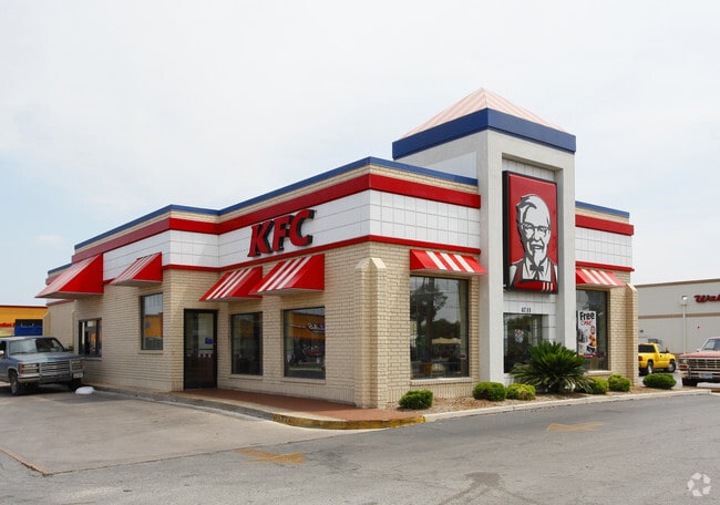
Property Detail
4800 W Commerce St
San Antonio-New Braunfels, TX
NCB 9024 (MAVERICK), LOT 6 2023 NEW PER PLAT 20002/1711-1712 FILED 4/1/22
09024-000-0060
BEXAR
Regionalshoppingcenterormallwithanchorstore
Texas
B and X Area of moderate flood hazard, usually the area between the limits of the 100-year and 500-year floods.
6
2025
19.15 AC
2025
Northwest
171100
San Antonio
223,148 SF
NEARBY LISTINGS FOR SALE OR LEASE
DEMOGRAPHICS near 4800 W Commerce St
1 mile
3 mile
5 mile
2025 Total Population
18,135
148,847
341,665
2030 Population
18,994
155,693
358,715
Pop Growth 2025-2030
+ 4.74%
+ 4.60%
+ 4.99%
Average Age
38
38
39
2025 Total Households
5,803
49,139
124,475
HH Growth 2025-2030
+ 4.86%
+ 4.73%
+ 5.37%
Median Household Inc
$37,216
$42,051
$47,280
Avg Household Size
3.00
2.90
2.60
2025 Avg HH Vehicles
2.00
2.00
2.00
Median Home Value
$87,147
$136,438
$165,700
Median Year Built
1960
1959
1963
Nearby Places
Map Layers
Map Styles
 Street
 Aerial
Layers
 Traffic
 Biking
Places
Listings with unknown addresses are not visible on the map
- Restaurants
- Banks
- Shops
- Fitness
- Groceries
PUBLIC TRANSPORTATION
COMMUTER RAIL
San Antonio Amtrak Station (Sunset Limited - Amtrak, Texas Eagle - Amtrak)
Drive
Walk
Distance
San Antonio Amtrak Station (Sunset Limited - Amtrak, Texas Eagle - Amtrak)
11 min
5.1 mi
AIRPORT
San Antonio International
Drive
Walk
Distance
San Antonio International
18 min
11.3 mi
Freight Ports
Calhoun Port
Drive
Walk
Distance
Calhoun Port
187 min
152.0 mi
Nearby Properties
Address
Land Use
TOTAL SIZE
Lot Size
Zoning
Address
Land Use
TOTAL SIZE
Lot Size
Zoning
324,044 SF
16.87 AC
Address
Land Use
TOTAL SIZE
Lot Size
Zoning
326,820 SF
12.57 AC
Address
Land Use
TOTAL SIZE
Lot Size
Zoning
442,263 SF
37.97 AC
Address
Land Use
TOTAL SIZE
Lot Size
Zoning
726,948 SF
16.86 AC
Address
Land Use
TOTAL SIZE
Lot Size
Zoning
66,404 SF
44.45 AC
Address
Land Use
TOTAL SIZE
Lot Size
Zoning
352,890 SF
19.97 AC
Address
Land Use
TOTAL SIZE
Lot Size
Zoning
245,371 SF
20.50 AC
Address
Land Use
TOTAL SIZE
Lot Size
Zoning
Address
Land Use
TOTAL SIZE
Lot Size
Zoning
98,208 SF
0.94 AC
Address
Land Use
TOTAL SIZE
Lot Size
Zoning
325,718 SF
38.35 AC
Address
Land Use
TOTAL SIZE
Lot Size
Zoning
99,538 SF
11.89 AC
Address
Land Use
TOTAL SIZE
Lot Size
Zoning
102,456 SF
7.35 AC
Address
Land Use
TOTAL SIZE
Lot Size
Zoning
173,363 SF
10.29 AC
Address
Land Use
TOTAL SIZE
Lot Size
Zoning
315,630 SF
10.19 AC
Address
Land Use
TOTAL SIZE
Lot Size
Zoning
195,120 SF
19.77 AC
Address
Land Use
TOTAL SIZE
Lot Size
Zoning
187,200 SF
17.85 AC
Address
Land Use
TOTAL SIZE
Lot Size
Zoning
143,212 SF
14.85 AC
Address
Land Use
TOTAL SIZE
Lot Size
Zoning
132,291 SF
7 AC
Address
Land Use
TOTAL SIZE
Lot Size
Zoning
133,892 SF
7.41 AC
Address
Land Use
TOTAL SIZE
Lot Size
Zoning
155,130 SF
13.89 AC
Address
Land Use
TOTAL SIZE
Lot Size
Zoning
222,095 SF
10.01 AC
Address
Land Use
TOTAL SIZE
Lot Size
Zoning
249,640 SF
Address
Land Use
TOTAL SIZE
Lot Size
Zoning
197,650 SF
20.69 AC
Address
Land Use
TOTAL SIZE
Lot Size
Zoning
48,688 SF
7.77 AC
Address
Land Use
TOTAL SIZE
Lot Size
Zoning
117,770 SF
6.76 AC
Address
Land Use
TOTAL SIZE
Lot Size
Zoning
129,800 SF
5.60 AC
Address
Land Use
TOTAL SIZE
Lot Size
Zoning
196,328 SF
7.83 AC
Address
Land Use
TOTAL SIZE
Lot Size
Zoning
127,092 SF
11.30 AC
Address
Land Use
TOTAL SIZE
Lot Size
Zoning
275,840 SF
10.06 AC
The World's #1 Commercial Real Estate Marketplace
Connect with us
© 2026 CoStar Group
The information above has been obtained from sources believed reliable. While we do not doubt its accuracy we have not verified it and make no guarantee, warranty or representation about it. It is your responsibility to independently confirm its accuracy and completeness. Any projections, opinions, assumptions, or estimates used are for example only and do not represent the current or future performance of the property. The value of this transaction to you depends on tax and other factors which should be evaluated by your tax, financial, and legal advisors. You and your advisors should conduct a careful, independent investigation of the property to determine to your satisfaction the suitability of the property for your needs.