Property Record
1 Lanark Rd, Chapel Hill, NC 27517
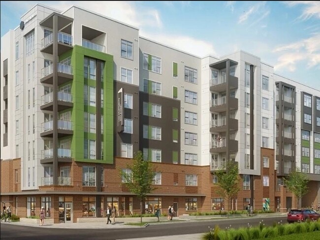

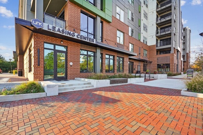
Property Detail
1 Lanark Rd
9798265227
9A GLEN LENNOX P123/150-151
Multifamilydwelling
ORANGE
B and X Area of moderate flood hazard, usually the area between the limits of the 100-year and 500-year floods.
North Carolina
2025
2.43 AC
2025
Meadowmont
012103
Raleigh/Durham
238,990 SF
Durham-Chapel Hill, NC
NEARBY LISTINGS FOR SALE OR LEASE
DEMOGRAPHICS near 1 Lanark Rd
1 mile
3 mile
5 mile
2025 Total Population
4,546
65,640
131,898
2030 Population
4,726
68,028
137,183
Pop Growth 2025-2030
+ 3.96%
+ 3.64%
+ 4.01%
Average Age
40
36
38
2025 Total Households
2,001
24,769
53,917
HH Growth 2025-2030
+ 4.30%
+ 4.18%
+ 4.46%
Median Household Inc
$107,954
$83,996
$95,020
Avg Household Size
2.20
2.20
2.20
2025 Avg HH Vehicles
2.00
2.00
2.00
Median Home Value
$812,801
$636,741
$622,612
Median Year Built
1977
1988
1992
Nearby Places
Map Layers
Map Styles
 Street
 Aerial
Layers
 Traffic
 Biking
Places
Listings with unknown addresses are not visible on the map
- Restaurants
- Banks
- Shops
- Fitness
- Groceries
PUBLIC TRANSPORTATION
AIRPORT
Raleigh-Durham International
Drive
Walk
Distance
Raleigh-Durham International
24 min
15.8 mi
Freight Ports
Port of Wilmington
Drive
Walk
Distance
Port of Wilmington
184 min
159.9 mi
Nearby Properties
Address
Land Use
TOTAL SIZE
Lot Size
Zoning
Address
Land Use
TOTAL SIZE
Lot Size
Zoning
104,541 SF
404.01 AC
Address
Land Use
TOTAL SIZE
Lot Size
Zoning
215,860 SF
12.28 AC
Address
Land Use
TOTAL SIZE
Lot Size
Zoning
264,710 SF
32.50 AC
R1
Address
Land Use
TOTAL SIZE
Lot Size
Zoning
116,223 SF
34.65 AC
Address
Land Use
TOTAL SIZE
Lot Size
Zoning
244,609 SF
2.72 AC
Address
Land Use
TOTAL SIZE
Lot Size
Zoning
193,344 SF
10.96 AC
MU(D)
Address
Land Use
TOTAL SIZE
Lot Size
Zoning
575,091 SF
3.21 AC
Address
Land Use
TOTAL SIZE
Lot Size
Zoning
4,128 SF
678.68 AC
R1
Address
Land Use
TOTAL SIZE
Lot Size
Zoning
81,191 SF
12.33 AC
OI4
Address
Land Use
TOTAL SIZE
Lot Size
Zoning
55,318 SF
9.05 AC
R4
Address
Land Use
TOTAL SIZE
Lot Size
Zoning
2,748 SF
17.80 AC
R-5-CZD
Address
Land Use
TOTAL SIZE
Lot Size
Zoning
134,448 SF
59.23 AC
Address
Land Use
TOTAL SIZE
Lot Size
Zoning
9,423 SF
43.95 AC
PDR 6.800
Address
Land Use
TOTAL SIZE
Lot Size
Zoning
287,718 SF
4.97 AC
Address
Land Use
TOTAL SIZE
Lot Size
Zoning
150,677 SF
2.93 AC
Address
Land Use
TOTAL SIZE
Lot Size
Zoning
280,771 SF
6.14 AC
RC(D)
Address
Land Use
TOTAL SIZE
Lot Size
Zoning
144,619 SF
3.22 AC
Address
Land Use
TOTAL SIZE
Lot Size
Zoning
38,300 SF
3.95 AC
MU(D)
Address
Land Use
TOTAL SIZE
Lot Size
Zoning
21,078 SF
227.43 AC
OI3R2
Address
Land Use
TOTAL SIZE
Lot Size
Zoning
111,512 SF
5.17 AC
OI(D)
Address
Land Use
TOTAL SIZE
Lot Size
Zoning
135,540 SF
4.34 AC
Address
Land Use
TOTAL SIZE
Lot Size
Zoning
6,846 SF
19.50 AC
RS-M(D)
Address
Land Use
TOTAL SIZE
Lot Size
Zoning
30,300 SF
13.83 AC
Address
Land Use
TOTAL SIZE
Lot Size
Zoning
71,680 SF
20.17 AC
R5CCC
Address
Land Use
TOTAL SIZE
Lot Size
Zoning
121,500 SF
37.15 AC
Address
Land Use
TOTAL SIZE
Lot Size
Zoning
95,924 SF
30.93 AC
Address
Land Use
TOTAL SIZE
Lot Size
Zoning
361,420 SF
1.68 AC
Address
Land Use
TOTAL SIZE
Lot Size
Zoning
85,652 SF
16.49 AC
R1R5
Address
Land Use
TOTAL SIZE
Lot Size
Zoning
28,272 SF
21.12 AC
OI2R4
The World's #1 Commercial Real Estate Marketplace
Connect with us
© 2026 CoStar Group
The information above has been obtained from sources believed reliable. While we do not doubt its accuracy we have not verified it and make no guarantee, warranty or representation about it. It is your responsibility to independently confirm its accuracy and completeness. Any projections, opinions, assumptions, or estimates used are for example only and do not represent the current or future performance of the property. The value of this transaction to you depends on tax and other factors which should be evaluated by your tax, financial, and legal advisors. You and your advisors should conduct a careful, independent investigation of the property to determine to your satisfaction the suitability of the property for your needs.