Property Record
1 Mockingbird Cir, Houston, TX 77074
NEARBY LISTINGS FOR SALE OR LEASE
Property Detail
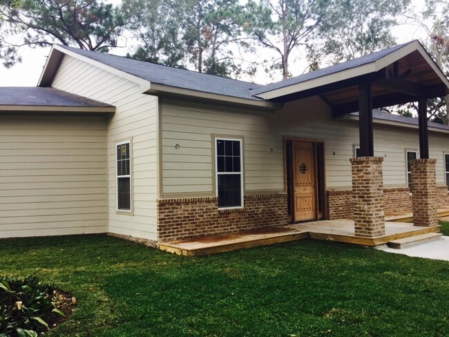
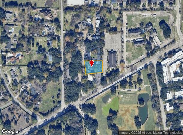
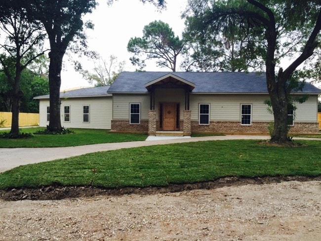
1 Mockingbird Cir
Houston-The Woodlands-Sugar Land, TX
Westmoreland Farms
0520110230036
Harris
Sfr
Texas
AE
0.64 AC
48201C0845M
Southwest Beltway 8
8,945 SF
Houston
DEMOGRAPHICS near 1 Mockingbird Cir
1 Mile
3 Mile
5 Mile
2024 Total Population
26,242
241,883
545,605
2029 Population
27,027
247,752
561,476
Pop Growth 2024-2029
+ 2.99%
+ 2.43%
+ 2.91%
Average Age
34
35
36
2024 Total Households
9,015
87,241
208,693
HH Growth 2024-2029
+ 2.96%
+ 2.33%
+ 2.91%
Median Household Inc
$38,219
$39,430
$46,445
Avg Household Size
2.80
2.70
2.50
2024 Avg HH Vehicles
1.00
1.00
2.00
Median Home Value
$207,785
$232,761
$244,926
Median Year Built
1976
1976
1978
Nearby Places
Map Layers
Map Styles
 Street
 Aerial
- Restaurants
- Banks
- Shops
- Fitness
- Groceries
PUBLIC TRANSPORTATION
AIRPORT
William P Hobby
DRIVE
WALK
Distance
William P Hobby
37 min
22.5 mi
George Bush Intcntl/Houston
DRIVE
WALK
Distance
George Bush Intcntl/Houston
43 min
32.0 mi
Freight Ports
Port of Houston
DRIVE
WALK
Distance
Port of Houston
33 min
20.0 mi
SALE & LEASE HISTORY
LISTING DATE
SALE/LEASE

Nov 10, 2022
For Lease
Mar 24, 2020
For Lease
Nearby Properties
Address
Land Use
TOTAL SIZE
Lot Size
Zoning
Address
Land Use
TOTAL SIZE
Lot Size
Zoning
1,202,191 SF
39.08 AC
Address
Land Use
TOTAL SIZE
Lot Size
Zoning
627,632 SF
24.12 AC
Address
Land Use
TOTAL SIZE
Lot Size
Zoning
188,178 SF
18.49 AC
Address
Land Use
TOTAL SIZE
Lot Size
Zoning
769,005 SF
20.46 AC
Address
Land Use
TOTAL SIZE
Lot Size
Zoning
544,698 SF
15.66 AC
Address
Land Use
TOTAL SIZE
Lot Size
Zoning
539,308 SF
21 AC
Address
Land Use
TOTAL SIZE
Lot Size
Zoning
493,494 SF
13.54 AC
Address
Land Use
TOTAL SIZE
Lot Size
Zoning
456,076 SF
19.09 AC
Address
Land Use
TOTAL SIZE
Lot Size
Zoning
322,894 SF
17.51 AC
Address
Land Use
TOTAL SIZE
Lot Size
Zoning
623,343 SF
22.89 AC
Address
Land Use
TOTAL SIZE
Lot Size
Zoning
391,473 SF
17.11 AC
Address
Land Use
TOTAL SIZE
Lot Size
Zoning
434,744 SF
16.74 AC
Address
Land Use
TOTAL SIZE
Lot Size
Zoning
431,227 SF
15.51 AC
Address
Land Use
TOTAL SIZE
Lot Size
Zoning
307,488 SF
11 AC
Address
Land Use
TOTAL SIZE
Lot Size
Zoning
349,982 SF
18.44 AC
Address
Land Use
TOTAL SIZE
Lot Size
Zoning
443,535 SF
13.14 AC
Address
Land Use
TOTAL SIZE
Lot Size
Zoning
352,526 SF
11.50 AC
Address
Land Use
TOTAL SIZE
Lot Size
Zoning
280,253 SF
12.54 AC
Address
Land Use
TOTAL SIZE
Lot Size
Zoning
208,600 SF
10.82 AC
Address
Land Use
TOTAL SIZE
Lot Size
Zoning
293,300 SF
10.12 AC
Address
Land Use
TOTAL SIZE
Lot Size
Zoning
272,600 SF
7.13 AC
Address
Land Use
TOTAL SIZE
Lot Size
Zoning
292,235 SF
9.78 AC
Address
Land Use
TOTAL SIZE
Lot Size
Zoning
341,127 SF
10 AC
Address
Land Use
TOTAL SIZE
Lot Size
Zoning
89,524 SF
19.94 AC
Address
Land Use
TOTAL SIZE
Lot Size
Zoning
192,093 SF
15.66 AC
Address
Land Use
TOTAL SIZE
Lot Size
Zoning
362,942 SF
16.30 AC
Address
Land Use
TOTAL SIZE
Lot Size
Zoning
282,897 SF
11.41 AC
Address
Land Use
TOTAL SIZE
Lot Size
Zoning
450,647 SF
23.98 AC
Address
Land Use
TOTAL SIZE
Lot Size
Zoning
361,496 SF
15.95 AC
Address
Land Use
TOTAL SIZE
Lot Size
Zoning
218,744 SF
9.52 AC
The World's #1 Commercial Real Estate Marketplace
Connect with us
© 2026 CoStar Group
The information above has been obtained from sources believed reliable. While we do not doubt its accuracy we have not verified it and make no guarantee, warranty or representation about it. It is your responsibility to independently confirm its accuracy and completeness. Any projections, opinions, assumptions, or estimates used are for example only and do not represent the current or future performance of the property. The value of this transaction to you depends on tax and other factors which should be evaluated by your tax, financial, and legal advisors. You and your advisors should conduct a careful, independent investigation of the property to determine to your satisfaction the suitability of the property for your needs.