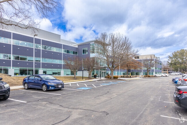
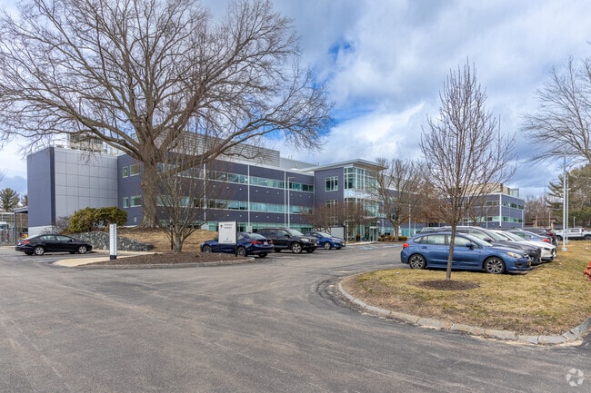
Property Record
10 Maguire Rd, Lexington, MA 02421

Current Lease Availabilities
Property Detail
10 Maguire Rd
LEXI-000085-000000-000015
Middlesex
Commercialnec
Massachusetts
ND
15
AE The base floodplain where base flood elevations are provided. AE Zones are now used on new format FIRMs instead of A1-A30 Zones.
16 AC
2024
Lexington/Arlington
2025
Boston
358600
Boston-Cambridge-Newton, MA-NH
297,389 SF
NEARBY LISTINGS FOR SALE OR LEASE
DEMOGRAPHICS near 10 Maguire Rd
1 mile
3 mile
5 mile
2025 Total Population
3,955
41,953
125,905
2030 Population
4,125
43,729
131,498
Pop Growth 2025-2030
+ 4.30%
+ 4.23%
+ 4.44%
Average Age
41
42
43
2025 Total Households
1,414
14,835
46,222
HH Growth 2025-2030
+ 4.38%
+ 4.31%
+ 4.59%
Median Household Inc
$182,341
$179,567
$160,519
Avg Household Size
2.80
2.80
2.60
2025 Avg HH Vehicles
2.00
2.00
2.00
Median Home Value
$1,019,926
$1,039,274
$881,450
Median Year Built
1965
1966
1969
Nearby Places
Map Layers
Map Styles
 Street
 Aerial
Layers
 Traffic
 Biking
Places
Listings with unknown addresses are not visible on the map
- Restaurants
- Banks
- Shops
- Fitness
- Groceries
PUBLIC TRANSPORTATION
COMMUTER RAIL
Lincoln (Fitchburg/South Acton Line - Massachusetts Bay Transportation Authority Commuter Rail (Purple Line))
Drive
Walk
Distance
Lincoln (Fitchburg/South Acton Line - Massachusetts Bay Transportation Authority Commuter Rail (Purple Line))
16 min
7.6 mi
Concord (Fitchburg/South Acton Line - Massachusetts Bay Transportation Authority Commuter Rail (Purple Line))
Drive
Walk
Distance
Concord (Fitchburg/South Acton Line - Massachusetts Bay Transportation Authority Commuter Rail (Purple Line))
17 min
8.3 mi
AIRPORT
General Edward Lawrence Logan International
Drive
Walk
Distance
General Edward Lawrence Logan International
35 min
22.4 mi
Freight Ports
Port of Boston
Drive
Walk
Distance
Port of Boston
35 min
22.1 mi
Nearby Properties
Address
Land Use
TOTAL SIZE
Lot Size
Zoning
Address
Land Use
TOTAL SIZE
Lot Size
Zoning
72,799 SF
69.22 AC
IND
Address
Land Use
TOTAL SIZE
Lot Size
Zoning
135,300 SF
30.85 AC
PD
Address
Land Use
TOTAL SIZE
Lot Size
Zoning
37.77 AC
PD
Address
Land Use
TOTAL SIZE
Lot Size
Zoning
32.07 AC
PD
Address
Land Use
TOTAL SIZE
Lot Size
Zoning
345,794 SF
24.17 AC
IND
Address
Land Use
TOTAL SIZE
Lot Size
Zoning
262,278 SF
3.80 AC
PD
Address
Land Use
TOTAL SIZE
Lot Size
Zoning
325,799 SF
21.70 AC
IND
Address
Land Use
TOTAL SIZE
Lot Size
Zoning
292,150 SF
17.76 AC
Address
Land Use
TOTAL SIZE
Lot Size
Zoning
30,480 SF
179 AC
A
Address
Land Use
TOTAL SIZE
Lot Size
Zoning
342,677 SF
56.46 AC
ND
Address
Land Use
TOTAL SIZE
Lot Size
Zoning
11.70 AC
BG
Address
Land Use
TOTAL SIZE
Lot Size
Zoning
25.50 AC
BG
Address
Land Use
TOTAL SIZE
Lot Size
Zoning
100,271 SF
13.25 AC
CM
Address
Land Use
TOTAL SIZE
Lot Size
Zoning
6.69 AC
PD
Address
Land Use
TOTAL SIZE
Lot Size
Zoning
9.82 AC
PD
Address
Land Use
TOTAL SIZE
Lot Size
Zoning
216,224 SF
5.71 AC
NPD
Address
Land Use
TOTAL SIZE
Lot Size
Zoning
102,899 SF
28.88 AC
IND
Address
Land Use
TOTAL SIZE
Lot Size
Zoning
30,578 SF
13.22 AC
R
Address
Land Use
TOTAL SIZE
Lot Size
Zoning
28.03 AC
IR
Address
Land Use
TOTAL SIZE
Lot Size
Zoning
242,454 SF
4.28 AC
IG
Address
Land Use
TOTAL SIZE
Lot Size
Zoning
160,722 SF
15.63 AC
ND
Address
Land Use
TOTAL SIZE
Lot Size
Zoning
44,528 SF
23.01 AC
IND
Address
Land Use
TOTAL SIZE
Lot Size
Zoning
102,866 SF
10 AC
CM
Address
Land Use
TOTAL SIZE
Lot Size
Zoning
120,600 SF
4.75 AC
NPD
Address
Land Use
TOTAL SIZE
Lot Size
Zoning
2,432 SF
26.58 AC
B
Address
Land Use
TOTAL SIZE
Lot Size
Zoning
201,763 SF
25.39 AC
COM
Address
Land Use
TOTAL SIZE
Lot Size
Zoning
86,532 SF
CM
Address
Land Use
TOTAL SIZE
Lot Size
Zoning
71,382 SF
44.98 AC
CD
The World's #1 Commercial Real Estate Marketplace
Connect with us
© 2026 CoStar Group
The information above has been obtained from sources believed reliable. While we do not doubt its accuracy we have not verified it and make no guarantee, warranty or representation about it. It is your responsibility to independently confirm its accuracy and completeness. Any projections, opinions, assumptions, or estimates used are for example only and do not represent the current or future performance of the property. The value of this transaction to you depends on tax and other factors which should be evaluated by your tax, financial, and legal advisors. You and your advisors should conduct a careful, independent investigation of the property to determine to your satisfaction the suitability of the property for your needs.