Property Record
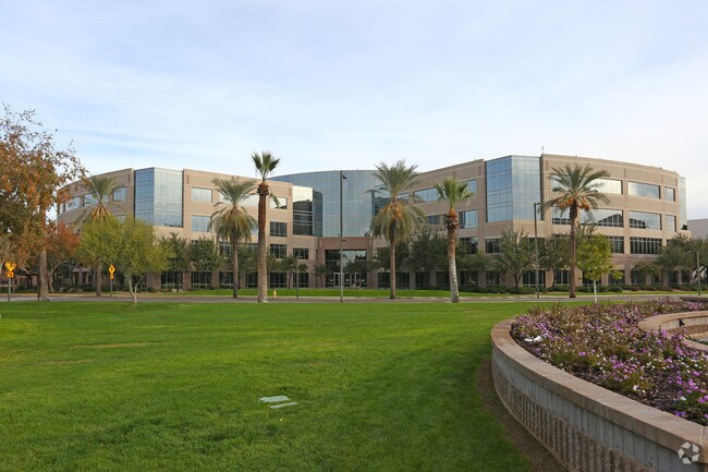
100 N 15Th Ave, Phoenix, AZ 85007


Property Detail
100 N 15Th Ave
112-02-143
CAPITAL ADDITION REPLAT MCR 578-40
Stateproperty
MARICOPA
C-2
Arizona
C and X Area of minimal flood hazard, usually depicted on FIRMs as above the 500-year flood level.
1
0
5.35 AC
2025
Southwest Phoenix
114301
Phoenix
416,837 SF
Phoenix-Mesa-Chandler, AZ
NEARBY LISTINGS FOR SALE OR LEASE
DEMOGRAPHICS near 100 N 15Th Ave
1 mile
3 mile
5 mile
2025 Total Population
18,142
107,661
370,883
2030 Population
19,387
113,258
386,508
Pop Growth 2025-2030
+ 6.86%
+ 5.20%
+ 4.21%
Average Age
36
36
35
2025 Total Households
6,767
42,172
130,100
HH Growth 2025-2030
+ 6.90%
+ 5.66%
+ 4.56%
Median Household Inc
$44,499
$59,364
$60,197
Avg Household Size
2.30
2.30
2.60
2025 Avg HH Vehicles
1.00
1.00
2.00
Median Home Value
$296,637
$418,753
$375,932
Median Year Built
1973
1968
1972
Nearby Places
Map Layers
Map Styles
 Street
 Aerial
Layers
 Traffic
 Biking
Places
Listings with unknown addresses are not visible on the map
- Restaurants
- Banks
- Shops
- Fitness
- Groceries
PUBLIC TRANSPORTATION
AIRPORT
Phoenix Sky Harbor International
Drive
Walk
Distance
Phoenix Sky Harbor International
14 min
6.4 mi
Phoenix-Mesa Gateway
Drive
Walk
Distance
Phoenix-Mesa Gateway
47 min
33.5 mi
Nearby Properties
Address
Land Use
TOTAL SIZE
Lot Size
Zoning
Address
Land Use
TOTAL SIZE
Lot Size
Zoning
582,073 SF
1.45 AC
C-C
Address
Land Use
TOTAL SIZE
Lot Size
Zoning
1.85 AC
Address
Land Use
TOTAL SIZE
Lot Size
Zoning
455,443 SF
3.21 AC
C-C
Address
Land Use
TOTAL SIZE
Lot Size
Zoning
997,436 SF
24.84 AC
DC
Address
Land Use
TOTAL SIZE
Lot Size
Zoning
24.15 AC
Address
Land Use
TOTAL SIZE
Lot Size
Zoning
339,909 SF
3 AC
C-C
Address
Land Use
TOTAL SIZE
Lot Size
Zoning
2,568,761 SF
48.36 AC
C-C
Address
Land Use
TOTAL SIZE
Lot Size
Zoning
270,000 SF
12.90 AC
I-1
Address
Land Use
TOTAL SIZE
Lot Size
Zoning
437,102 SF
1.02 AC
C-2
Address
Land Use
TOTAL SIZE
Lot Size
Zoning
2,334,671 SF
32.63 AC
C-2
Address
Land Use
TOTAL SIZE
Lot Size
Zoning
191,120 SF
1.43 AC
C-C
Address
Land Use
TOTAL SIZE
Lot Size
Zoning
1,636,025 SF
16.50 AC
C-DT
Address
Land Use
TOTAL SIZE
Lot Size
Zoning
577,883 SF
2.05 AC
C-DT
Address
Land Use
TOTAL SIZE
Lot Size
Zoning
781,334 SF
59.96 AC
I-1
Address
Land Use
TOTAL SIZE
Lot Size
Zoning
182,984 SF
146.12 AC
I-1
Address
Land Use
TOTAL SIZE
Lot Size
Zoning
568,512 SF
6.99 AC
C-DT
Address
Land Use
TOTAL SIZE
Lot Size
Zoning
671,803 SF
2.99 AC
C-DT
Address
Land Use
TOTAL SIZE
Lot Size
Zoning
1,378,775 SF
86.09 AC
M-H
Address
Land Use
TOTAL SIZE
Lot Size
Zoning
833,326 SF
1.31 AC
C-DT
Address
Land Use
TOTAL SIZE
Lot Size
Zoning
940,067 SF
12.22 AC
DTCBIO
Address
Land Use
TOTAL SIZE
Lot Size
Zoning
536,452 SF
0.58 AC
C-DT
Address
Land Use
TOTAL SIZE
Lot Size
Zoning
91,000 SF
7.57 AC
I-1
Address
Land Use
TOTAL SIZE
Lot Size
Zoning
981,015 SF
2.83 AC
C-DT
Address
Land Use
TOTAL SIZE
Lot Size
Zoning
429,457 SF
9.41 AC
C-DT
Address
Land Use
TOTAL SIZE
Lot Size
Zoning
384,291 SF
2.68 AC
C-DT
Address
Land Use
TOTAL SIZE
Lot Size
Zoning
782,912 SF
1.12 AC
C-DT
Address
Land Use
TOTAL SIZE
Lot Size
Zoning
550,269 SF
2.05 AC
DTCBCORE
Address
Land Use
TOTAL SIZE
Lot Size
Zoning
727,848 SF
0.06 AC
C-DT
Address
Land Use
TOTAL SIZE
Lot Size
Zoning
569,100 SF
0.95 AC
C-DT
Address
Land Use
TOTAL SIZE
Lot Size
Zoning
222,983 SF
1.61 AC
C-DT
The World's #1 Commercial Real Estate Marketplace
Connect with us
© 2026 CoStar Group
The information above has been obtained from sources believed reliable. While we do not doubt its accuracy we have not verified it and make no guarantee, warranty or representation about it. It is your responsibility to independently confirm its accuracy and completeness. Any projections, opinions, assumptions, or estimates used are for example only and do not represent the current or future performance of the property. The value of this transaction to you depends on tax and other factors which should be evaluated by your tax, financial, and legal advisors. You and your advisors should conduct a careful, independent investigation of the property to determine to your satisfaction the suitability of the property for your needs.