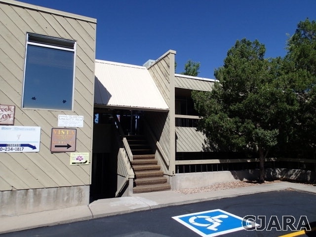
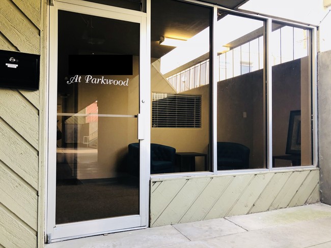
Property Record
1000 N 9Th St, Grand Junction, CO 81501
Current Lease Availabilities
NEARBY LISTINGS FOR SALE OR LEASE
Property Detail
1000 N 9Th St
Grand Junction, CO
City Of Grand Junction Resurvey Of Secon
2945-141-04-025
LOTS 1-2-3-4-5 + 6 BLK 3 CITY OF GRAND JUNCTION RESURVEY OF SECOND DIVISION SEC 14 1S 1W UM RECD 4/17/1905 RECPT NO 54332 MESA CO RECDS
Officebuilding
Mesa
X
Colorado
08077C0810G
1-2
2023
0.59 AC
2024
Colorado Northwest Area
000200
Other Market Areas
13,620 SF
DEMOGRAPHICS near 1000 N 9Th St
1 Mile
3 Mile
5 Mile
2024 Total Population
14,471
62,049
103,941
2029 Population
15,181
65,303
109,243
Pop Growth 2024-2029
+ 4.91%
+ 5.24%
+ 5.10%
Average Age
37
41
42
2024 Total Households
6,238
26,461
42,924
HH Growth 2024-2029
+ 5.27%
+ 5.41%
+ 5.22%
Median Household Inc
$40,496
$55,523
$61,470
Avg Household Size
1.90
2.20
2.30
2024 Avg HH Vehicles
2.00
2.00
2.00
Median Home Value
$259,812
$315,866
$314,643
Median Year Built
1958
1980
1986
Nearby Places
Map Layers
Map Styles
 Street
 Aerial
- Restaurants
- Banks
- Shops
- Fitness
- Groceries
PUBLIC TRANSPORTATION
COMMUTER RAIL
Grand Junction Amtrak Station (California Zephyr - Amtrak)
DRIVE
WALK
Distance
Grand Junction Amtrak Station (California Zephyr - Amtrak)
4 min
1.6 mi
AIRPORT
Grand Junction Regional
DRIVE
WALK
Distance
Grand Junction Regional
10 min
4.1 mi
Freight Ports
Port of Long Beach
DRIVE
WALK
Distance
Port of Long Beach
818 min
789.4 mi
Nearby Properties
Address
Land Use
TOTAL SIZE
Lot Size
Zoning
Address
Land Use
TOTAL SIZE
Lot Size
Zoning
889,724 SF
22.01 AC
PD
Address
Land Use
TOTAL SIZE
Lot Size
Zoning
365,495 SF
20.90 AC
CSR
Address
Land Use
TOTAL SIZE
Lot Size
Zoning
482,392 SF
24.70 AC
CSR
Address
Land Use
TOTAL SIZE
Lot Size
Zoning
429,786 SF
16.99 AC
CSR
Address
Land Use
TOTAL SIZE
Lot Size
Zoning
444,676 SF
29.47 AC
CSR
Address
Land Use
TOTAL SIZE
Lot Size
Zoning
127,583 SF
12.35 AC
C-1
Address
Land Use
TOTAL SIZE
Lot Size
Zoning
181,976 SF
14.80 AC
CSR
Address
Land Use
TOTAL SIZE
Lot Size
Zoning
180,396 SF
17.75 AC
CSR
Address
Land Use
TOTAL SIZE
Lot Size
Zoning
227,855 SF
37.91 AC
Address
Land Use
TOTAL SIZE
Lot Size
Zoning
206,585 SF
18.98 AC
C-2
Address
Land Use
TOTAL SIZE
Lot Size
Zoning
75,770 SF
82.62 AC
CSR
Address
Land Use
TOTAL SIZE
Lot Size
Zoning
130,260 SF
0.20 AC
C-1
Address
Land Use
TOTAL SIZE
Lot Size
Zoning
399,553 SF
C-1
Address
Land Use
TOTAL SIZE
Lot Size
Zoning
127,269 SF
3.21 AC
B-2
Address
Land Use
TOTAL SIZE
Lot Size
Zoning
113,925 SF
0.16 AC
PD
Address
Land Use
TOTAL SIZE
Lot Size
Zoning
82,986 SF
4.20 AC
PD
Address
Land Use
TOTAL SIZE
Lot Size
Zoning
105,693 SF
18.23 AC
CSR
Address
Land Use
TOTAL SIZE
Lot Size
Zoning
112,810 SF
6.33 AC
MU
Address
Land Use
TOTAL SIZE
Lot Size
Zoning
69,390 SF
0.14 AC
C-1
Address
Land Use
TOTAL SIZE
Lot Size
Zoning
93,531 SF
5.19 AC
Address
Land Use
TOTAL SIZE
Lot Size
Zoning
94,639 SF
0.16 AC
C-1
Address
Land Use
TOTAL SIZE
Lot Size
Zoning
126,114 SF
13.75 AC
B-2
Address
Land Use
TOTAL SIZE
Lot Size
Zoning
66,178 SF
2.02 AC
PD
Address
Land Use
TOTAL SIZE
Lot Size
Zoning
86,946 SF
5.52 AC
C-1
Address
Land Use
TOTAL SIZE
Lot Size
Zoning
83,518 SF
1.45 AC
CSR
Address
Land Use
TOTAL SIZE
Lot Size
Zoning
70,394 SF
6.19 AC
PD
Address
Land Use
TOTAL SIZE
Lot Size
Zoning
215,583 SF
20.40 AC
C-1
Address
Land Use
TOTAL SIZE
Lot Size
Zoning
85,303 SF
8.45 AC
C-2
Address
Land Use
TOTAL SIZE
Lot Size
Zoning
79,905 SF
8.43 AC
PD
The World's #1 Commercial Real Estate Marketplace
Connect with us
© 2026 CoStar Group
The information above has been obtained from sources believed reliable. While we do not doubt its accuracy we have not verified it and make no guarantee, warranty or representation about it. It is your responsibility to independently confirm its accuracy and completeness. Any projections, opinions, assumptions, or estimates used are for example only and do not represent the current or future performance of the property. The value of this transaction to you depends on tax and other factors which should be evaluated by your tax, financial, and legal advisors. You and your advisors should conduct a careful, independent investigation of the property to determine to your satisfaction the suitability of the property for your needs.